There is a shop in London that I always peer into when I walk past but have always resisted going in as it presented a
More...
Highlighting the best London maps
There is a shop in London that I always peer into when I walk past but have always resisted going in as it presented a
More...
A few months back I had the honour of being asked to approve the use of a couple of excerpts from my London Surname Map
More...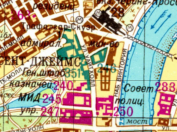
As a followup to yesterday’s article on the Soviet Cold War maps of London, above is an extract sent from the Landmark Information Group, which
More...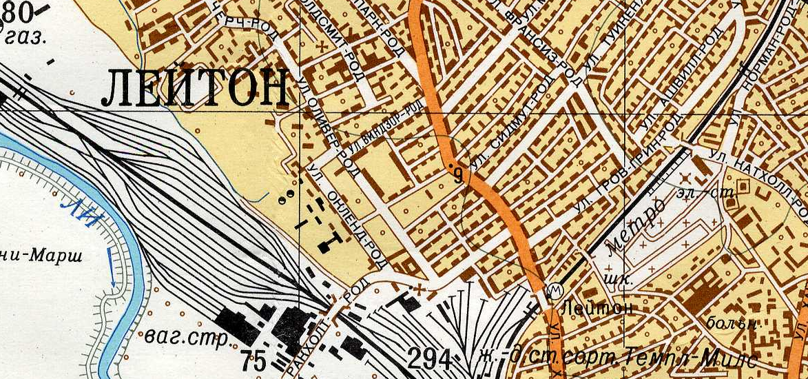
Yes the U.S.S.R. had its own maps of London, and other British cities, produced during Cold War era, i.e. the 1950s-1980s, to be perhaps used
More...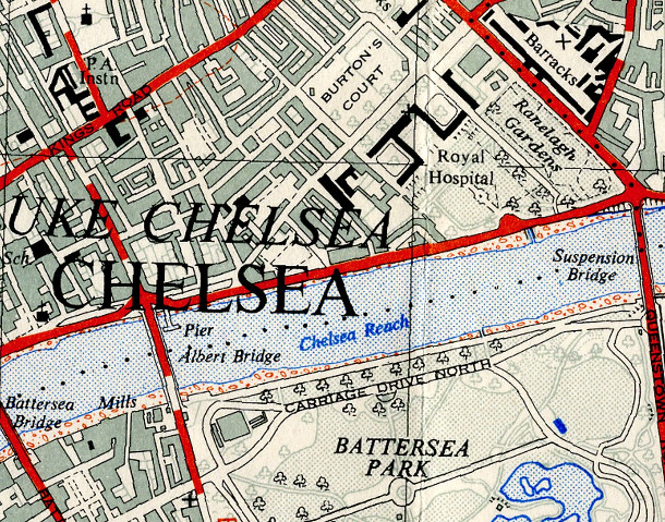
The OpenStreetMap Out-of-Copyright (OOC) project aims to scan in old Ordnance Survey maps of the country, so that they may be of some use when
More...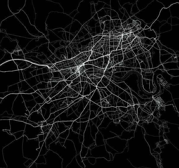
The above extract is an artwork from Jeremy Wood called My Ghost. Jeremy carried a GPS receiver around central London for nine years, gradually building
More...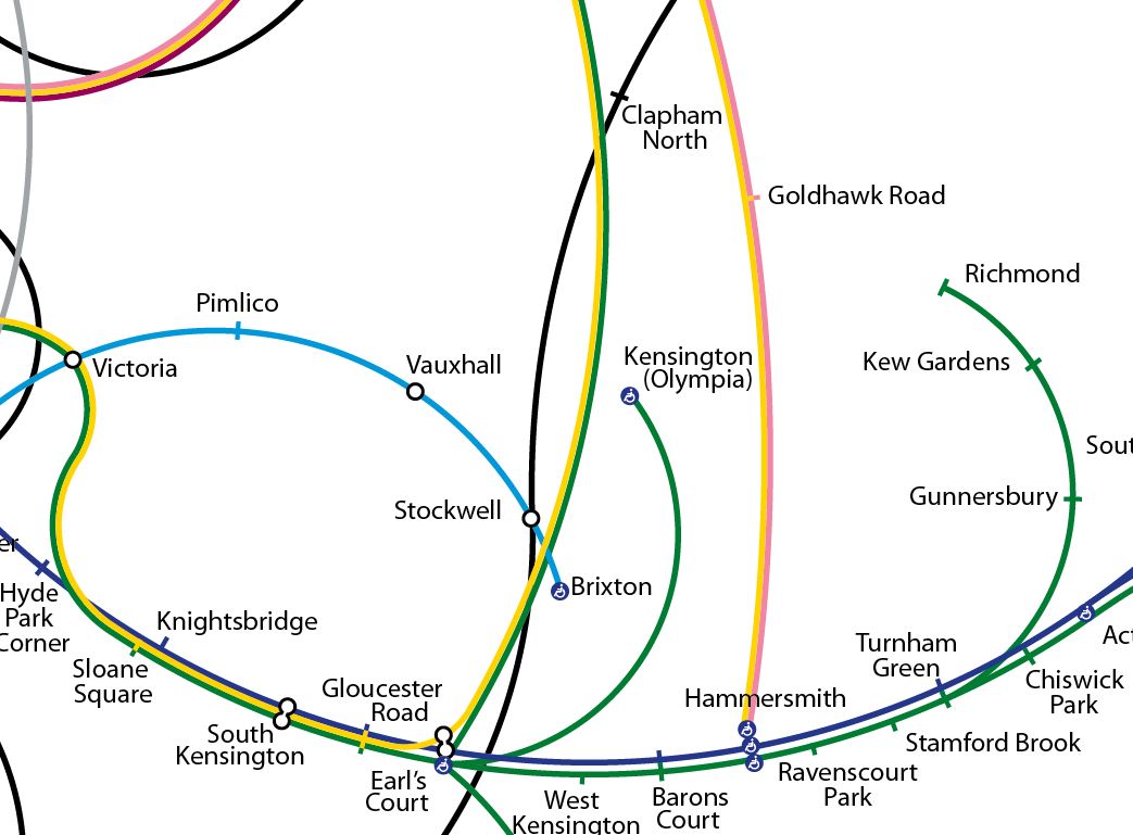
I’m a sucker for alternative maps of the London Underground, and here’s a great one by Francisco Dans (see the original in high-resolution on Flickr)
More...
This week, thousands of teenagers across the capital will receive GCSE results that will likely have an impact on the life decisions they take over the
More...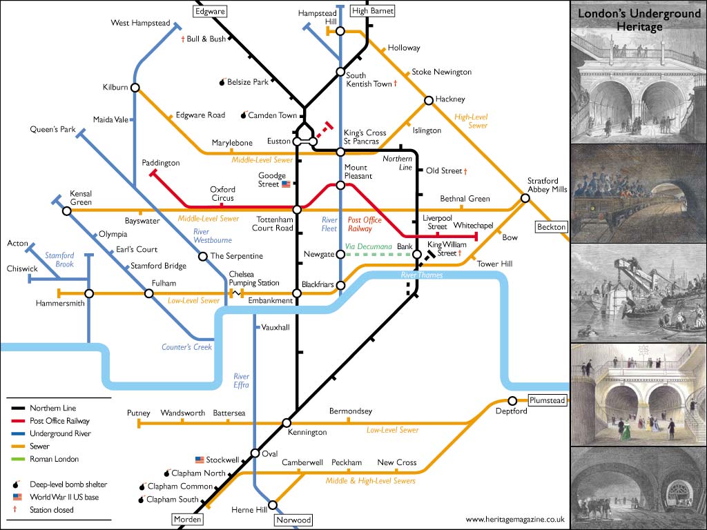
Aside from the odd rumble of a tube train, or perhaps a burst pipe in winter, Londoners often overlook the goings on beneath their feet.
More...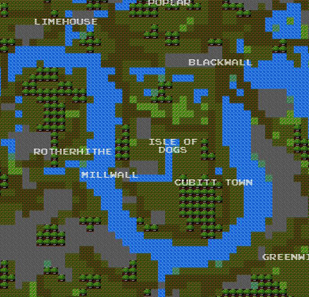
It’s a bit silly, and not exactly very helpful as a map for navigation – but it’s also a lot of fun. Brett Camper has
More...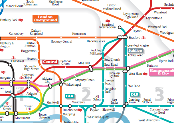
The “Beck” London Underground map is probably the most iconic and recognisable map of London in the world. As such, it is a favourite for
More...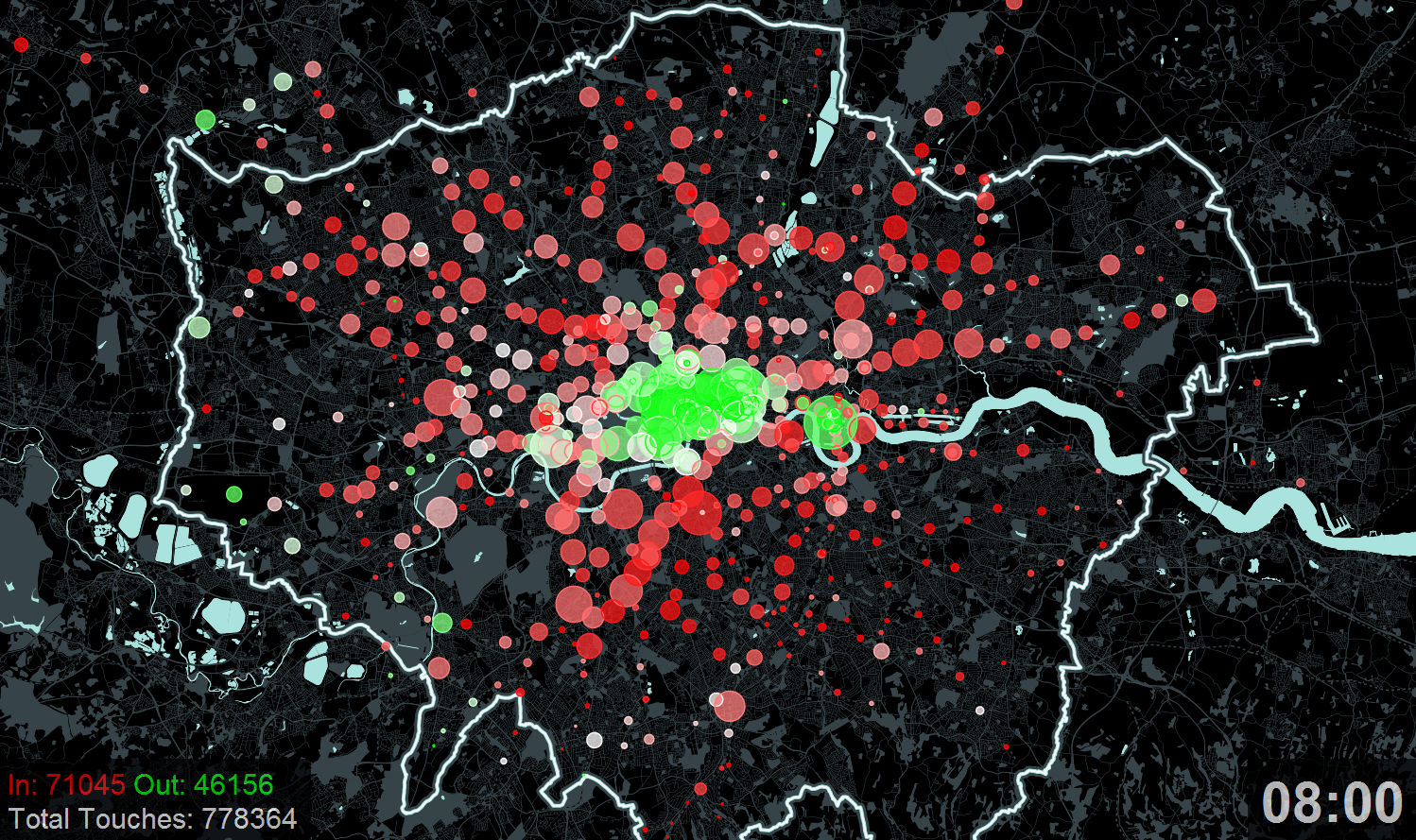
A new exhibition – Sense and the City – opens today at the Transport Museum in Covent Garden. It includes a number of transport data
More...