At first glance, this looks like a photo of London at night, maybe from the International Space Station (ISS) or another satellite. Creator Marc Khachfe
More...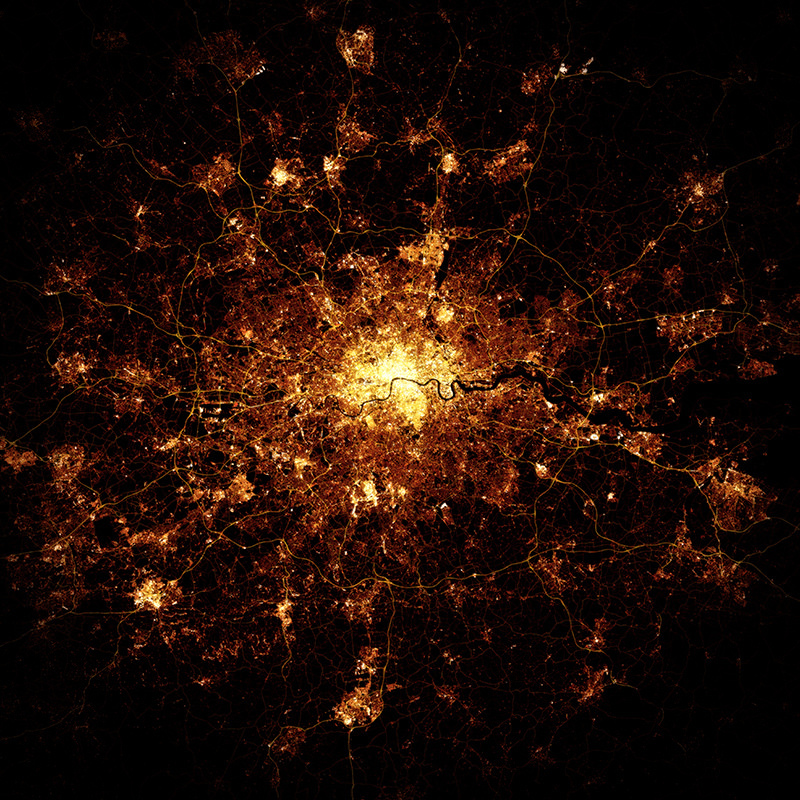
Highlighting the best London maps
At first glance, this looks like a photo of London at night, maybe from the International Space Station (ISS) or another satellite. Creator Marc Khachfe
More...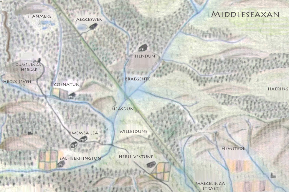
Earlier this week I did a “map swap” with Matt Brown, editor of Londonist, the popular London website. This lovely hand-drawn map, created by Matt
More...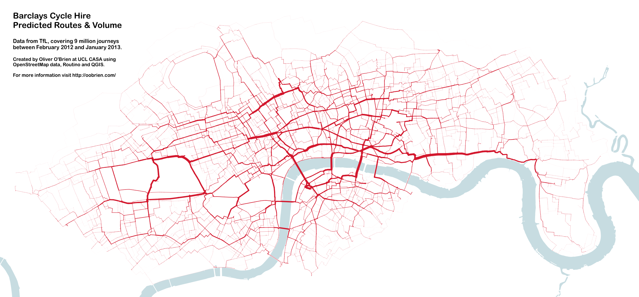
You may remember this map produced by Mapping London co-editor James in 2012. A version of this map appears in a journal article published by
More...
Over half a million cycle journeys now take place in London every day, and a whole service industry has grown in the capital, to cater
More...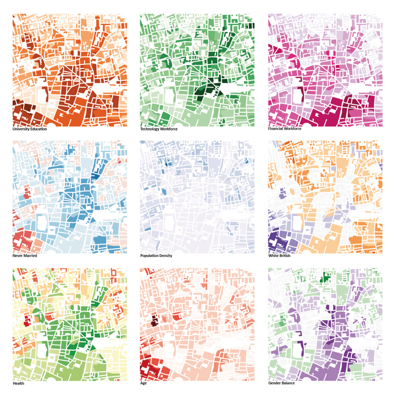
This was the submission by the Mapping London editors into the 10×10 Drawing the City London 2013 art event, which was a charity auction run
More...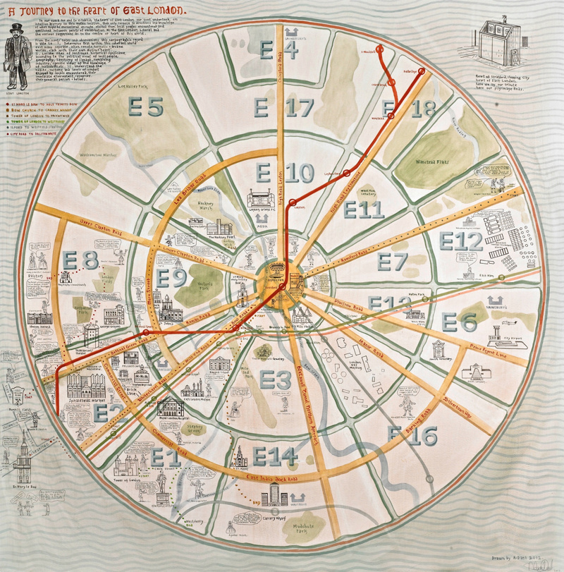
We are big fans of maps based on a circle and of Adam Dant’s work so this map, which combines the two, is a real
More...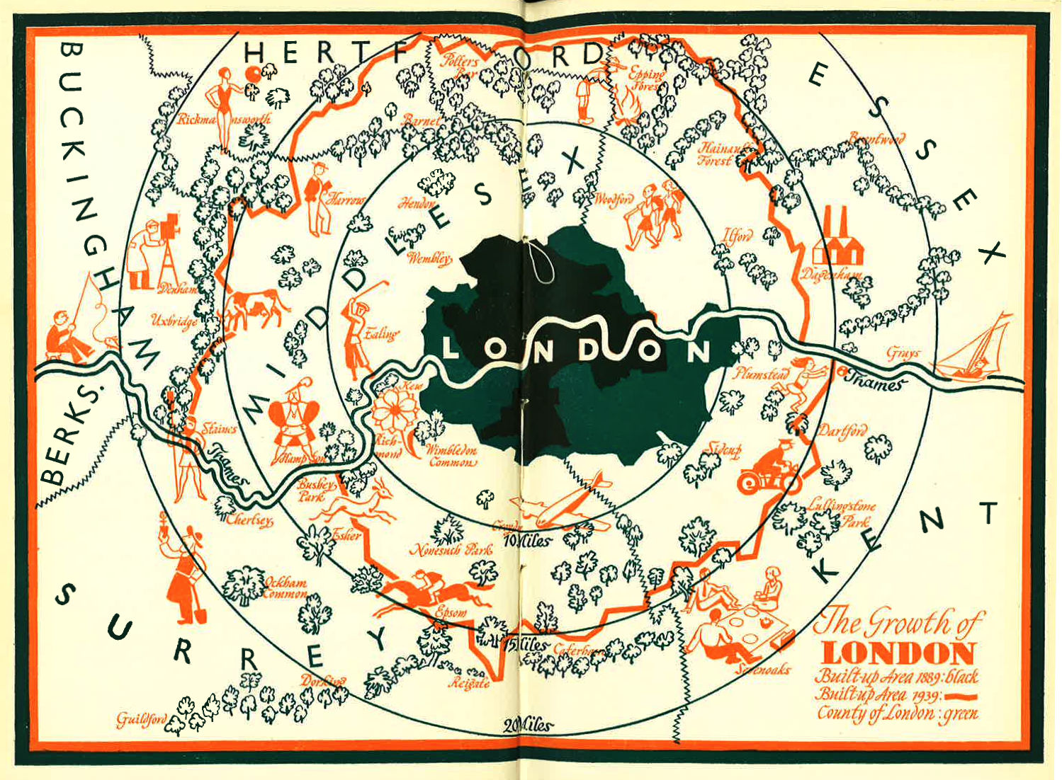
I was intrigued by this blog post of a lovely looking map of London’s Green Belt, dated 1939. The map can be compared a modern
More...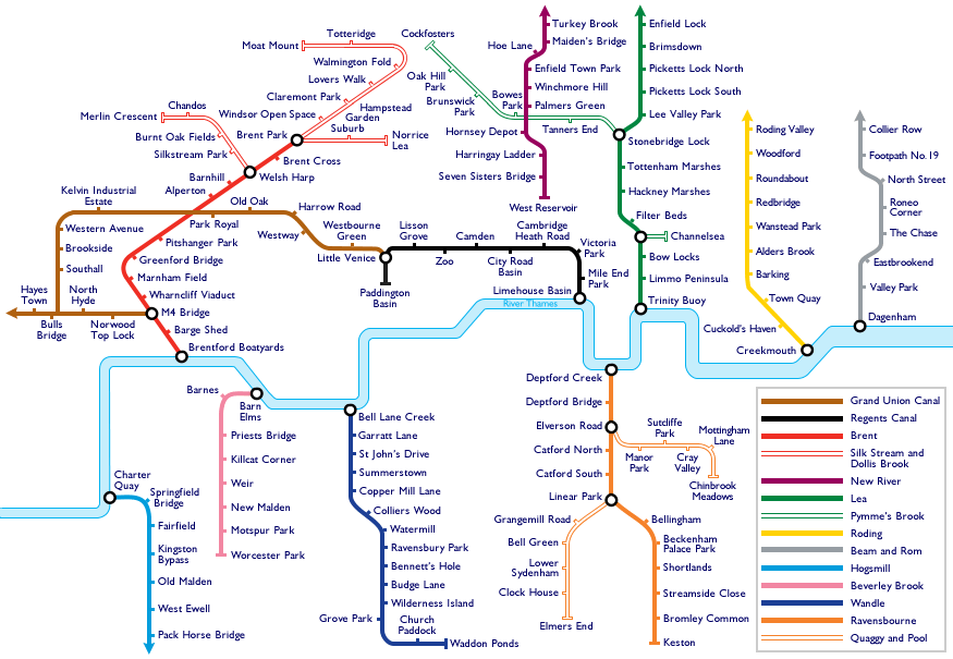
Travelling around London is a little harder today. With a tube strike on, the roads are clogged with traffic jams, and the pavements are full
More...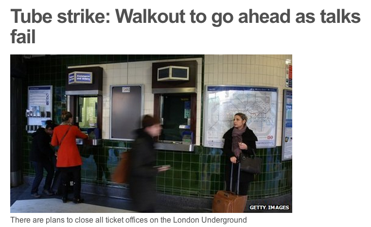
With two rounds of Tube strikes set to upset your daily commute, here are a few maps to help make the most of not being
More...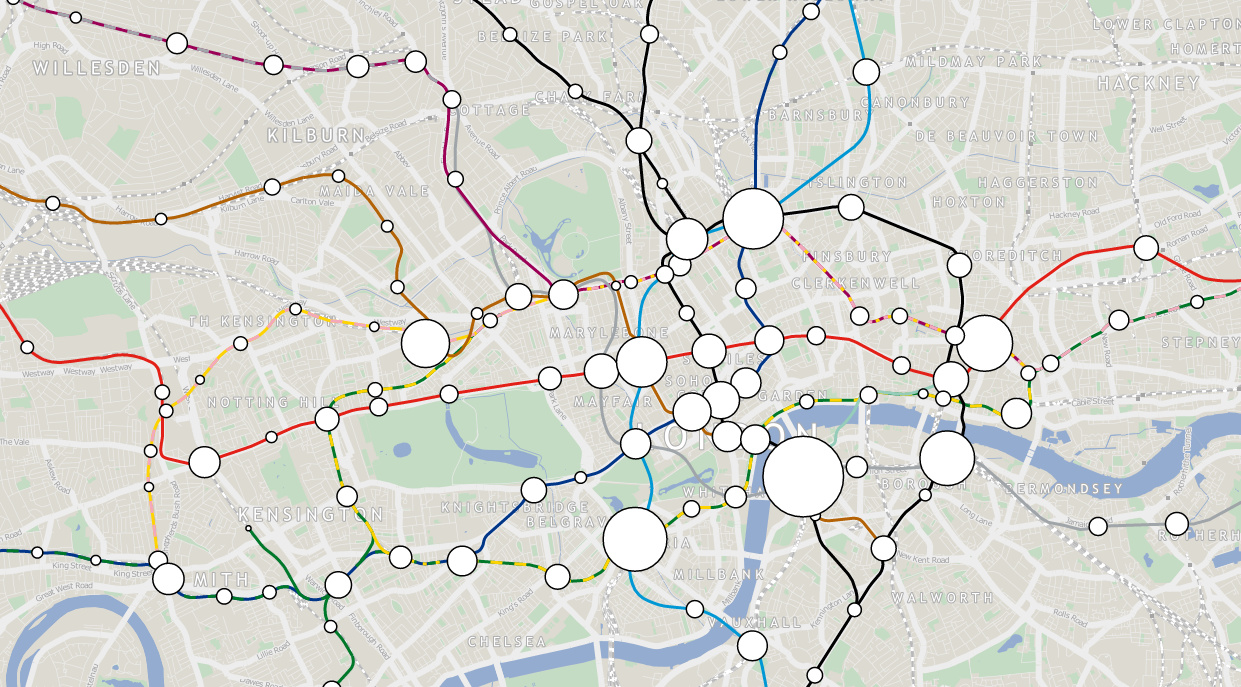
London Tube Data Map takes ten years worth of passenger entry/exit counts for stations on the London Underground network, and sizes the circle representing each
More...
Today, Mapping London brings you not one, but eight maps from prolific cartographer/artist Adam Dant, via the excellent hyper-local blog Spitalfields Life. Firstly, Stories of
More...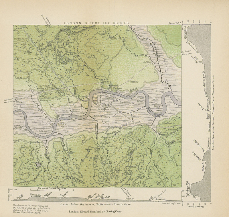
This map (full size version) is a plate in “A History of London” by John William Loftie which was published in 1884. It is one
More...