This colourful, much adorned map was produced as a fold-out poster on the back of the official guide for the British Empire Exhibition which took
More...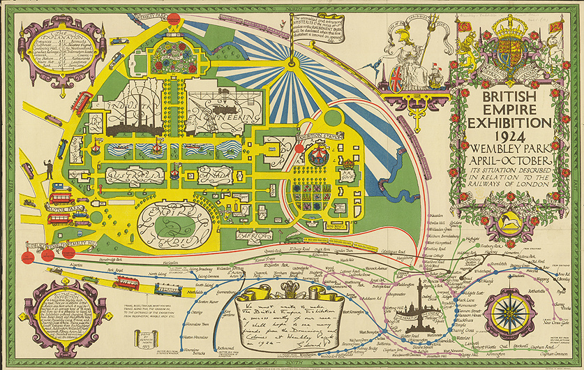
Highlighting the best London maps
This colourful, much adorned map was produced as a fold-out poster on the back of the official guide for the British Empire Exhibition which took
More...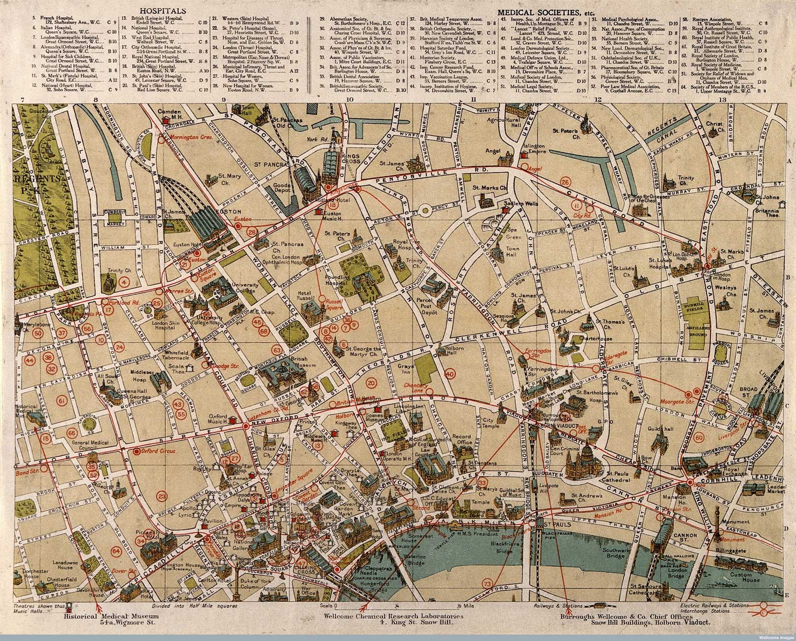
Published in 1913 (and available to download from the Wellcome Library) this series of intriguing maps depict London’s “sites of medical interest”. It looks like
More...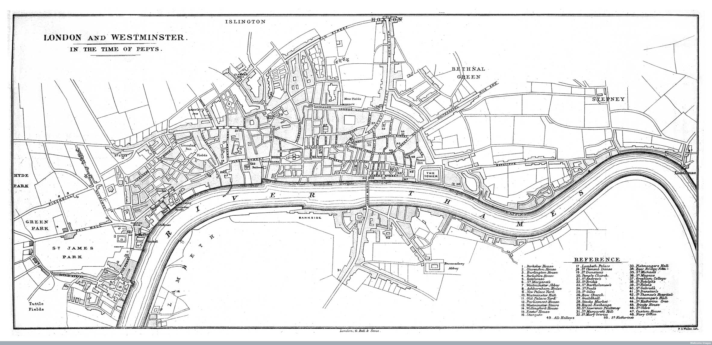
The Wellcome Image Library contains a number of interesting maps of London that are all free to use. I recently spotted a couple relating to
More...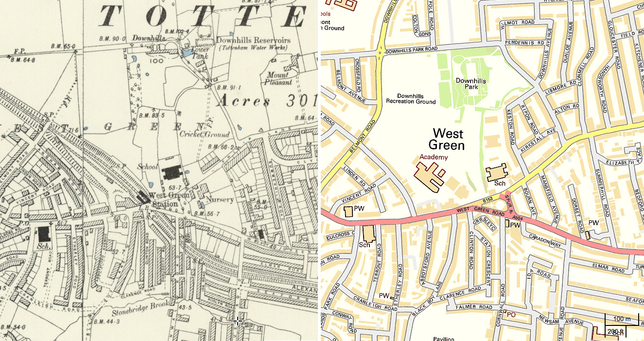
The National Library of Scotland’s (NLS) Map Department has recently completed a huge georeferencing exercise, taking a set of Six-Inch-To-Mile (1:10560) maps for the whole
More...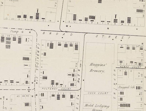
John Snow’s map of cholera has become one of the most iconic of an era when the importance of statistics and graphics were becoming recognised. The map
More...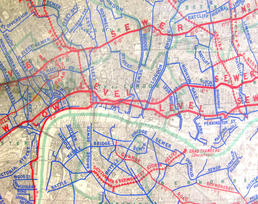
London has many networks – roads, tube trains, electricity, water – but there is another key one, one which was very important in allowing London
More...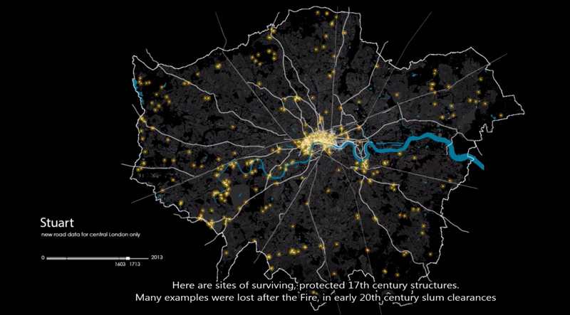
This animation shows how the roads in the London area formed, from Roman times through the industrial revolution and to the modern day. London’s boundary
More...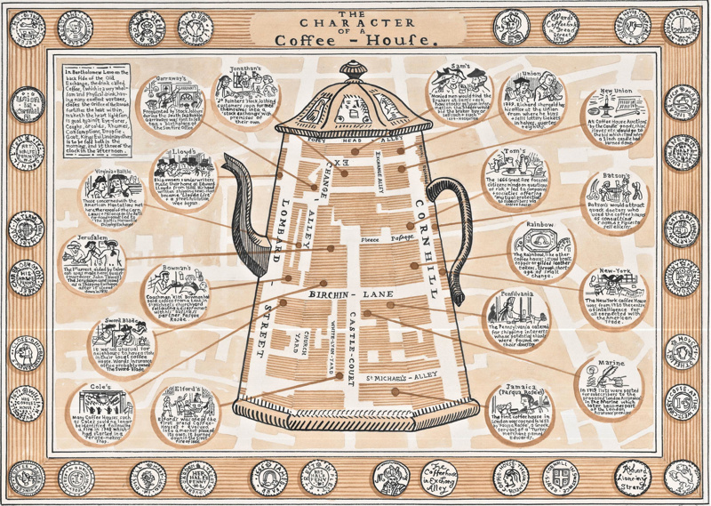
This attractive hand-drawn map, by Adam Dant, is of the coffee houses of the City of London in the 1700s. Adam uses the gradual separation
More...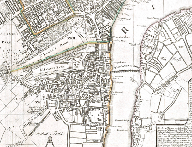
We were pleased to recently receive a number of hi-resolution scans of some very old and beautiful London maps, courtesy of the British Library, which
More...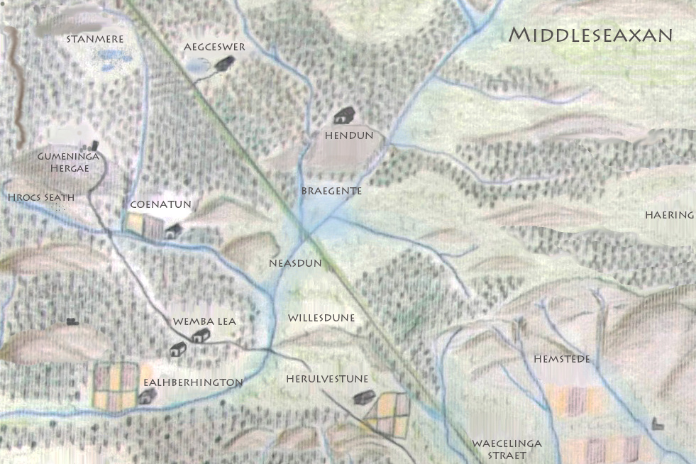
Earlier this week I did a “map swap” with Matt Brown, editor of Londonist, the popular London website. This lovely hand-drawn map, created by Matt
More...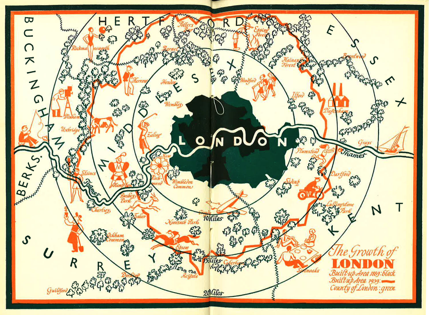
I was intrigued by this blog post of a lovely looking map of London’s Green Belt, dated 1939. The map can be compared a modern
More...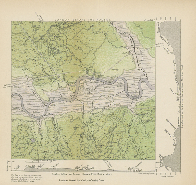
This map (full size version) is a plate in “A History of London” by John William Loftie which was published in 1884. It is one
More...