There is always interest in London’s astronomical rents and house prices. As with any global city, there is huge demand for somewhere to live in
More...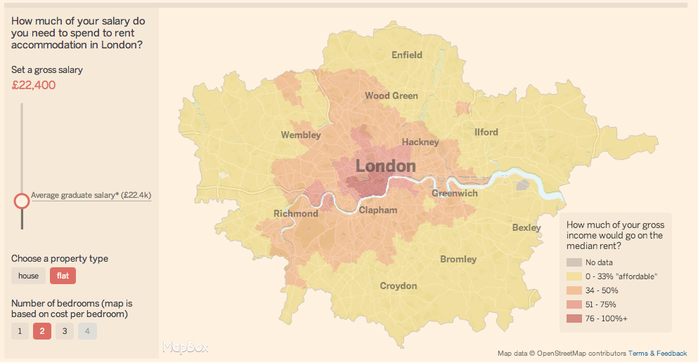
Highlighting the best London maps
There is always interest in London’s astronomical rents and house prices. As with any global city, there is huge demand for somewhere to live in
More...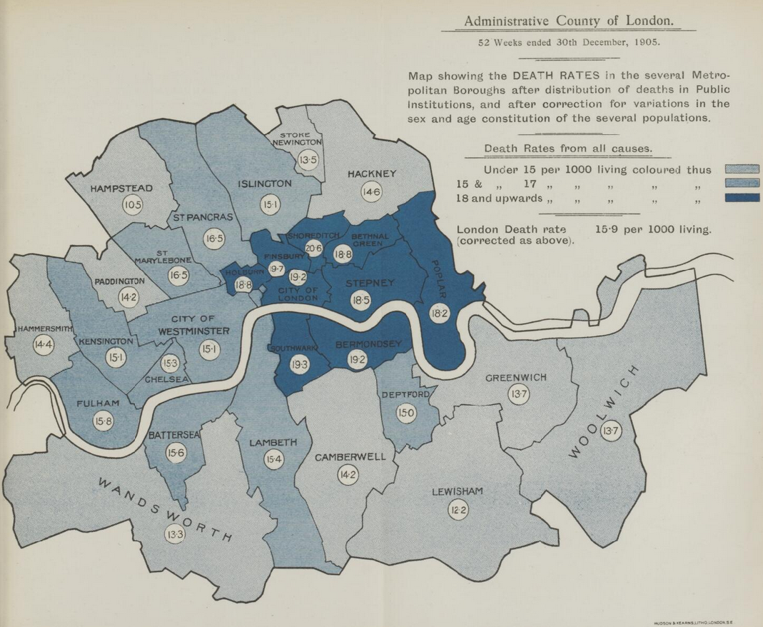
A great new resource has just been released by the Wellcome Library. They have meticulously scanned “Medical Officer of Health” reports for London between 1848 and
More...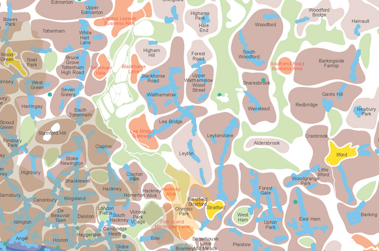
The above extract (click for full-size version) is from a map that we’ve wanted to feature for a long time, ever since an fascinating talk
More...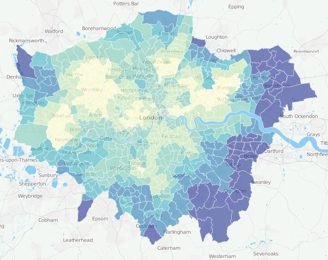
One of my earliest projects at UCL, back in 2009, was to create a customisable online map of all the 2001 Census key statistics. The
More...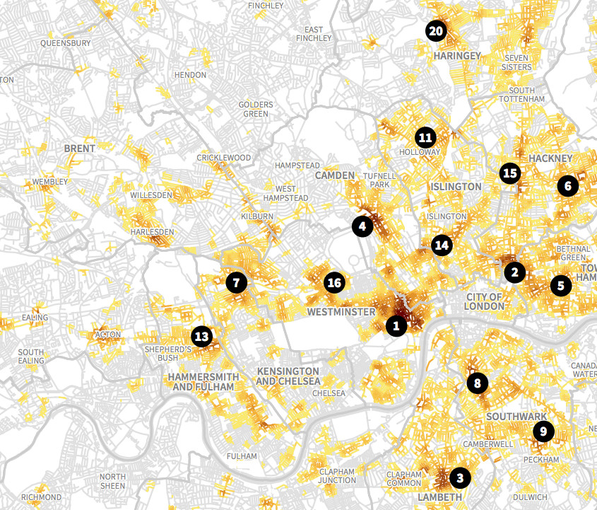
This is an extract of a map, by Matt Ashby, formerly of the UCL SECReT (Security and Crime Science) lab, that takes police.uk open data
More...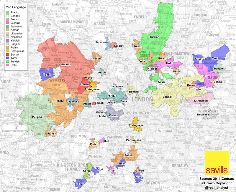
A map full of striking patterns, from Savills’ analyst Neal Hudson. It shows the areas of London where, for each area, the second most popular
More...
Rentonomy, who describe themselves as, for now, “an easy-to-use site that looks at London in a totally new way and gives you all the tools
More...
Most government statistics are mapped according to official geographical units such as wards or lower super output areas. Whilst such units are essential for data
More...
Duncan Smith from UCL CASA has produced some great maps of commuter flows. Each line represents the routes people follow to work (as a straight line from
More...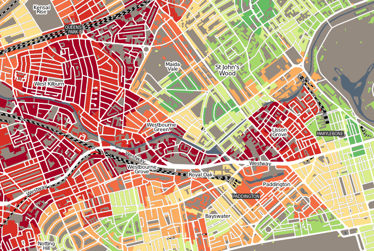
“Geodemographics of Housing in Great Britain – a new visualisation in the style of Charles Booth’s map” is a map that I have produced that
More...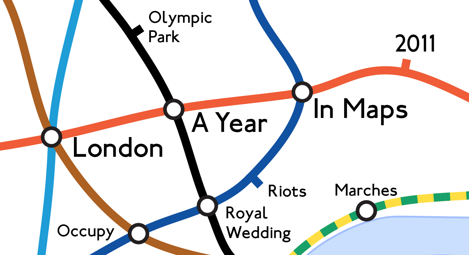
Mapping London editors James and Ollie look back at some of the many maps produced each year in London to highlight the highs and lows
More...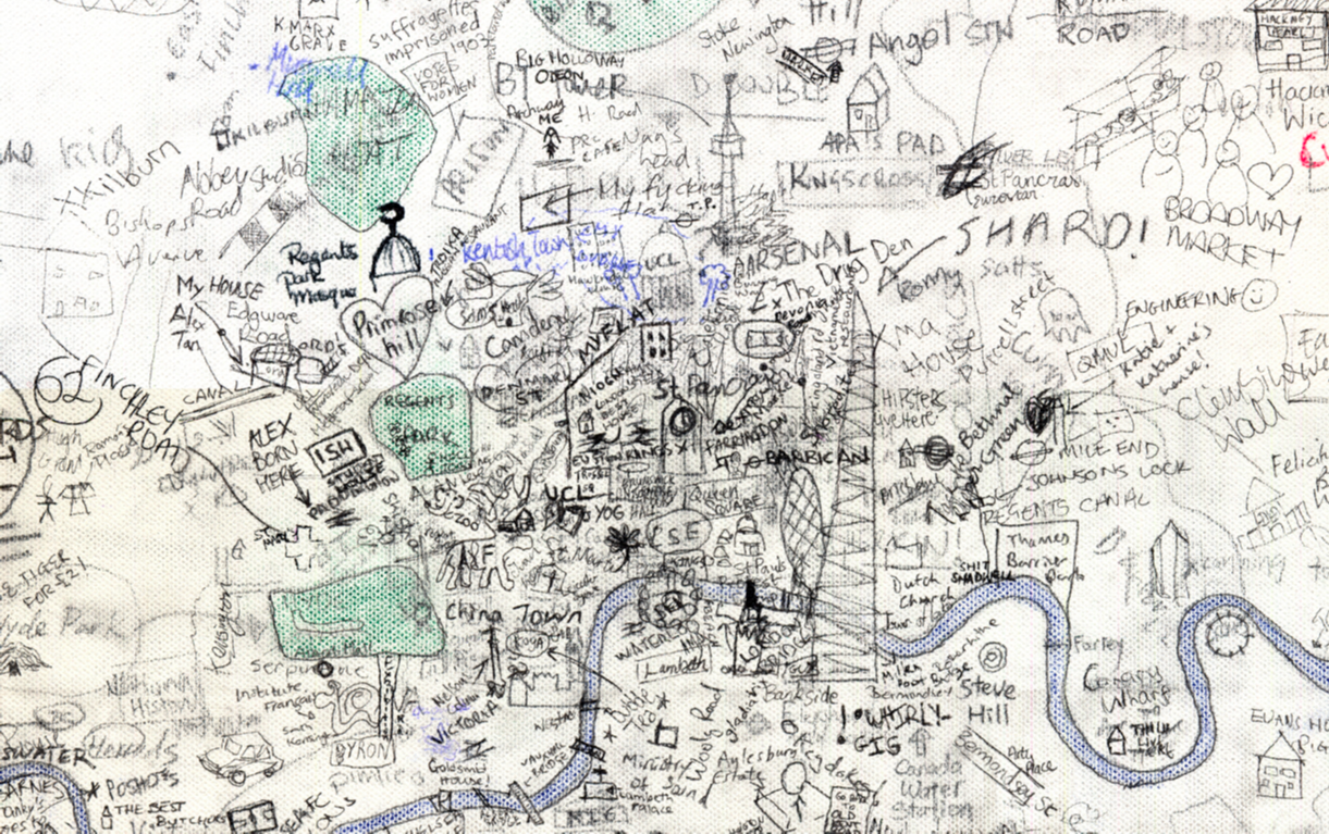
Step aside Stephen Walter, over 270 UCL students (and staff) have created their own interactive hand drawn map of London. Organised by two students Alistair Leak and
More...