London has a long and gruesome history – indeed part of its tourist industry is focused on tours and attractions based on the “Jack the
More...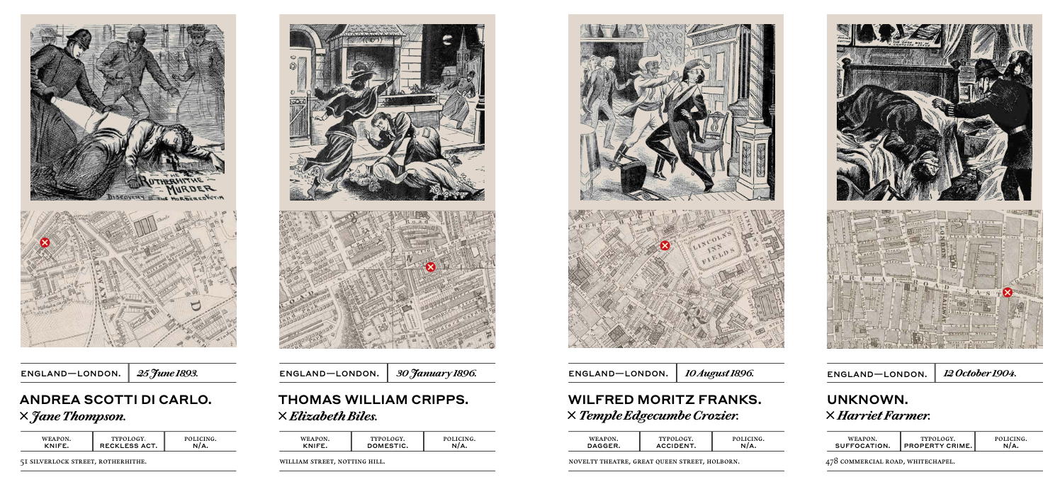
Highlighting the best London maps
London has a long and gruesome history – indeed part of its tourist industry is focused on tours and attractions based on the “Jack the
More...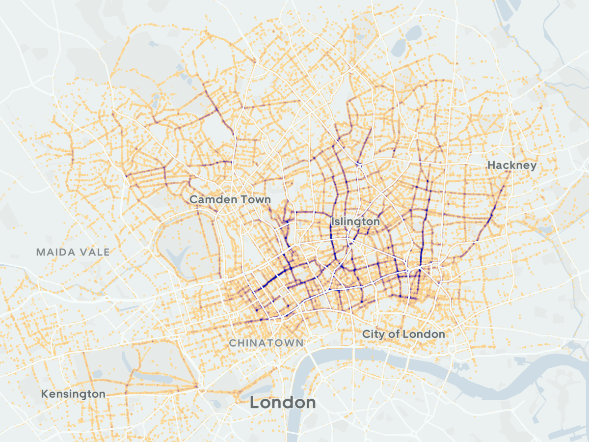
The bright red JUMP bikes are alas gone from the streets of London, following the takeover of Uber’s JUMP micromobility division by rival Lime. They
More...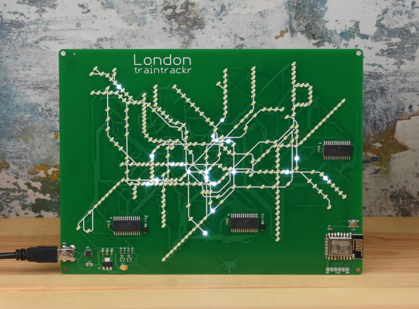
Missing travelling on the London Underground? Now, you can see the trains running, live, on this custom-made circuit board showing thetube network. An array of
More...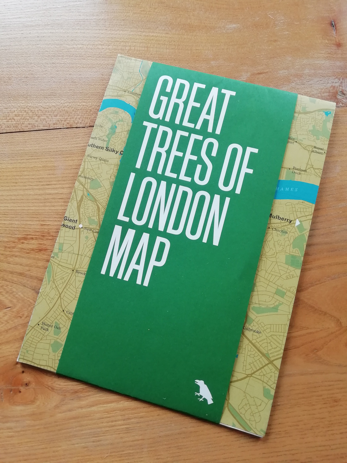
Blue Crow Media, long-time makers of bespoke themed maps of London and other places, have switched from their regular architecture focus and produced a lovely
More...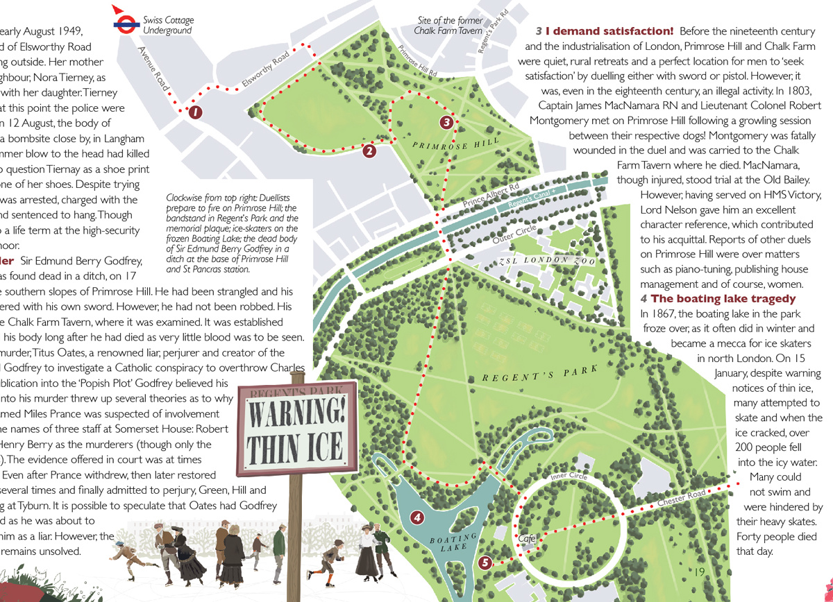
“Bloody London” is a new book by author, illustrator cartographer David Fathers. Previously writing about the Thames Path in London, the Regents’ Canal and London’s
More...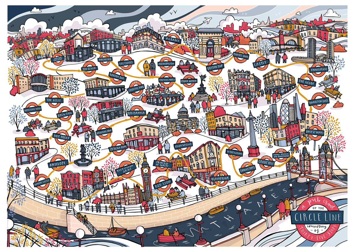
One of London’s hardest challenge, the Circle Line Pub Crawl, got even harder a few years ago when Transport for London reconfigured the line to
More...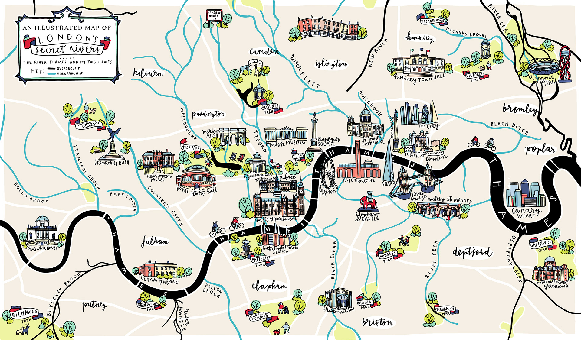
London has a lot more rivers than just the River Thames and River Lea – but many of the rest are either very small and
More...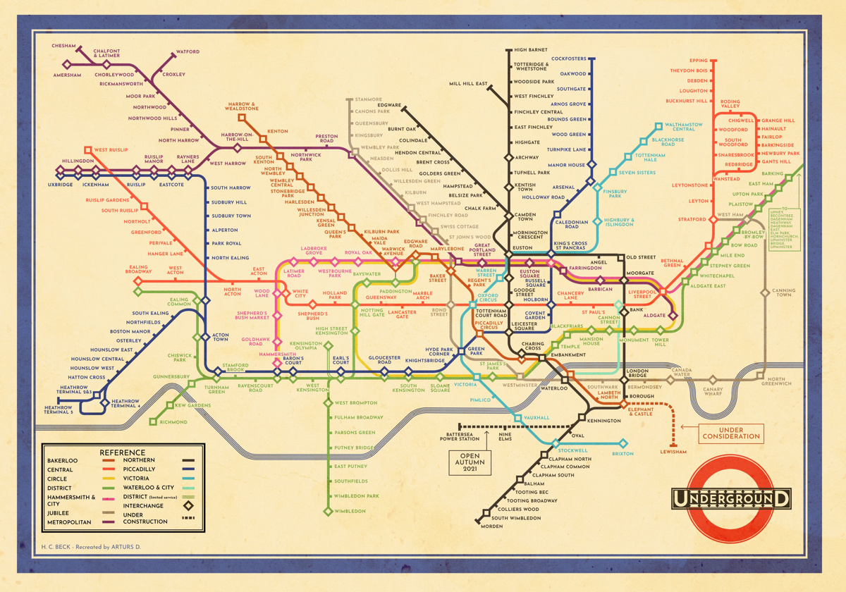
This creation by Arturs D, a volunteer at the London Transport Museum, is a faithful transplantion of the original c.1933 H.C. “Harry” Beck London tube
More...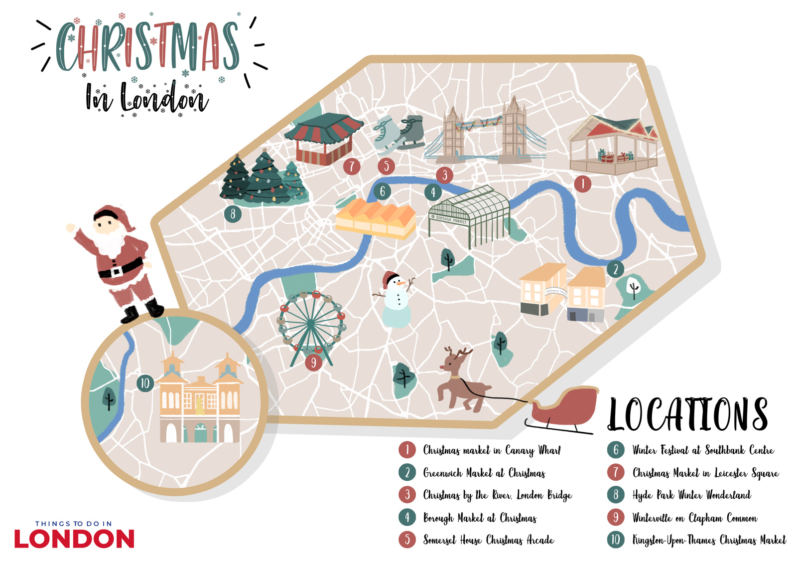
The days may be short, but London comes alive in the month leading up to Christmas, with a number of Christmas Markets popping up at
More...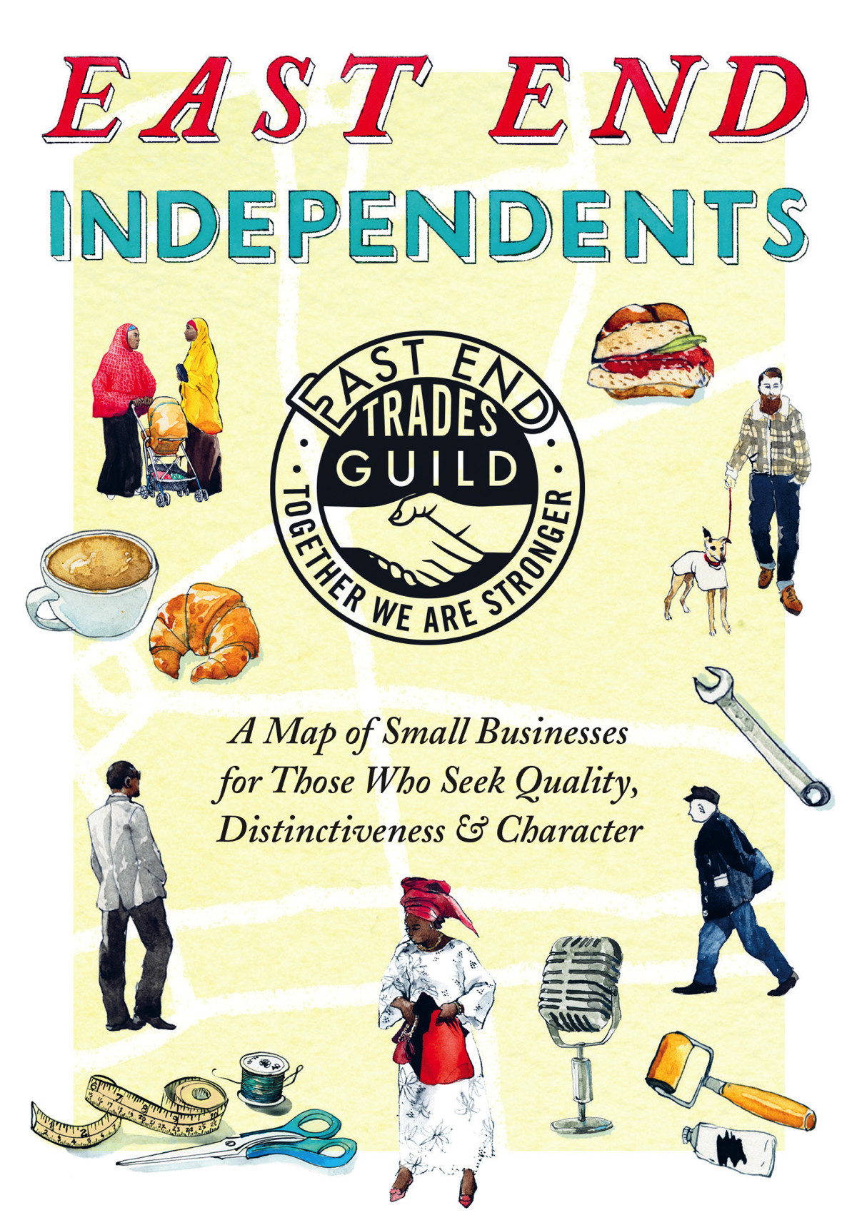
Following the original 2017 edition and a 2018 update, The East End Trades Guild have launched a new version of their specially created map of
More...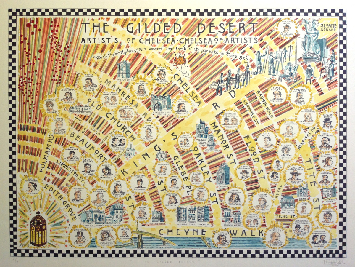
Adam Dant, artist, creates art which is often based around a geographical location, using cartography to frame a topic, often drawing out a key road
More...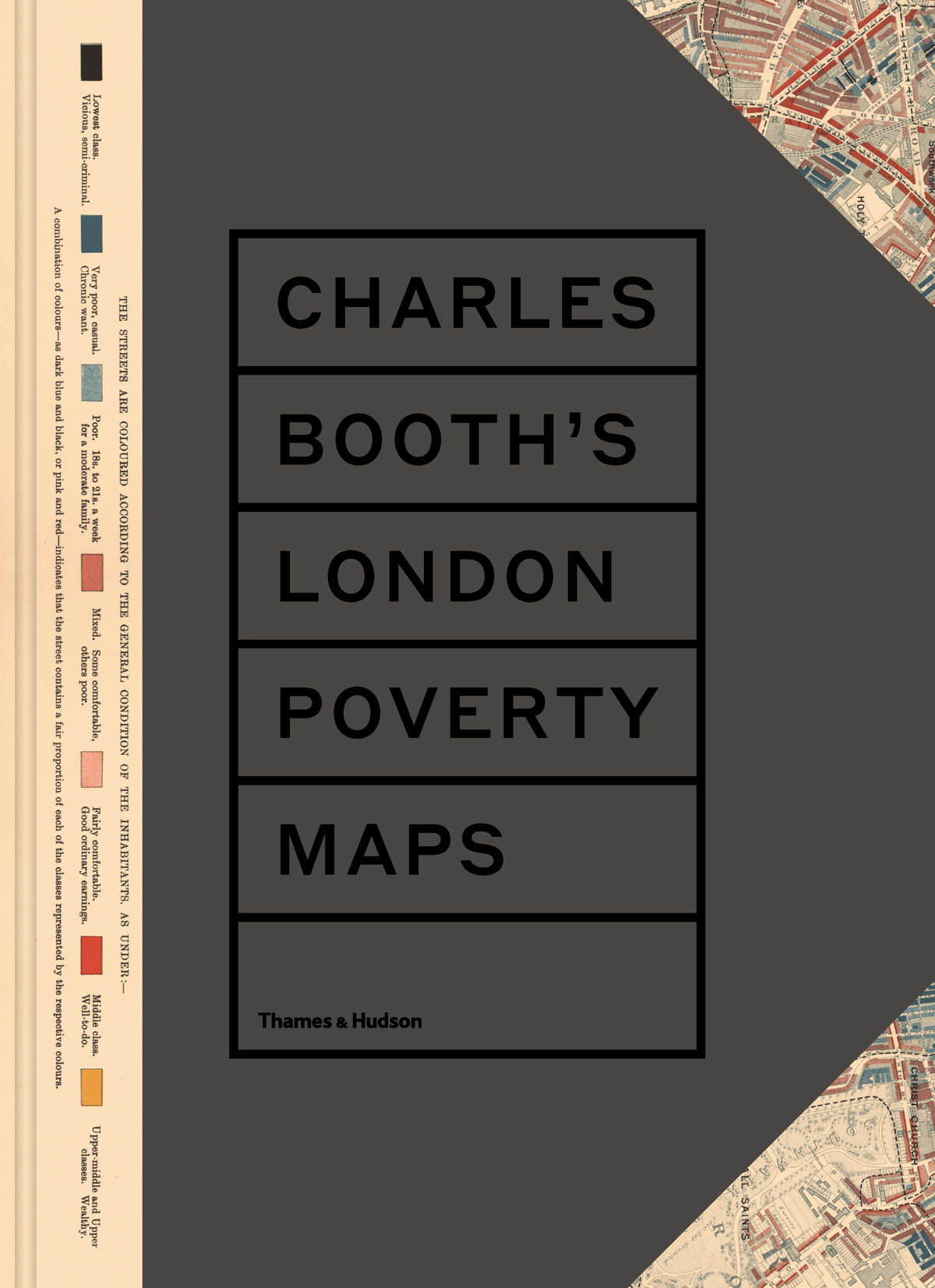
The season for giving and receiving approaches once again. Here’s Mapping London’s guide to the best gifts for that London, or cartographical, enthusiast in your
More...