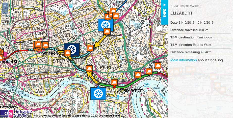
Crossrail is a huge project tunnelling out a new railway line under central London. We featured the Crossrail “live” maps showing the location of the Tunnel Boring Machines (TBMs), back in September 2012. However things have picked up since then and the project has reached its maximum state of activity, with six TBMs currently toiling under the capital – and one which has already completed its job and will now be buried in situ.
The “live” map can be viewed here – it is updated every couple of weeks. Green represents completed tunnel while yellow shows tunnel that will be dug in the month or so.
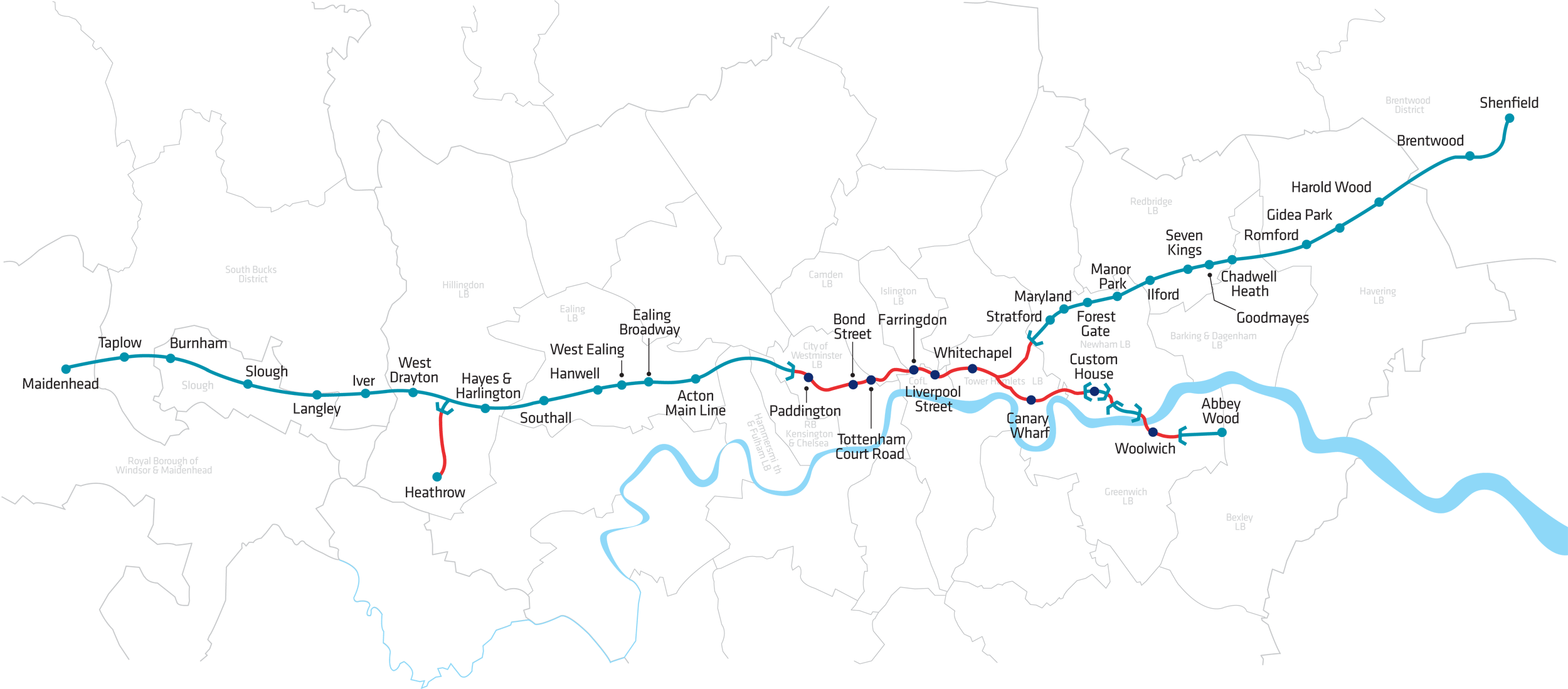
Crossrail’s full route across London (including above ground sections) will look like this:
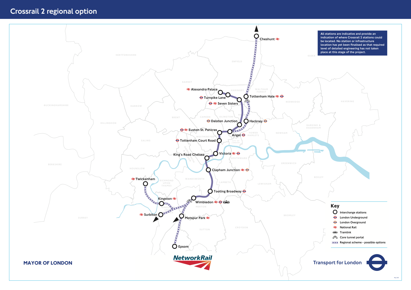
Even as Crossrail is being built, Crossrail 2 is in its very early planning stages. A consultation was carried out earlier this year, the results of which were published recently, showing strong support for the “regional” option, which like the current Crossrail, will extend outside of London. Here is an indicative map of where Crossrail 2 will go, should it be built:


Crossrail is the most exciting big infrastructure projects happening in London at the moment. It will dramatically speed up travelling from east to west and connect Canary Wharf directly to Heathrow. London has changed in exciting ways over the last several hundred years as recored on your London Maps and it still keeps changing!
Love the maps – thanks for sharing – any chance you know where a CR1 and CR2 shape file can be found?
Yes – try tfl_lines.json and tfl_stations.json at https://github.com/oobrien/vis/tree/master/tube/data which is on my GitHub account. In GeoJSON format, which is easy to convert to Shapefile should you need. Not official. Look out for “name”: “Crossrail” and “name”: “Crossrail 2” for CR1 and CR2 respectively.