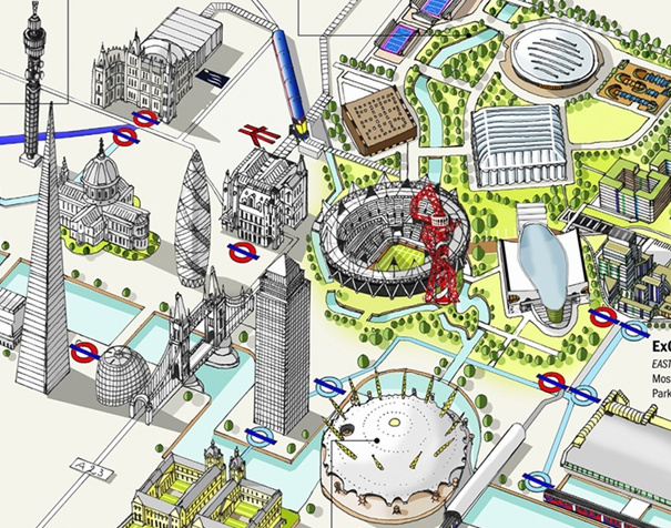
Thanks to the Chairman of CASA, Prof Michael Batty, for tipping me off about this map of Olympic Venues in London, created by Katherine Baxter and Steven Potter of LondonTown. Above is just a small extract from the map. This is another in a good series of infographic maps that LondonTown has produced recently – a previous one included a rather nice map of the Diamond Jubilee Pageant on the Thames.
I like the isometric projection and hand-drawn feel of the map. Venues are shown in indicative locations rather than being geographically correct, as the details of London between the venues are missed out. This makes it a very poor map for navigating around London between the venues, but a good graphic illustrating just how many venues in London there are, and how they relate geographically to the major London landmarks.
There is a zoomable, slippy version here, and also versions in 10 other languages here.

This is great! Isometric maps have a certain informative but friendly mood to them. Reykjavik also has a map similar to this of their downtown: http://visualizingurbanfutures.wordpress.com/2012/07/27/reykjavik-centre-map/