London’s railway terminus stations are major landmarks in the inner city – they form a ring around the city’s core are used by many, these days, not just to catch a train, but to meet, shop and walk through. A new book, “London’s Great Railway Stations” has been published this month. Written by transport historian Oliver Green and lavishly illustrated with hundreds of stunning photographs by Benjamin Graham, it is published by Francis Lincoln.
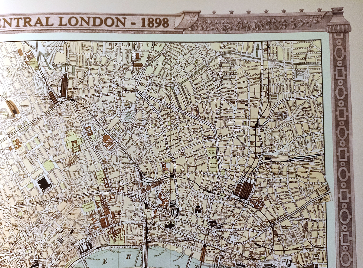
Mapping London is interested in the book, not just because so many of the maps featured so far here include one or more of these iconic structures on them, but because the book itself includes a rather nice, historic map which neatly includes all the terminii featured in the book. The map, simply called “Central London – 1898”, is one of the first to include all the aforementioned grand stations on it, as Marylebone was opened in 1899, and so would have been structurally present by the time this map was drawn.
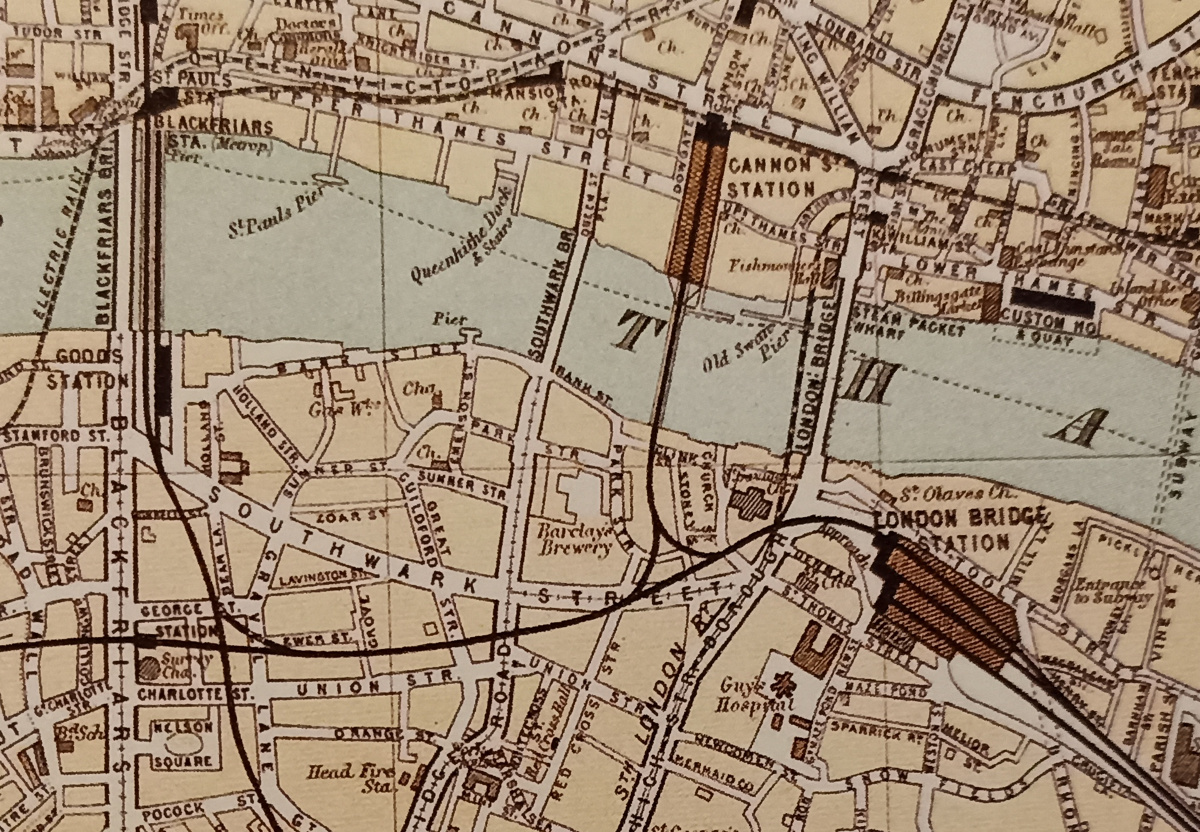
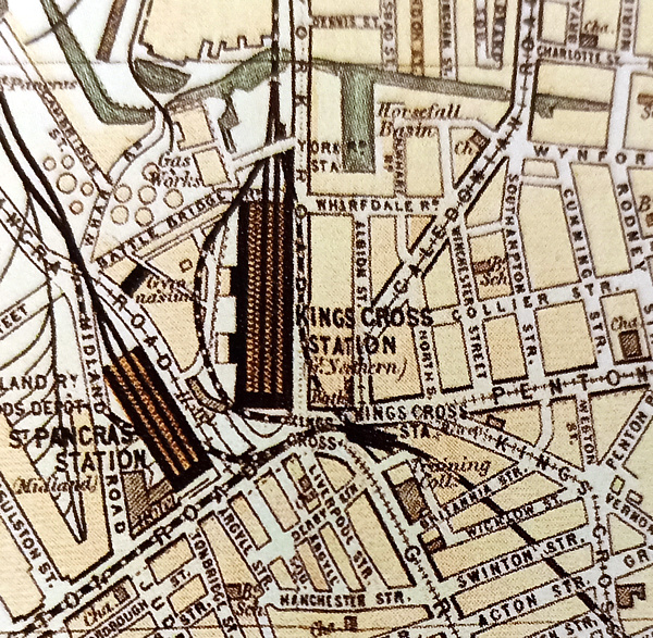
The map purports to show not only the stations themselves and their extents but also includes a simplified track layout right in the station itself. It includes a few no-longer-with-us curiosities that were present at the time – the track that ran through Waterloo station itself and on to London Bridge, and a loop around King’s Cross from Farringdon that then heads north – these days, the loop is wider and goes via St Pancras. But, by and large, the railway stations and network shown are what is with us today. Railways stick around. The map might be 123 years old but central London is strikingly recognisable in it.
A good, subtle use of colour makes this map pleasing on the eye, with pastel greens and blues for parks and water, the railway stations in brown, the tracks in black, and roads in cream. Other prominent buildings, such as the British Museum and Houses of Parliament, are shown in black. The map has a substantial artistic border around it – something that you don’t often see with modern-day mapping.
The map is from the “Royal Atlas of England and Wales” which was edited by J. G. Bartholomew (of the very famous family business) and published by George Newnes of London.
It’s a lovely little map and a nice way to frame the rest of the book. & there are a couple of other maps in the book too. But why you really want “London’s Great Railway Stations” is the photography. Both old and contemporary images of each of the featured stations are included, and they really are lovely. Although all the stations were built in the 19th century, many of them have been substantially renovated in the last couple of decades, in some cases the Victorian detail has been restored, while for others, modern extensions and reworking of the structures have brought the old buildings into the modern age with contemporary design. If you never look upwards when you next catch a train from one of these transport “temples”, then do so next time – and until then, feast your eyes on this weighty coffee-table-style book, which is now available in hardcover from Amazon and travel focused bookshops.