Central London has long been a spatial challenge for tourists and others unfamiliar with it. It’s very big, and most of it isn’t built on an easily understandable grid pattern. Quirks and kinks in streets built back in Roman times, persist to the modern day. The tube network is never far away from you when you are in “Zone 1” and offers a navigational relief but it’s always best to explore a city by walking with it.
With this in mind, the “London all-on-one” pocket map, part of a series of UK city centre maps under the brand “Quickmap“, might be what you need. Claiming it is “London’s only tube, bus train, walk diagram” it certainly is bring something new to the table. Can it compete with the free “around this station” maps available at most tube stations, or Google Maps on your smartphone? Perhaps!
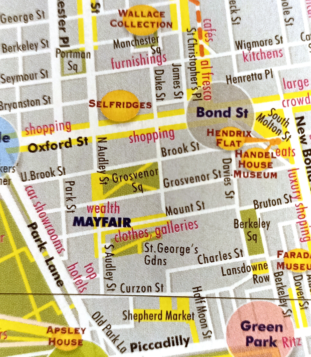
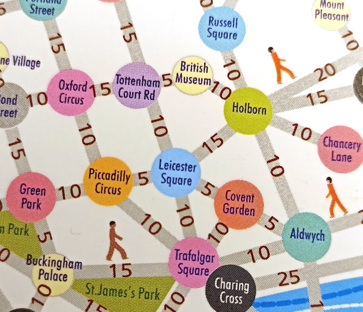
The all-on-one map is in fact three maps – firstly a simple walking node-network map for Zone 1 itself (see picture below) on the back cover which has estimated walking times (e.g. Albert Hall to South Kensington 15 minutes), and secondly a detailed walking map for Zones 1 (+ Richmond, Hampstead and the Isle of Dogs) which highlights the main attractions but also traffic free streets and precincts, and very wide pavements, allowing the discerning tourist to develop a traffic-lite route around the centre of London and the other three classic tourist districts.
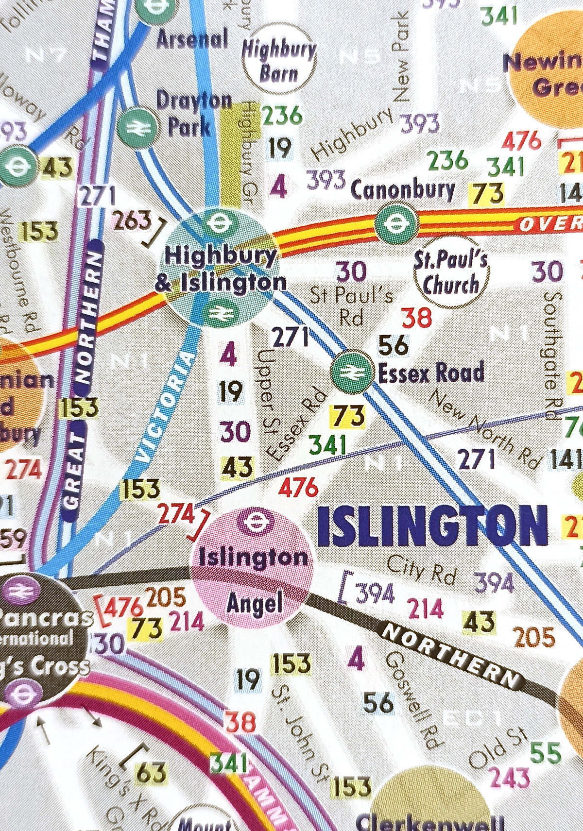
But the value of the all-in-one map is the final map (see top picture), as it includes not only the full tube and train network for Zones 1 and 2 (and parts of Zone 3) but also a bus map too. TfL used to publish ultra-detailed bus maps allowing, on a single map, to see where all the bus routes went. They scrapped this a few years ago, to be replaced with just a few “spider maps” showing routes out from a specific point. The all-in-one has a good go at recreating this. Each road that has a bus route on it is included, with the numbers of the buses running along each segment. Different colours are used, to allow one to trace out a route without being dazzled by the other numbers sharing that street. As being on a bus is one of the best and cheapest ways to explore inner London, having a single map that integrates all the routes is a rare and valuable find these days.
Transport for London does fairly regularly tinker with its bus network (particularly at the moment when the combination of the forthcoming Elizabeth line, a budget crisis, and a general desire to declutter bus routes in the centre of London and move them out to the suburbs) so this kind of map only works if it is regularly kept up to date. Thankfully, that is the case with the all-on-one map which has already had more than 20 editions produced – more than one a year.
There are a few additional cartographical touches worth mentioning. Central London’s main neighbourhoods are shown as circles with varying colours – and the colour and network of circles is repeated across all three maps. Indeed, along with the bus routes and showing the tube/train network, colour is one the key techniques used to show the large amount of information on a compact, paper much such as this. Also – the map is geographic – not a tube map. This includes the walking times network map. This means it is well suited to being above ground. But, where it won’t affect navigation, the streets and rail lines are simplified – they curve gently to declutter the map while ensuring that everything still joins up correctly. It’s a subtle effect but does aid readability. Finally, postcode areas are also included, carefully, in the background. As most London street signs have the postcode area on them (e.g. Whitehall SW1) this acts as an additional cross reference.
Overall, if you want to make full use of the central London bus network, or choose a route which is pleasant to walk through, then the all-one-map is a carefully designed and useful tool for the tourist. It is available from publisher Central Books, or Amazon.