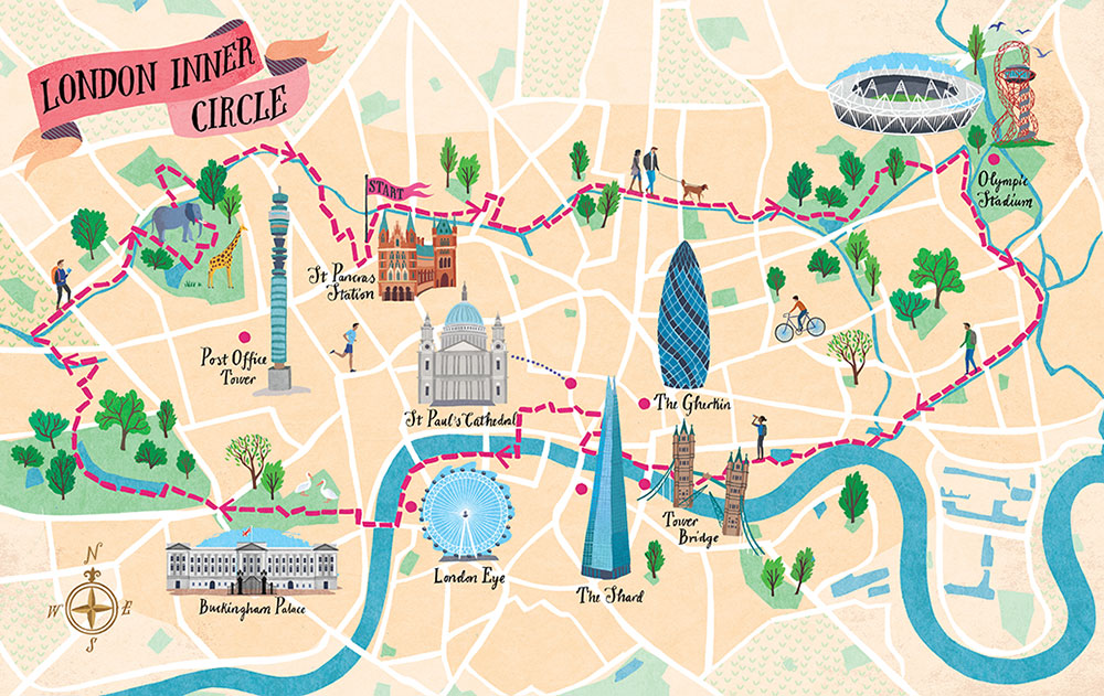

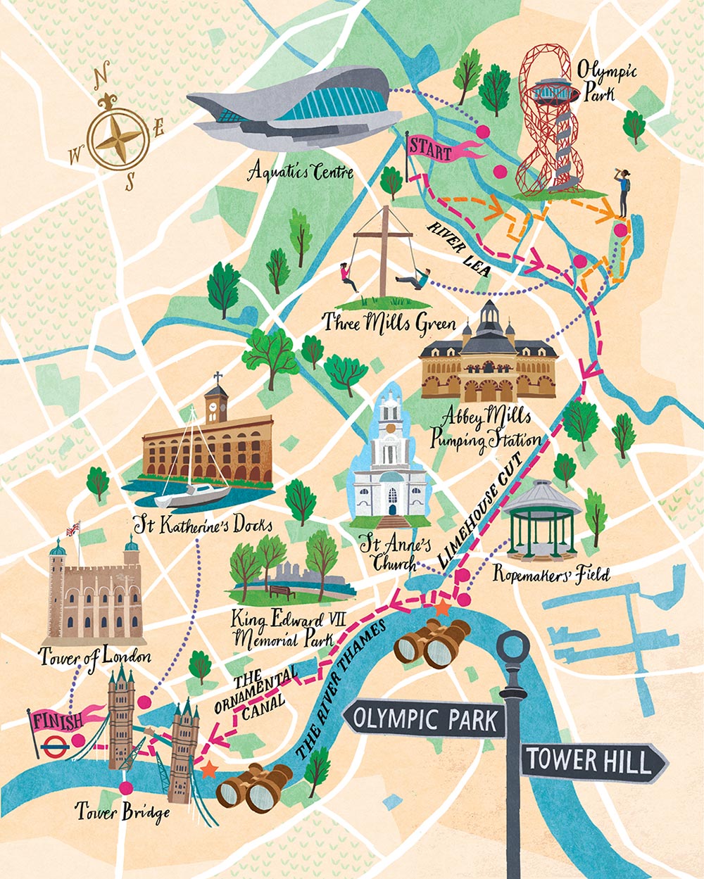
Urban Rambles is a new book by Nicholas Rudd-Jones, featuring walks through many of England’s cities. The book comes with a 22 route maps, drawn by illustrator Sara Mulvanny (see her portfolio page for the book), including a couple in London, which we feature here. Above is the “London Inner Circle” which stretches from Hyde Park to the Olympic Park, and makes good use of the Regent’s Canal, Thames Path and the Royal Parks, to avoid road-walking in the centre of the capital whereever possible and form a complete loop. Having walked, cycled and even boated recently along the Regent’s Canal, I can confirm that it is a lovely route. Below is another London map in the book, Olympic Park to Tower Hill, which focuses on the eastern end of the above walk, the enlarged scale meaning that more cartouches and other cartographic niceties appear.
The colour palette used for the maps is very pleasant – it reminds me a little of the Stamen Watercolour map, but, being hand-drawn, the textures are used discerningly, and don’t distract from the waypoint or route detail. Key landmarks are sketched, with dotted lines connecting them to their actual locations on the map. A number of other cartographic details, such as stars showing particularly scenic locations, trees showing the key green areas, and an attractive compass rose, finish off the map.
Urban Rambles is available on Amazon or in all good bookshops.
Urban Rambles — https://t.co/3TI10zmLZI