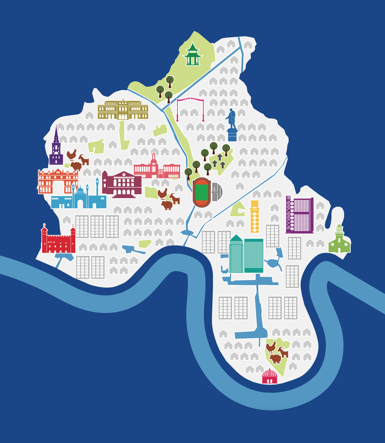

Tower Hamlets council, one of the 32 London borough councils, has produced this simple pictorial map as part of a consultation for “Tower Hamlets 2031”, setting the “local plan” for urban realm policy for the next 15 years. The map appears on various advertising panels throughout the borough at the moment, and also appears on their website. It is purely an illustrative graphic of the present day Tower Hamlets, with the consultation documents themselves containing many much more detailed (but less pretty) maps of current and planned designations.
We really like the map being simple and attractive, it showcasing the many famous buildings in Tower Hamlets, both old (Tower of London, Chrisp Street Clock Tower) and new (East London Mosque, Canary Wharf) as well as highlighting the three city farms and other larger green spaces in the borough. It also shows the extensive canal network, basins and docks that are a key part of the borough’s fabric and the focus of its regeneration work.
If every borough had a map like this then it would show just how interesting (almost) every borough in London is, rather than the traditional focus on the tourist hot-spots in Westminster, Camden and the City.
Tower Hamlets Pictorial Map — https://t.co/grDEcEI89T
New post on CASA blog: Tower Hamlets Pictorial Map https://t.co/SzIs2Up9bj
Tower Hamlets Pictorial Map | Mapping London at https://t.co/rKLD7xNpuG
RT @MapLondon: Tower Hamlets pictorial map: https://t.co/vxxlzpjHsx https://t.co/4WOtLB6nIS
#TowerHamlets Pictorial #Map | Mapping London https://t.co/GYWIhZtxbd
RT @LoveWapping: #TowerHamlets Pictorial #Map | Mapping London https://t.co/GYWIhZtxbd