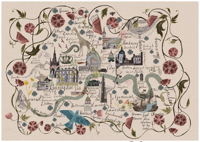

Mapping London stumbled upon this lovely cartographic art-piece of London, created by illustrator Josie Shenoy, at her stall at the South Bank Christmas Market (almost underneath the southern end of the Hungerford Bridge that goes across to Charing Cross, near Foyles’s South Bank outpost). It’s called River Thames and is available as a print and in a number of other formats (e.g. notebooks and cards) from the stall as well as online.
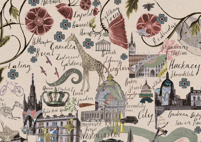
We really like the combination of landmarks, placenames and flora/fauna. A cartographic trick (variable scaling – like on the tube map) is used to include mentions of all boroughs, including the outermost (hello Havering), while retaining the famous wiggles of the Thames, and the most iconic landmarks in the centre of the capital.
There is also another design, of London secrets – it includes the lost rivers that follow under our feet, abandoned and closed tube stations, and other hidden London miscellany. This second design is not on the website yet so you’ll need to go to the stall itself to see it!
This is the first in a series of articles featuring great maps that would make good Christmas gifts. Tis the season!
Spotted on a walk along the South Bank.