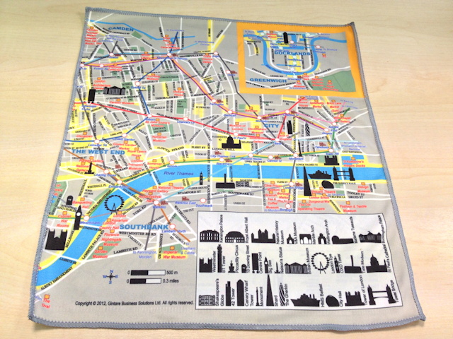

Silky Map is a bespoke map of central London, printed on a soft cleaning cloth, the kind you would use for cleaning your iPhone screen or camera lens. As such, there’s a good chance you’ll be keeping it in your camera bag or wallet, and therefore it’s potentially a London map that you will always have handy.
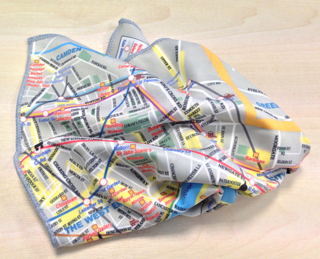
Because of the material it’s printed on, if you scrunch up the map and then lay it out flat again, it doesn’t get creased, but returns to its mint condition. This is a much better result than the Crumpled Map which remained resolutely crumpled even when it was unravelled. The cloth has a map on both sides – one with the City area and an extract of Docklands, and the other showing the West End and an extract of Hampstead.
The cartography of the map is quite lively – it’s not the prettiest we’ve seen, but the medium of a cleaning cloth requires a map which is relatively simple and vivid in design. The map is designed with tourists in mind, with attractions pointed out, significant landmarks shown as silhouettes, and interesting and attractive streets and areas highlighted in yellow. The tube network is highlighted prominently. The map almost fully up to date – showing the Shard, although not the Circle Line extension to Hammersmith. There are a couple of mistakes – the DLR network dequence in the Docklands extract has a couple of stations out of order, and few of the other stations are a block away from where they actually are – but nothing too major.
You can find out more about Silky Map on the creator’s website.
Thanks to Gintare for sending us a Silky Map! Our computer monitors are now dust free!
I’m very excited to know that you monitors are finally clean! 🙂
Thank you for writing such a lively review! 🙂