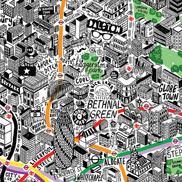

This wonderful map (above is just an extract) has been drawn by artist & illustrator Jenni Sparks. It’s a hand-drawn map of central and inner-city London. Tube/train lines, parks and rivers are coloured, everything else is shown in black-and-white. Buildings are all drawn in a 45-degree isometric style. Annotations reveal characteristics of an area that won’t appear on traditional maps. Dalston comes with a bicycle, plastic-framed glasses and a moustache. Canary Wharf is festooned with various currency symbols. The map is bang up to date – the Shard is shown as completed. The Olympic Stadium also appears, complete with some shining Olympic rings.
Further information is on her blog, with A1/A2 prints for sale.
Extract from Jenni’s website.
Hi, I fell into your blog by a happy chance following links from twitter. I was wondering whether you’d be able to let me know how long is the copyright on old maps, and where in London could I have visual access to consult some older Uk countryide maps. I’m a designer and thinking of working on a project in relation to these. Thanks.
Hi Kasia – this page may help:
http://wiki.openstreetmap.org/wiki/Out-of-copyright_maps
Hi Oliver,
thank you for the link, perfect.
Hi!
How can I buy one of those maps?
Hi Siria,
They’re great aren’t they! I think you can them online at http://www.evermade.com.