
Charles Booth’s 1899 Poverty Map of London is a seminal work in the history of London maps and the development of geodemographics (characterising people based on where they live) which are now widely used by marketers and retailers. Over the course of several years, Charles and his researchers knocked on doors all around London, interviewing and characterising the people they met, into seven categories, such as “Well-to-do” or “Vicious, semi-criminal”. The houses were then coloured in, on the map, according to their category. The resulting map allows an at-a-glance look at the characteristics of suburbs and whole districts of London at the turn of the 20th century.
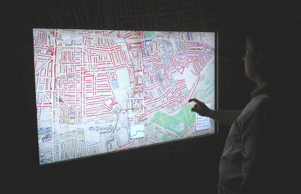
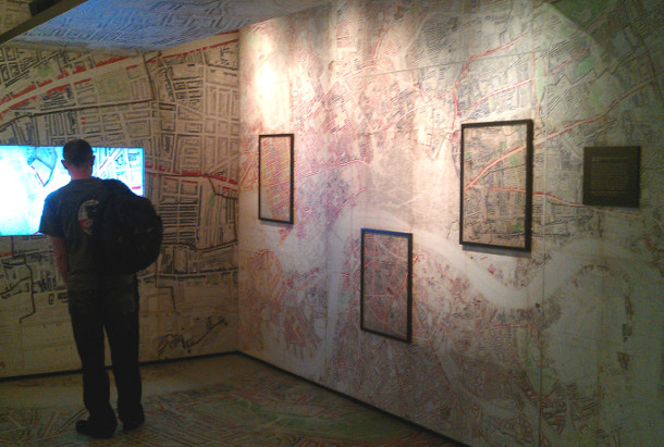
The Museum of London’s modern galleries recently reopened after a two-year refit, and one of the highlights of the new section is a “walk-in” Booth Poverty Map. The floor, walls and ceiling are covered with the map, while a touch screen allows visitors to pan and zoom in on the map and, for certain places, find out additional characteristics of the area concerned. It’s worth visiting, if you can find the museum (it’s suspended above a roundabout in the City of London, so not intuitive to find) – and other highlights include a scale model of the original Skylon, and the gilded coach used by the Lord Mayor of the City of London in his annual parade.
Hi, I was contacted recently by Century Films … think you might be interested in their latest project
http://www.oursecretstreets.com
Taking Booth’s remarkable social maps as its starting point, this major new series will update the most comprehensive social survey ever conducted.
Thanks Mike, very interesting to read that. I look forward to seeing their documentary series next year.