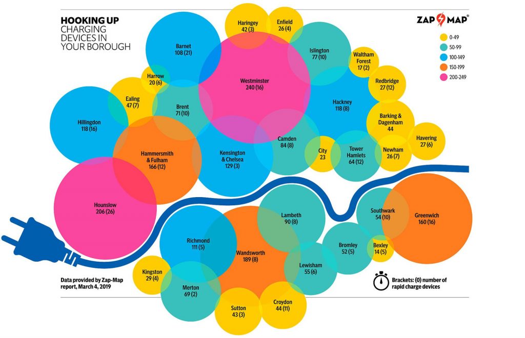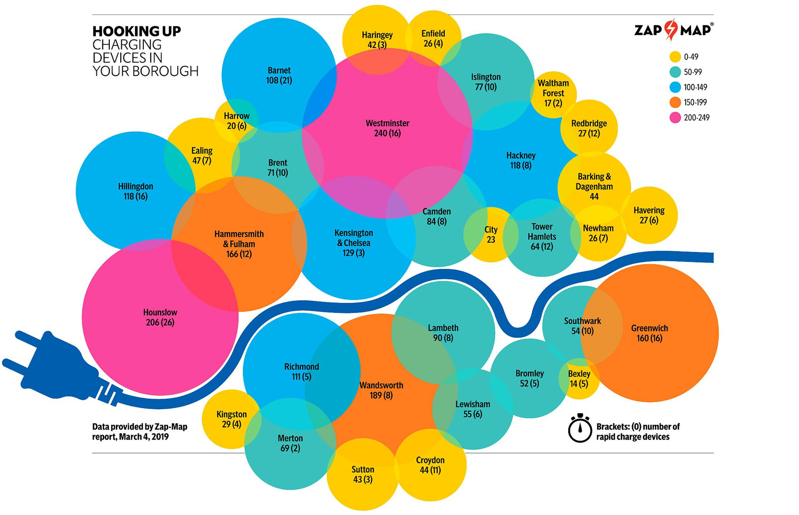
This map, “Hooking Up”, was produced by the Evening Standard newspaper as part of their Future London project, in association with Source London, a service provider/lobbyist of charging points in London, and Zap-Map, who hold a comprehensive database of the locations of these facilities.
The map can be seen in an Evening Standard article detailing how each borough is expanding its public electric charge point network – a critical piece of infrastructure needed for a cleaner, more efficient future where London’s motor vehicles will be electrically powered.
While the map is a bit naughty in its colour scheme, using various different hues to represent a linear scale (number of charge points in each borough), can also see the key metric simply from the size of the circle representing each borough. The different hues, combined with translucency, also allow the circles to overlap slightly without much loss of visual impact of each circle, allowing the boroughs to remain in the approximately correct geographical location while allowing the big facility boroughs (Westminster, Hounslow, Hammersmith & Fulham, Wandsworth and Greenwich) to rightly dominate the map.
The slightly overlapping circles also look a little like a cartoon exhaust cloud, which may have been a deliberate idea. The map is finished off with a really clever touch – the all-important River Thames is shown as a charging cable.
The map was drawn by Adrian Black, a graphic designer who regularly contributes to the Evening Standard. Found online. © Adrian Black/Evening Standard.

Electric Car Charge Map — https://t.co/NC7vKkAx4T
Electric Car Charge #Map https://t.co/6u48oFheut