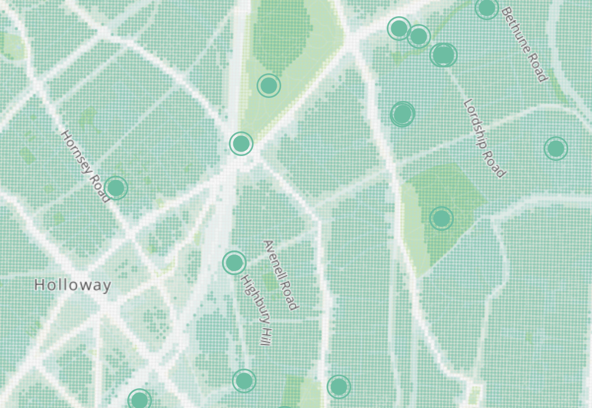

Tranquil Pavement is an online map recently launched by the Tranquil City project based in London, in association with the Outlandish Cooperative and funded by Organicity. It aims to highlight tranquil places to visit, if the hustle and bustle of city life gets too much, by plotting “crowdsourced “locations – referenced in an Instagram feed – as green circles, and also shows a general overlay map shade of calmness (or otherwise) across the capital. The latter is shown by a white (higher noise/pollution) to green (lower noise/pollution) gradient based on official data from DEFRA and the GLA. A different shade of green, showing park footprints, is underlaid to further emphasise likely tranquil locations. The background map makes a point of naming, and so highlighting, only smaller roads, rather than larger noisy artery roads, and also showing some water features, including, unusually, underground rivers such as the River Fleet.
The overall map – tending to green in more suburban outer London, but with green highlights for specific tranquil locations more likely to be in the inner city, results in a rather pleasing to look at – although perhaps grey black would be an even better colour for pollution/noise – representing the murk of an untranquil location.
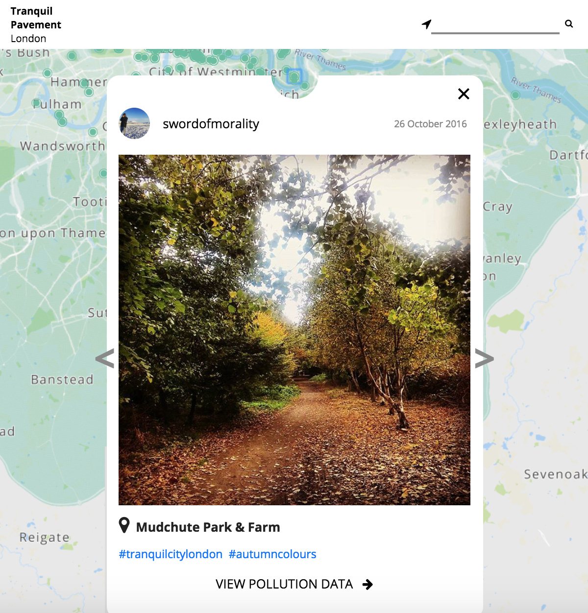
Explore the live map here, or add the #tranquilcitylondon tag to your geotagged photos of London’s peaceful places, on Instagram.
Tranquil Pavement https://t.co/6fHD3YFnqN | #GIS #mapping
There is a certain irony in crowdsourcing locations to get away from the hustle and bustle.
For those looking for a chilled city visit this weekend | Tranquil Pavement https://t.co/c6GDSsdmwI #FridayFeeling
There is a certain irony in “crowdsourcing” locations to get away from the hustle and bustle. https://t.co/Q9b8tNMZLE via @MapLondon
Tranquil Pavement – crowdsourcing peace and quiet amongst busy London streets: https://t.co/3Cahbtq0TC https://t.co/jT579HrYdK
#Wellbeing #GeographicalSkills Tranquil Pavement via @MapLondon https://t.co/eQ2UQHL19K via @MapLondon
RT @MapLondon: Tranquil Pavement – crowdsourcing peace and quiet amongst busy London streets: https://t.co/3Cahbtq0TC https://t.co/jT579HrY…
Ollie, thank you for your blog post.Really thank you! Awesome.
Thanks to @MapLondon for featuring our Tranquil Pavement London on their website. Check it out here:… https://t.co/tpgIdGT2pE
Thanks to @MapLondon for featuring our Tranquil Pavement London on their website. Check it out here:… https://t.co/tpgIdGT2pE
RT @tranquilcityapp: Thanks to @MapLondon for featuring our Tranquil Pavement London on their website. Check it out here: https://t.co/fzp6…
RT @tranquilcityapp: Thanks to @MapLondon for featuring our Tranquil Pavement London on their website. Check it out here: https://t.co/fzp6…
RT @tranquilcityapp: Thanks to @MapLondon for featuring our Tranquil Pavement London on their website. Check it out here: https://t.co/fzp6…
Can you help improve any of the maps on my website, which is promoting the idea of installing a running track in the City. Of particular interest is a pollution map,
Regards, John