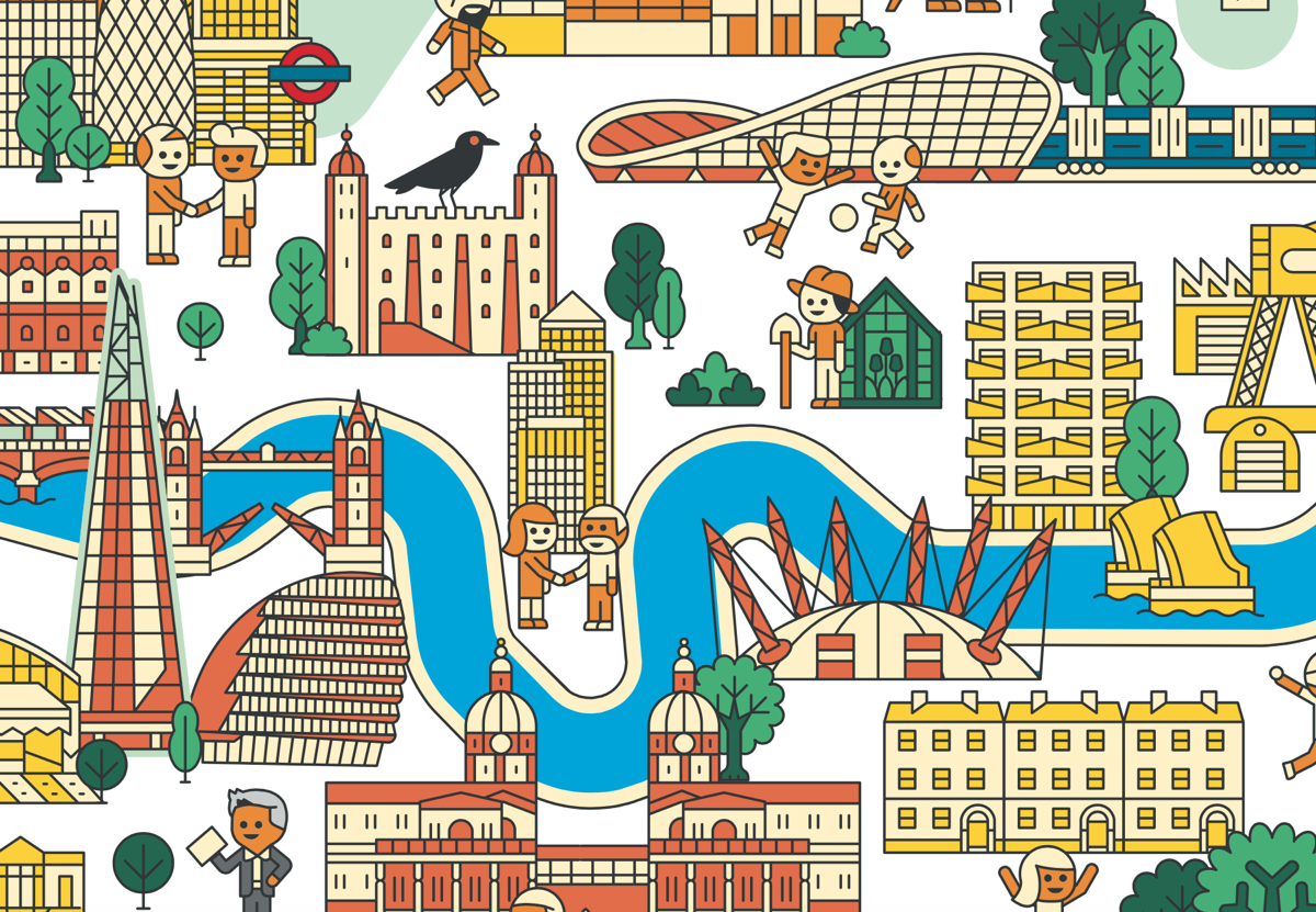
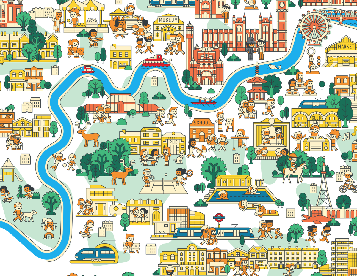
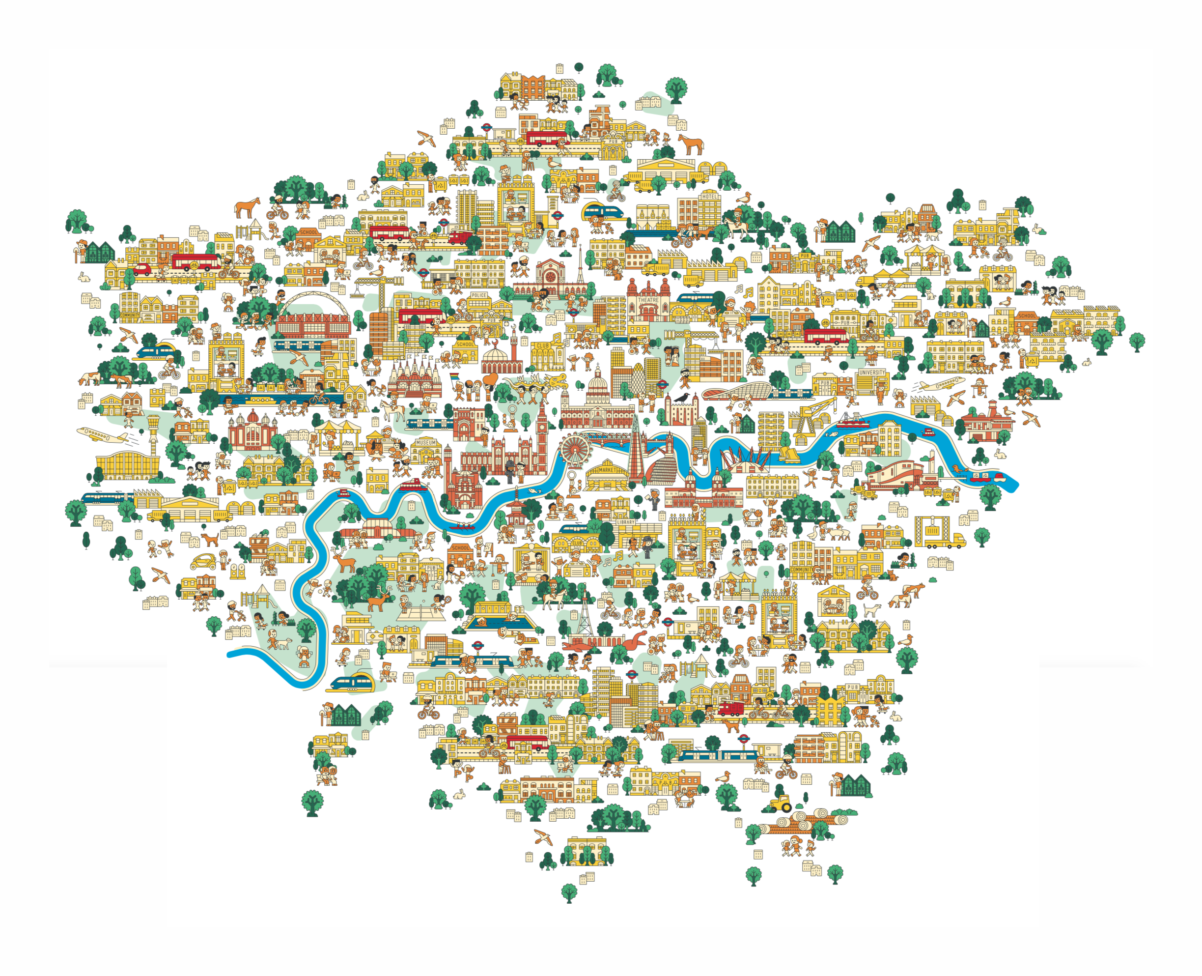
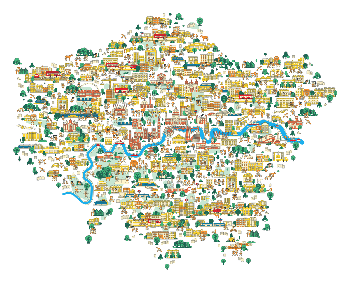
The Mayor of London released a draft version of his New London Plan this week. The plan is full of interesting maps, but one of the nicest looking ones is on the front cover. It’s an illustrative map created by, we believe, artist Jan Kallwejt (portfolio) which combines geographical landmarks, in their approximately correct relative locations, with illustrative features of the London experience – tube station roundels, parks with trees, and building terraces.
As this is a plan for the future of London, there are also some future references – tunnel portals for the proposed Crossrail 2, for example.

We really like the colour palette – yellow, cream, brown and green predominate. It’s nice also to see a comprehensive map like this, covering the whole of the Greater London Authority area, produced as a pure vector artwork, you can zoom right in for all the lovely detail. Direct link, or download a large version of the map.
Discovered through online announcements.
A nice simple yet comprehensive map, with nice artwork. Great map, thanks for sharing. Regards, Alastair Majury