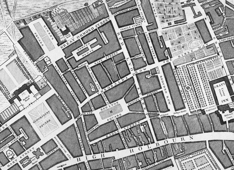

As an update to our previous feature on a replica map set of the John Rocque eighteenth century map of London, we feature the Locating London’s Past project. At the heart of the website is a high-resolution scanned version of the aforementioned historic map, allowing anyone to see this 260 270-year-old snapshot of (central) London in wonderful detail, including the individual alleyways and yards (with names clearly visible) linking the medieval street network. The project has “orthorectified” the old map, lining it up with the modern “Google Map” which is also available from a drop down on the website for a direct comparison. Interested researchers can add pins to the map referencing various historic records, such as plague deaths and Old Bailey proceedings, via the Data tab.
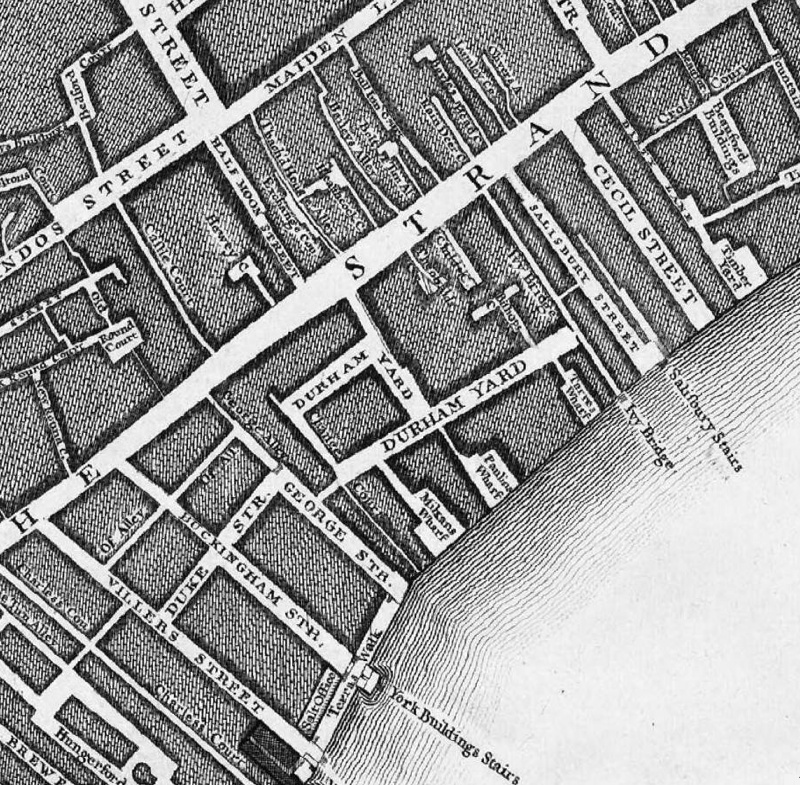
1740s London looks distinctly different – it’s much smaller, of course, and while the familiar street pattern is familiar in many places, there are some big changes too. One of the most striking differences is the lack of the Embankment road (for example, in the snapshot below). Instead, streets and yards just lead straight down to the edge of the River Thames, often ending at a flight of stairs down to the water itself. Most of these have disappeared now, the building of the Embankment and modern bridges across the Thames having put paid to that, although some are still intact, including a rather spectacular set accessible just east of Tower Bridge – the Horsleydown Old Stairs, which appear on the map too. University College London was still 80 years off being founded when this map was produced, and the area is shown simply as some small garden plots off Tottenham Court Road and the “Road to Highgate”. Spellings have changed – back then it was “High Holbourn” with a u, and “Red Lyon Street”, with a y. The exciting sounding “Liqourpond Road” is now just Clerkenwell Road.
The Thames also is shown bustling with rowing boats, flag-adorned barges and (to the east of the old London Bridge) tall-masted ships.
It’s great glimpse into a much older London, and with the lining up with Google Maps helps frame it within the metropolis of today.
Explore the map on the Locating London’s Past website.
Locating London’s Past was created by the Museum of London Archaeology (MOLA) group. Thank you to Sarah Jones of MOLA, who commented on the original Mapping London post on the Rocque 1746 map, for letting us know about this project.