Quite a bit of creative activity is going on in the south-west London borough of Wandsworth, as this map & guide, produced late last year,
More...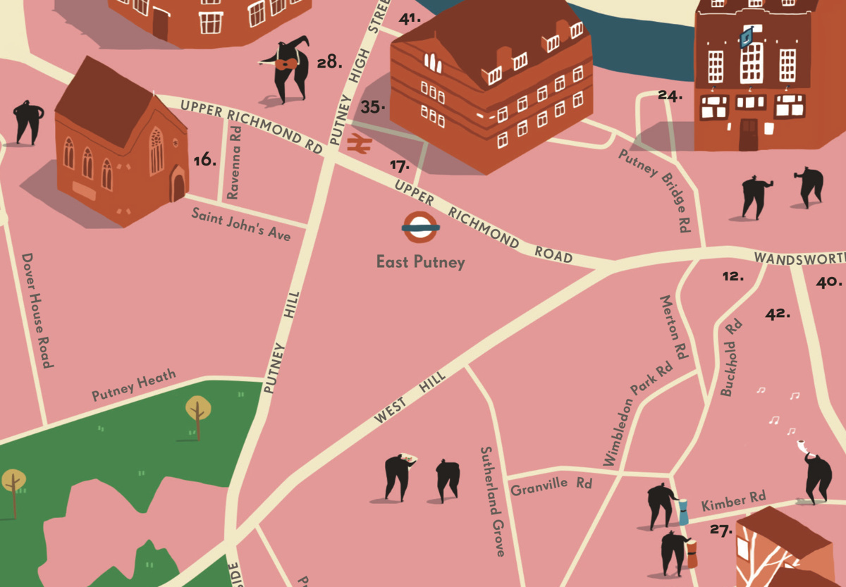
Highlighting the best London maps
Quite a bit of creative activity is going on in the south-west London borough of Wandsworth, as this map & guide, produced late last year,
More...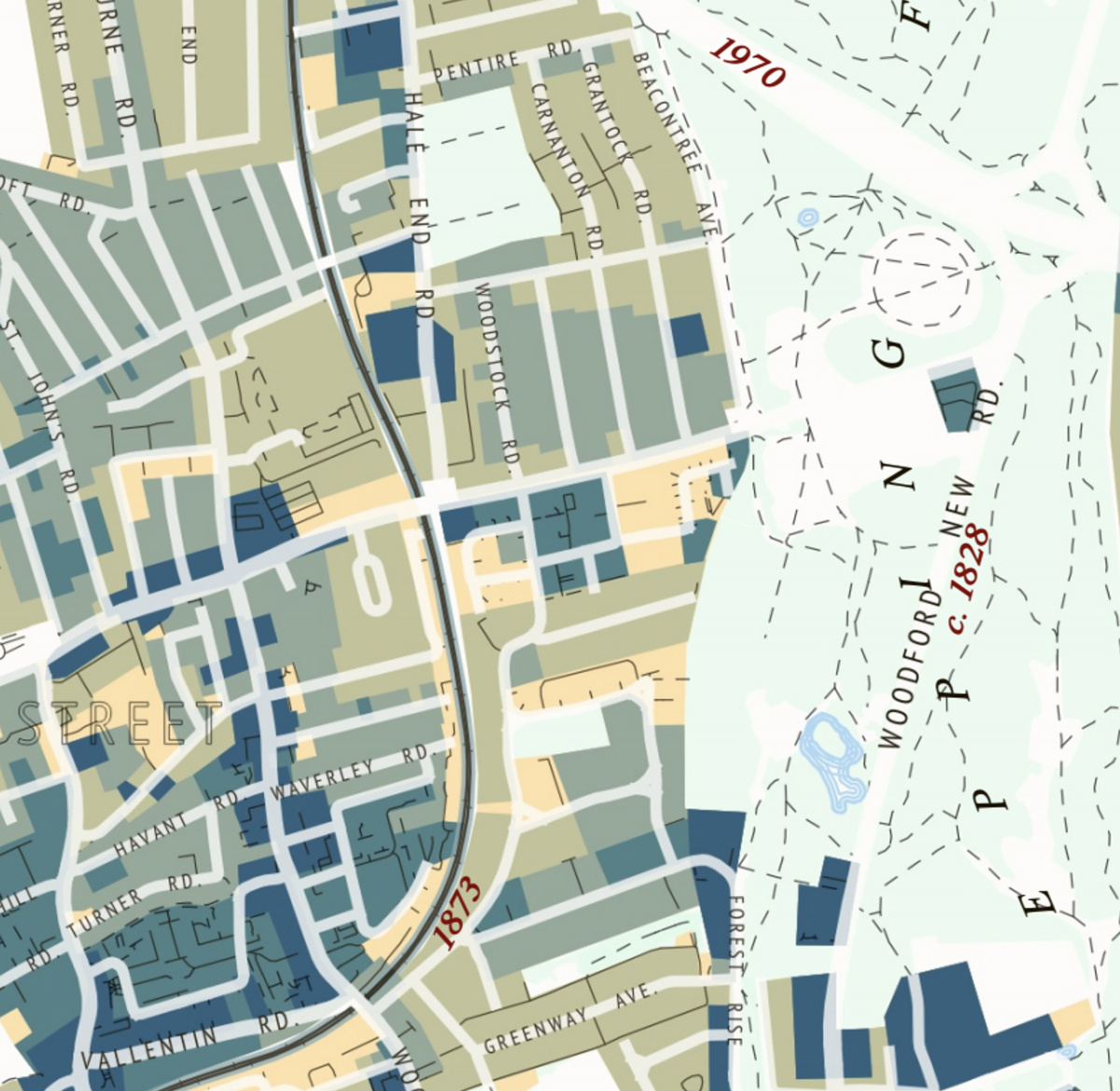
This attractive map of the housing and infrastructure history of Walthamstow and Leyton in north-east London has been created by Scott Davies. Scott used QGIS
More...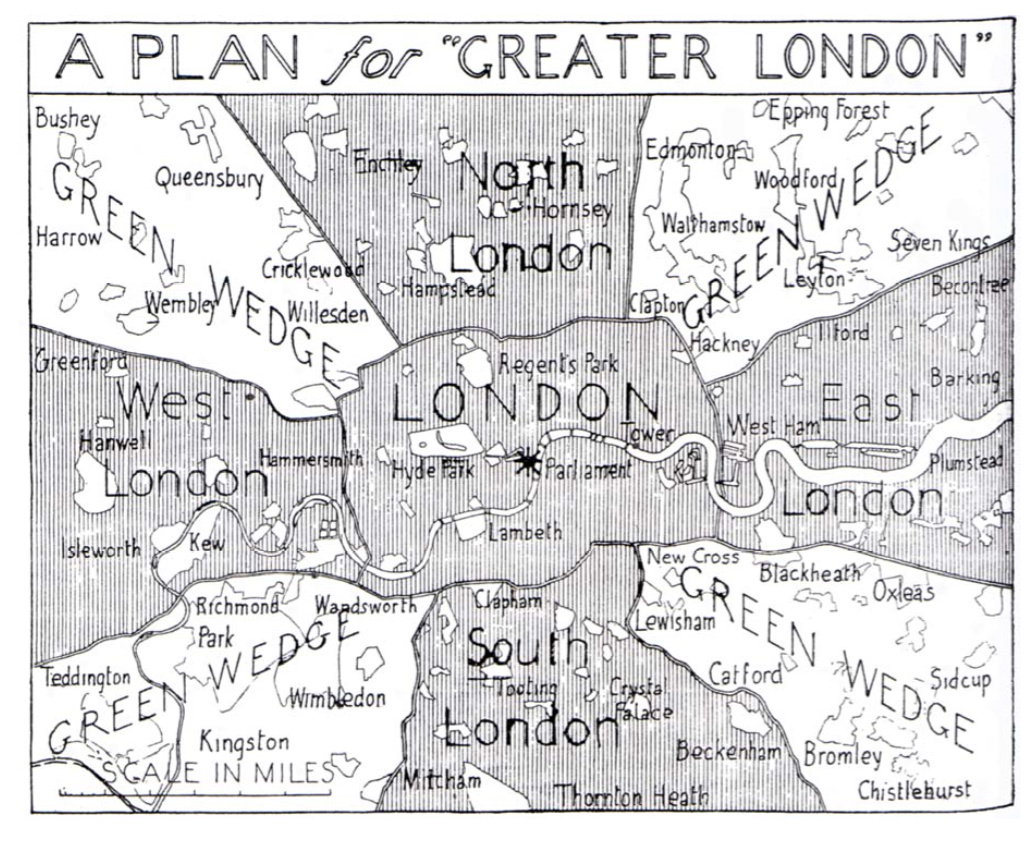
This map, “A Plan for Greater London”, is a 1943 masterplan for the rebuilding and enlargement of London, following the damage of the Blitz. Instead
More...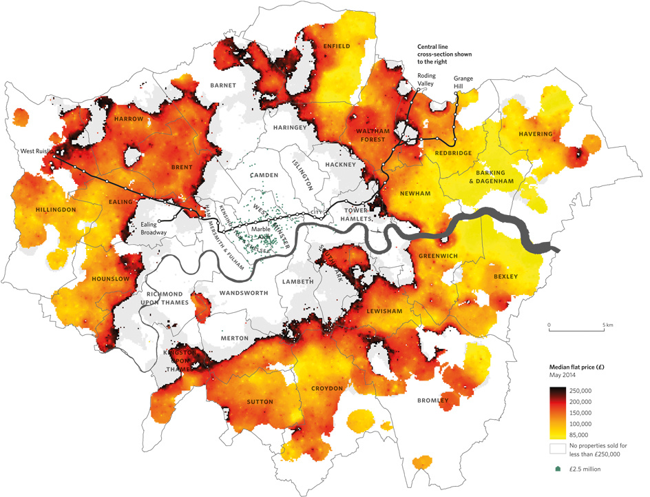
Above is a map from Mapping London co-editor Dr Cheshire’s new book The Information Capital that appeared in this week’s Time Out (print & online).
More...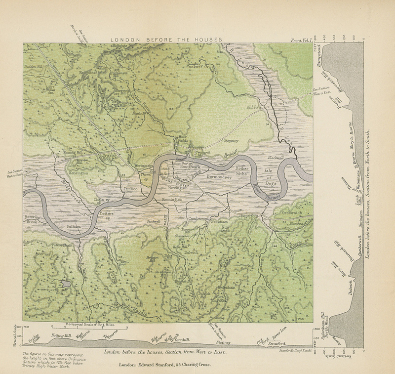
This map (full size version) is a plate in “A History of London” by John William Loftie which was published in 1884. It is one
More...