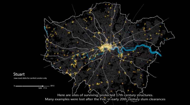
This animation shows how the roads in the London area formed, from Roman times through the industrial revolution and to the modern day. London’s boundary has expanded through the ages, and it’s interesting to see just how small the city was compared to its modern day size, as well as how the collection of villages around the capital developed, often in different waves, before being gradually subsumed into the modern-day Greater London. Protected buildings are show as yellow dots, glowing at the time that they first appear on the map.
The work was created by a team, including Flora Roumpani, a Ph.D candidate at the Bartlett Centre for Advanced Spatial Analysis (CASA) at UCL who animated the video, and Dr Kiril Stanilov who was also based at CASA as a Marie Curie Fellow a few years back, as an expert on modelling the development of cities along their networks. The Museum of London’s Archaeology service supplied some of the historic data and Polly Hudson was the director and designer. The video was commissioned by English Heritage.

Hi there, a great map to view with loads of info apart from the wrong Roman rd across Blackheath.It first ran thru Greenwich pk but was diverterd about 1460 away because of the Kentish cattle drovers moved there stock thru the park on route to London and the park owner got a little fed up so paid for the road to be made accross the heath. Look at the first maps from OS.
It’s fascinating watching it. Especially as Cambridge university has just published research showing how London outgrew its’ fish supply in the early 1200’s and has to import from Norway.
Awesome animation of London’s evolution through maps, from Roman Londinium through to today, created by @CASAUCL https://t.co/tqJKkDXfNn