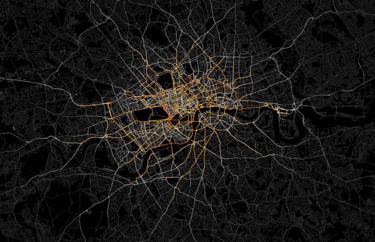
Ed Manley (UCL Geomatic Engineering) produced this great map of private hire vehicles in London (note my avoidance of the “T” word). He was able to obtain the GPS tracks from a large company’s fleet of drivers. There are 700,000 journeys on this map with the most popular roads in red, falling to orange, yellow, white then grey. As Ed says:
“The most popular routes are along Euston Road, Park Lane and Embankment, which may be somewhat expected, but make for a stark constrast with respect to the flow of most traffic in London. The connection with Canary Wharf comes out strongly, an indication of the company’s portfolio, though route choice here is interesting with selection of the The Highway more popular than Commercial Road.”
He is still crunching the numbers as part of his PhD research so we look forward to what he comes up with when it’s finished!
A map of professional Sat Nav followers! Pity you can’t see all the accidents they leave in their wake as they blindly follow the main roads!?!?
I do agree with you Mark! I think there is a lot more escape from the accidents now. If people still cant see then it is a shame.