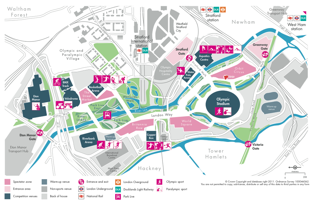

LOCOG (The London Organising Committee for the Olympic Games) yesterday released a new map of the key Olympic Park in east London, as part of their 200-days-to-go celebrations. They also detailed new games-mode names for several of the venues, entrances and key roads in the park, such as London Way (the only such named road in London, apparently), Victoria Gate, Victoria Walk (aka the Hackney Wick bit of the Greenway) and the Copper Box, the latter being a rather appropriate name for the Handball Arena. Eton Manor Transport Hub used to be known as East Marsh – part of Hackney Marshes. There is also a World Square and an Orbit Circus, neither areas look particularly square or circular, but maybe tiling on the ground will rectify this. Anyway it is a nicely done map with some clear cartography and good colour usage (I particularly like the slightly pastel theming), once you realise that northwards is pointing to the left…
As I live very locally to the site, I particularly appreciate such maps, as they lift the lid on what’s happening in the park, beyond what I can see through the tall perimeter fences.
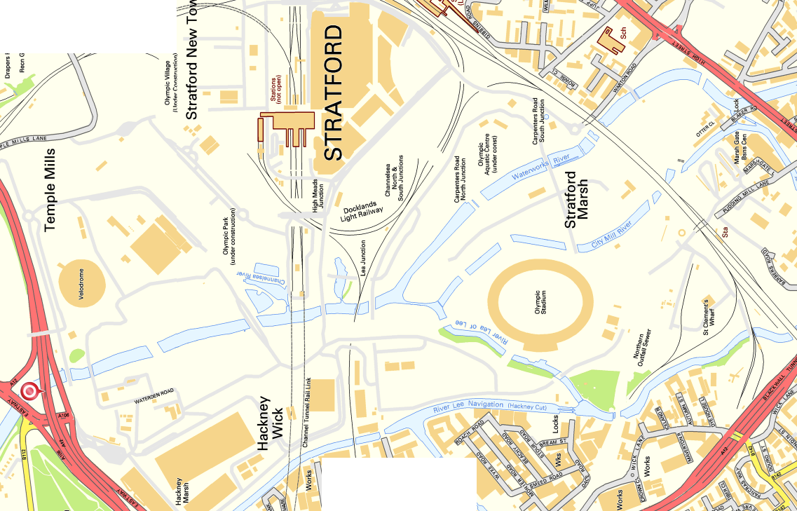
By way of comparison I have included another map below, which is the latest Ordnance Survey Street View map provided as part of its Open Data initiative, of the same area. I’ve rotated it so that northwards is also leftwards. This map is slightly older and the range of features included in the Open Data product is restricted. Path detail, in particular, is missing.
Both maps are © Crown Copyright and database right 2011 Ordnance Survey. Both can be clicked on to view a larger version. A higher quality PDF of the top map can be found by following the links from the press release linked above.
I thought I would try a different take on the Olympic Park Map, taking inspiration from Harry Beck and trying a tile-based approach:
http://www.zoomscape.me/examples/london-olympic-park-map