This decorative map, simply called “Kew”, was produced by Herry Perry of Vincent Brooks lithographers in 1929. It was part of a series of posters
More...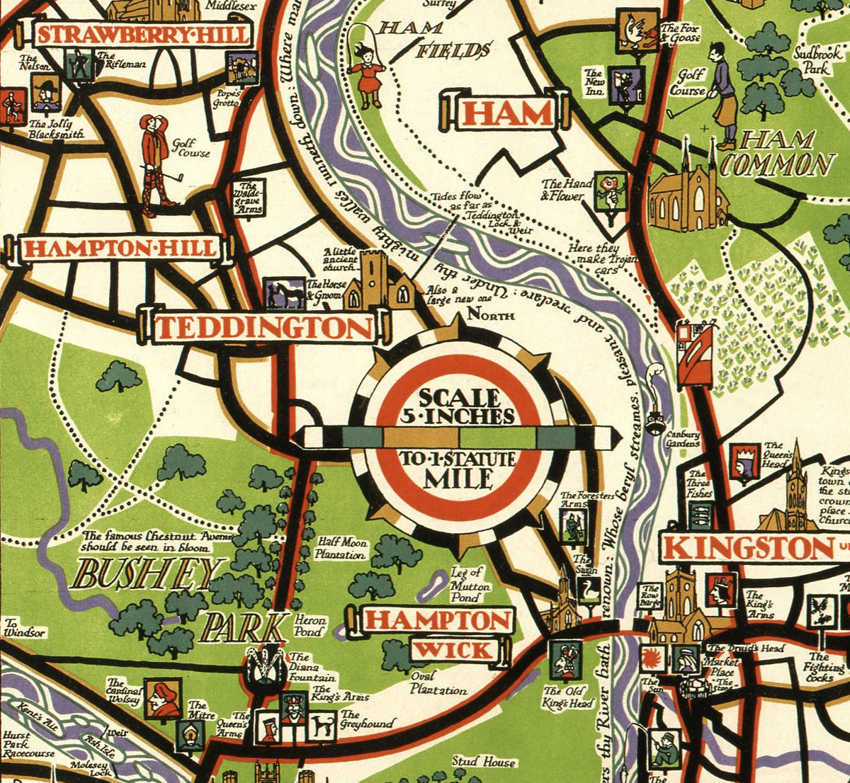
Highlighting the best London maps
This decorative map, simply called “Kew”, was produced by Herry Perry of Vincent Brooks lithographers in 1929. It was part of a series of posters
More...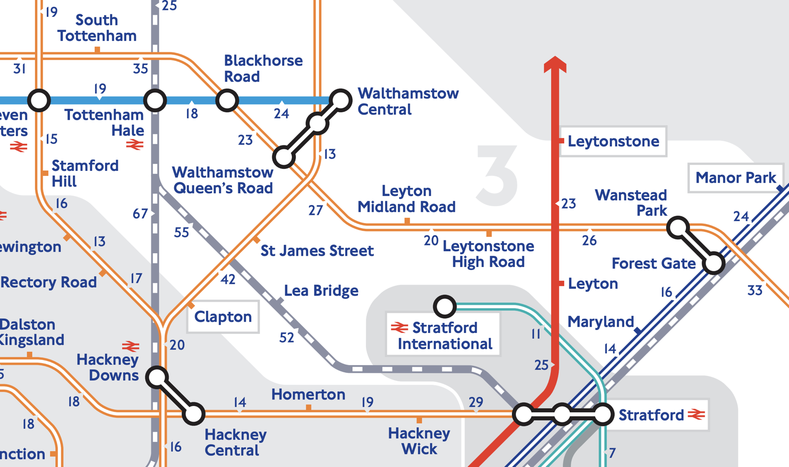
The weather’s lovely at the moment – the last thing you want to do is spend that time deep down in the bowels on London,
More...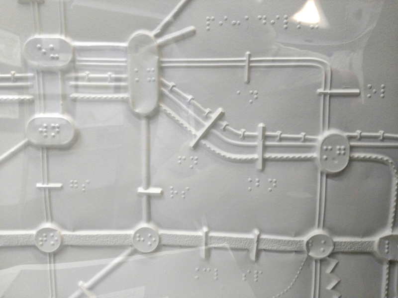
The Corporate Archives division of Transport for London recently held a short internal exhibition at their headquarters at Palestra, called “Mapping London” and showcasing new
More...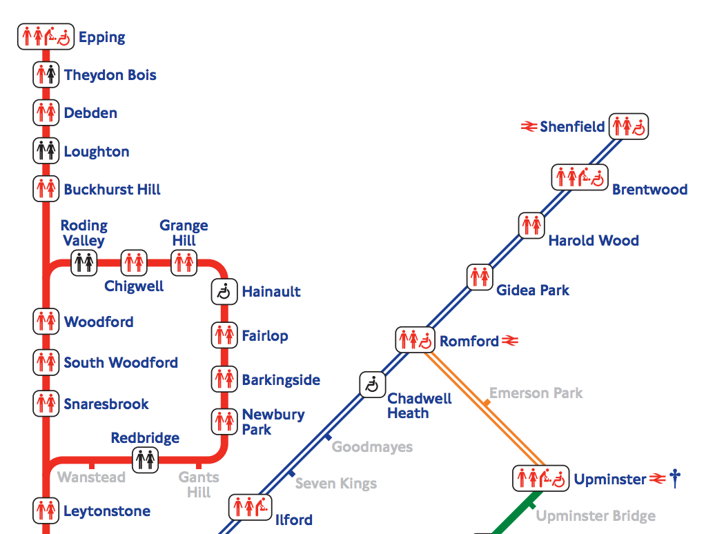
Caught short on the tube? TfL publishes all sorts of maps of the London Underground network, including this map of toilet facilities at stations. This
More...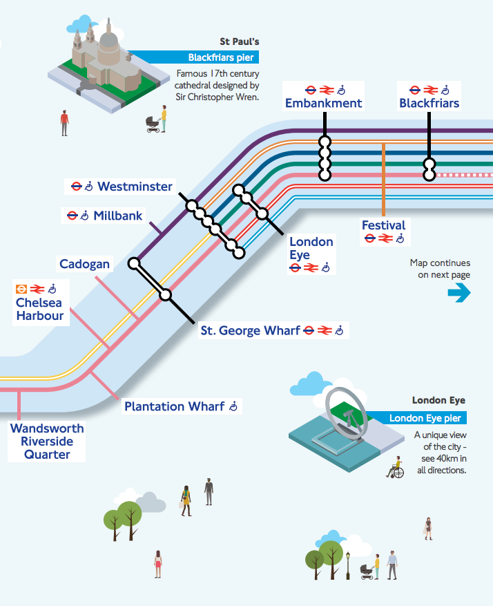
Londoners will be very familiar with the crowded London Underground services and their famous diagrammatic Tube Map, but might be less familiar with another public
More...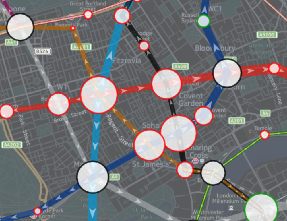
Tube Heartbeat visualises one of Transport for London’s most interesting and detailed open dataset, RODS. This has data on the approximate weekday volume of passengers
More...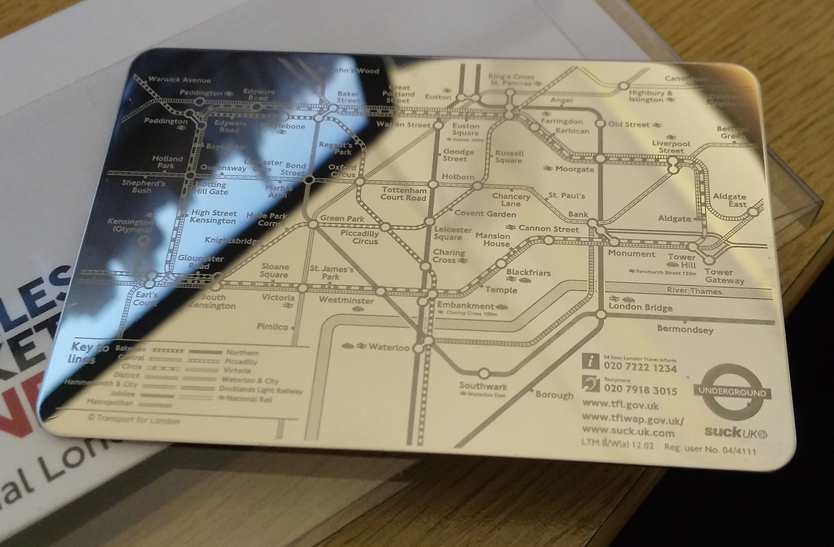
The tube map is almost certainly London’s most widely produced and collected map, with many millions of the pocket version being issued for free every
More...
[Updated – Thanks to this blog post, this map is now officially on the TfL website – read on!] The Transport for London (TfL) tube
More...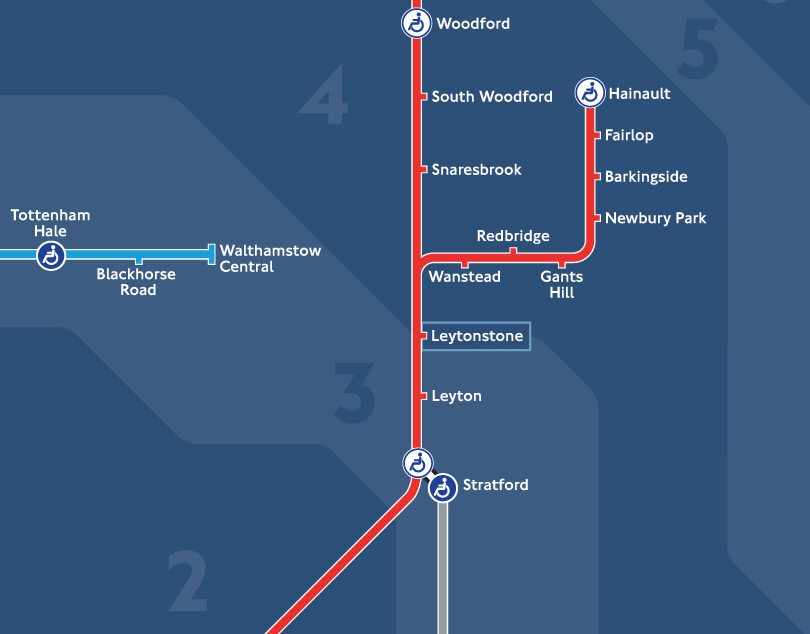
Transport for London are introducing an all-night service for parts of the London Underground, for Friday and Saturday nights from September. They have today unveiled
More...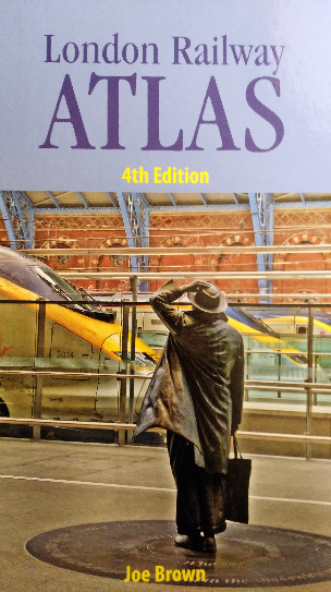
The London Railway Atlas is probably the most detailed map of London’s myriad of tube, train and tram lines, past and present, that you are
More...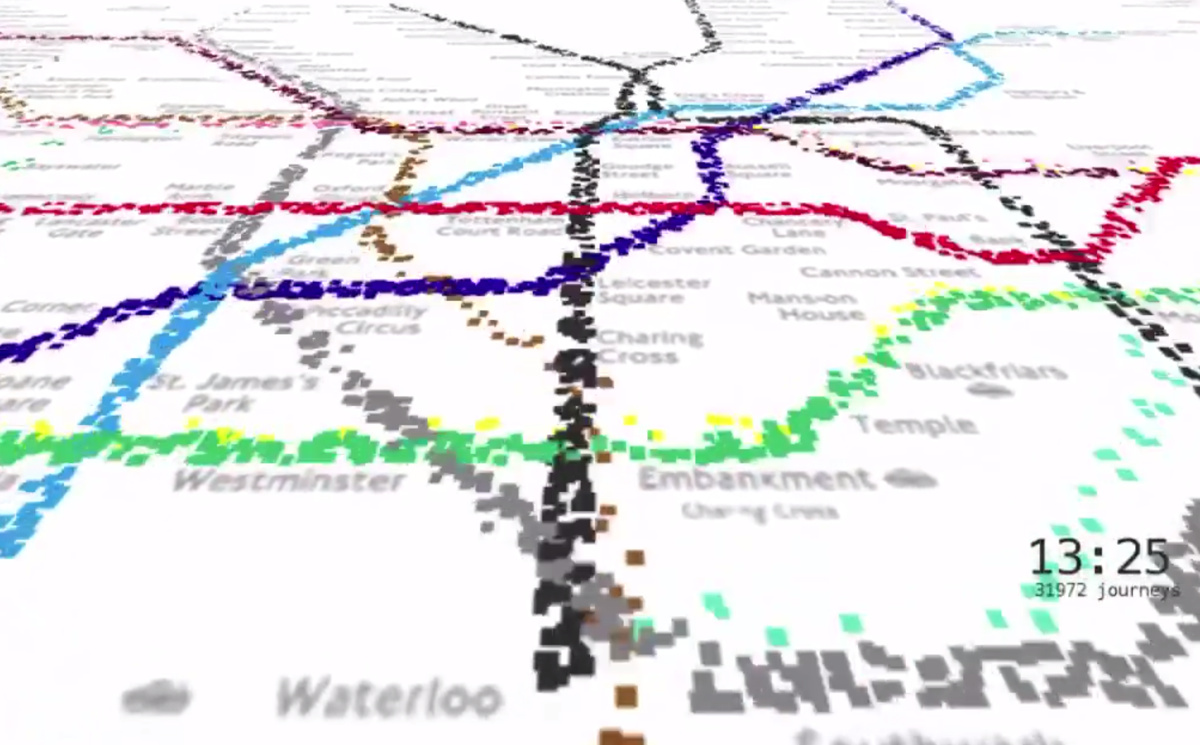
This animation from Will Gallia shows over 500,000 individual journeys on the London Underground network, it’s a 5% sample of Oyster-card journeys during a week
More...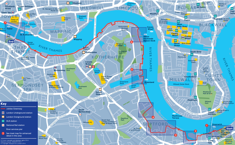
The Legible London project has been producing clear, attractive maps of parts of London, to help people navigate unfamiliar streets by foot, for a few
More...