The above extract (click for full-size version) is from a map that we’ve wanted to feature for a long time, ever since an fascinating talk
More...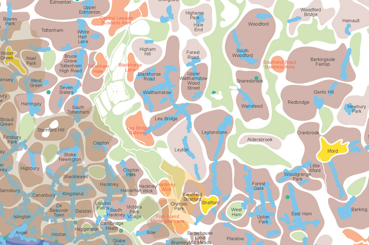
Highlighting the best London maps
The above extract (click for full-size version) is from a map that we’ve wanted to feature for a long time, ever since an fascinating talk
More...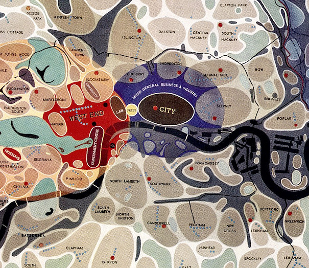
[Updated] This map of London districts, was intended to be used as a grand “masterplan” of how a post-WW2 London could look. Each district appears
More...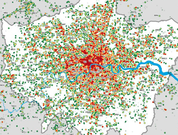
Many Twitter messages, or “tweets”, are sent with latitude/longitude information, allowing an insight into the places where the most amount of tweeting happens. For a
More...