We featured TrainTracker, a live circuit board map of where the trains are on the London Underground – with lights representing the train locations –
More...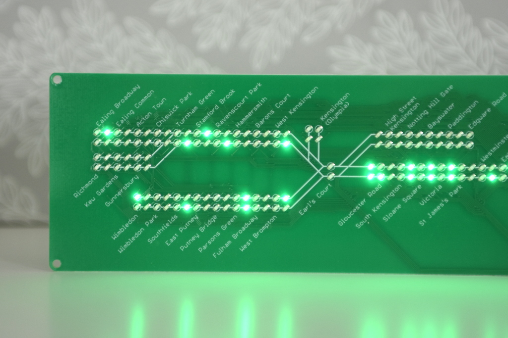
Highlighting the best London maps
We featured TrainTracker, a live circuit board map of where the trains are on the London Underground – with lights representing the train locations –
More...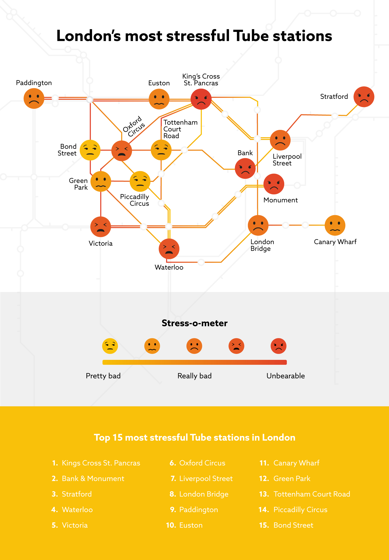
From conference facility organisers PowWowNow comes this map/infographic showing the worst tube stations in central London for stress. They’ve produced a simple index of tube
More...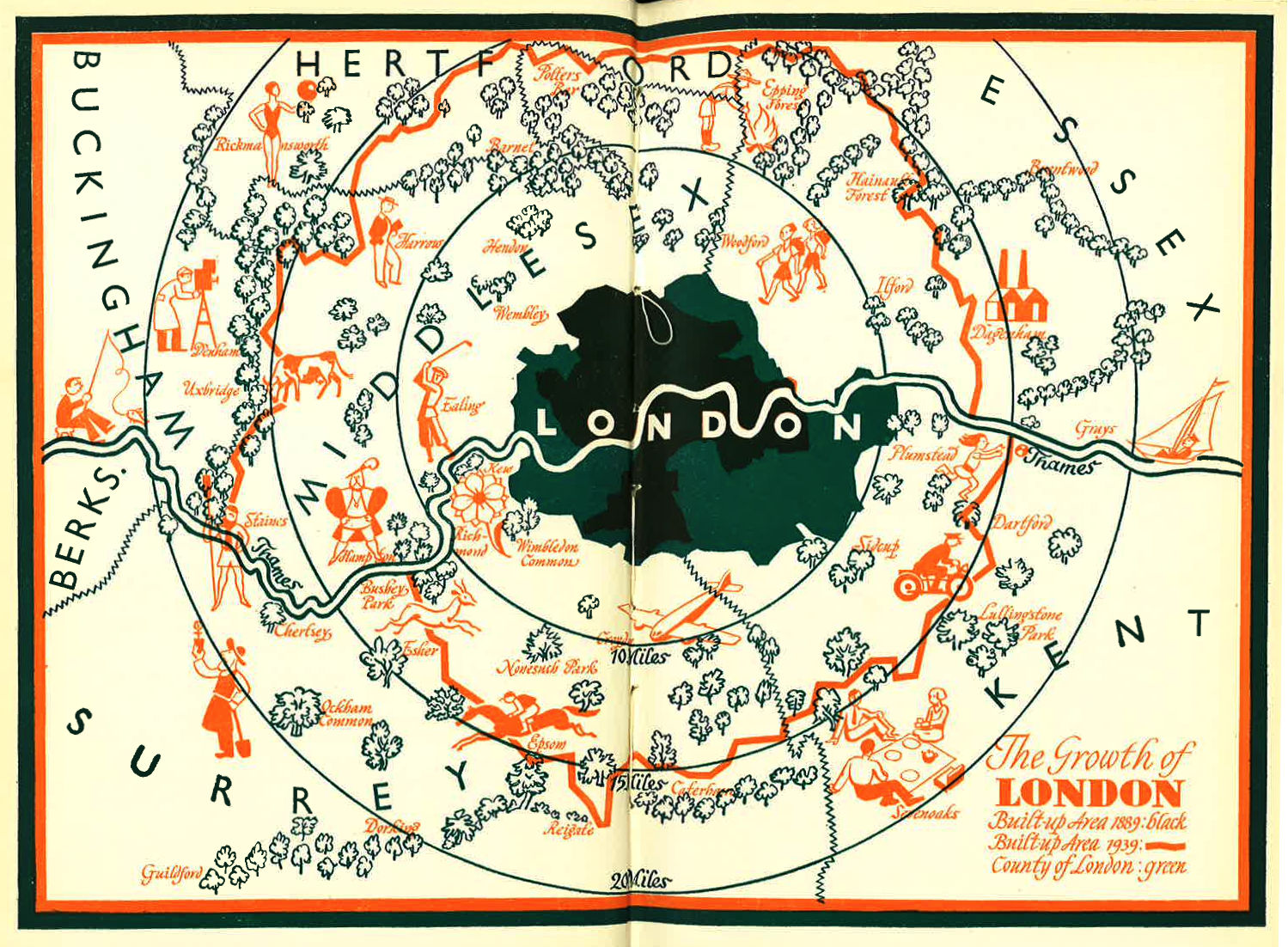
I was intrigued by this blog post of a lovely looking map of London’s Green Belt, dated 1939. The map can be compared a modern
More...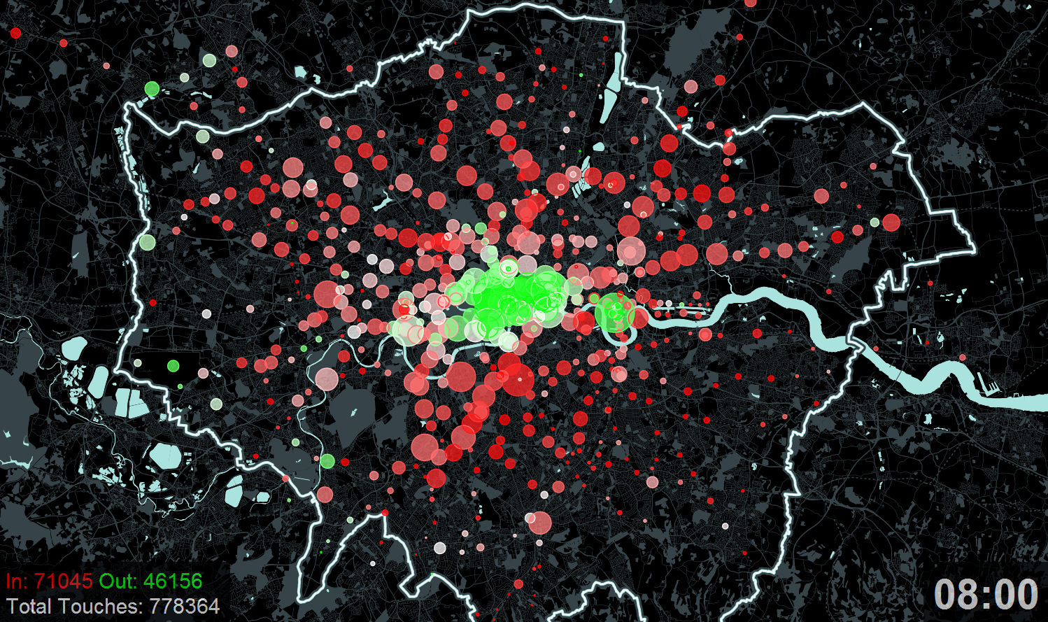
A new exhibition – Sense and the City – opens today at the Transport Museum in Covent Garden. It includes a number of transport data
More...