This map, dating from 1875, appears on the back of a “Guinea season ticket” for entry to Alexandra Palace, in north London. The palace was
More...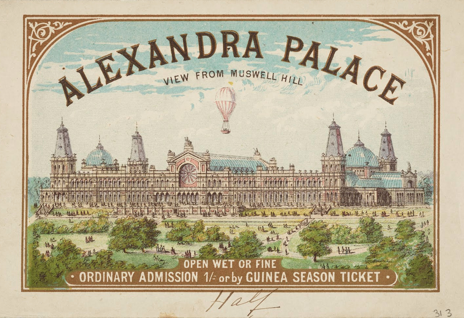
Highlighting the best London maps
This map, dating from 1875, appears on the back of a “Guinea season ticket” for entry to Alexandra Palace, in north London. The palace was
More...
The public may not be able to visit Tottenham Court Road station’s Crossrail concourse or platforms yet, thanks to the well-publicised delay across the wider
More...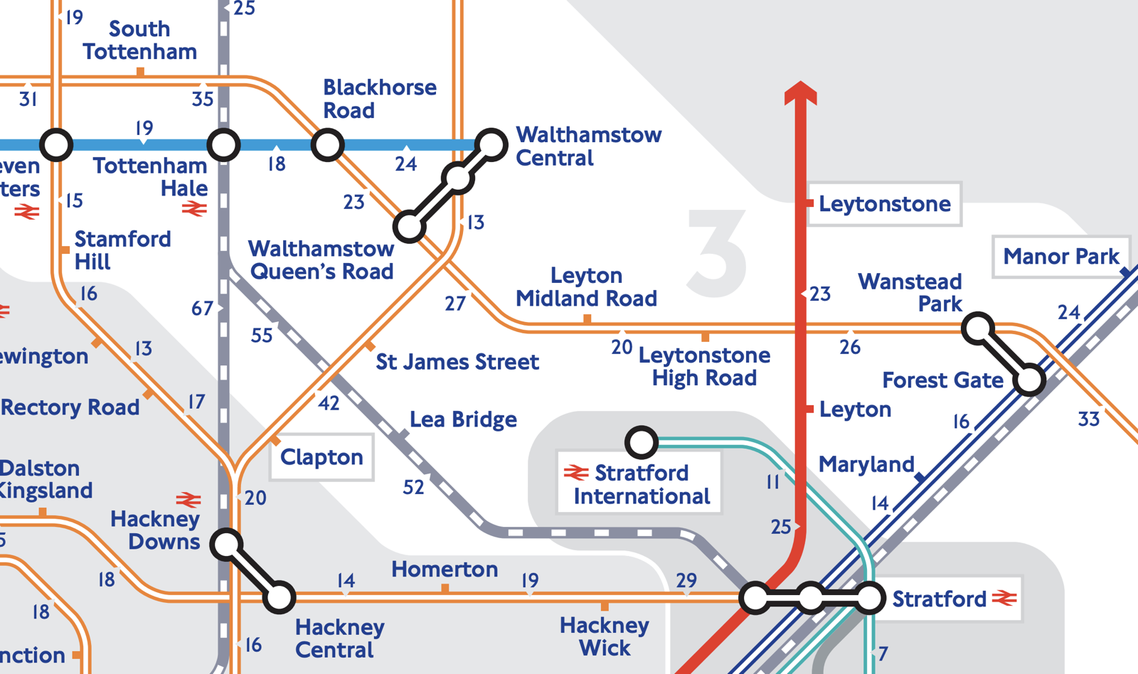
The weather’s lovely at the moment – the last thing you want to do is spend that time deep down in the bowels on London,
More...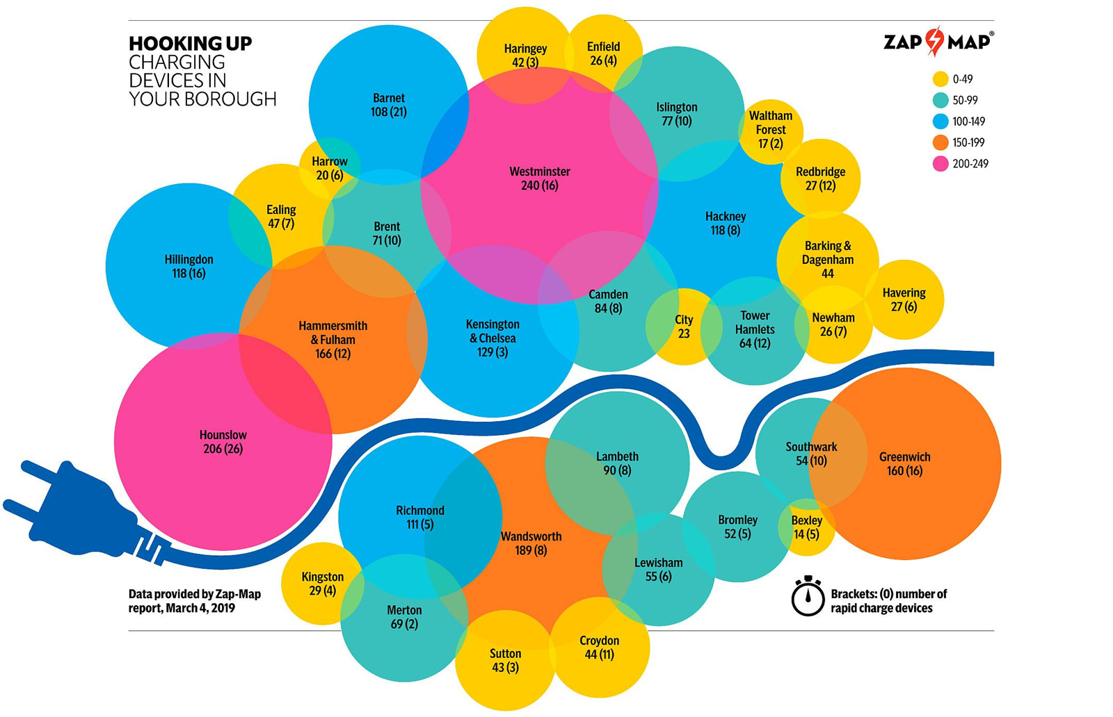
This map, “Hooking Up”, was produced by the Evening Standard newspaper as part of their Future London project, in association with Source London, a service
More...
You know about London’s South Bank – the other side of the river has been looking on at envy at the pedestrian utopia over there
More...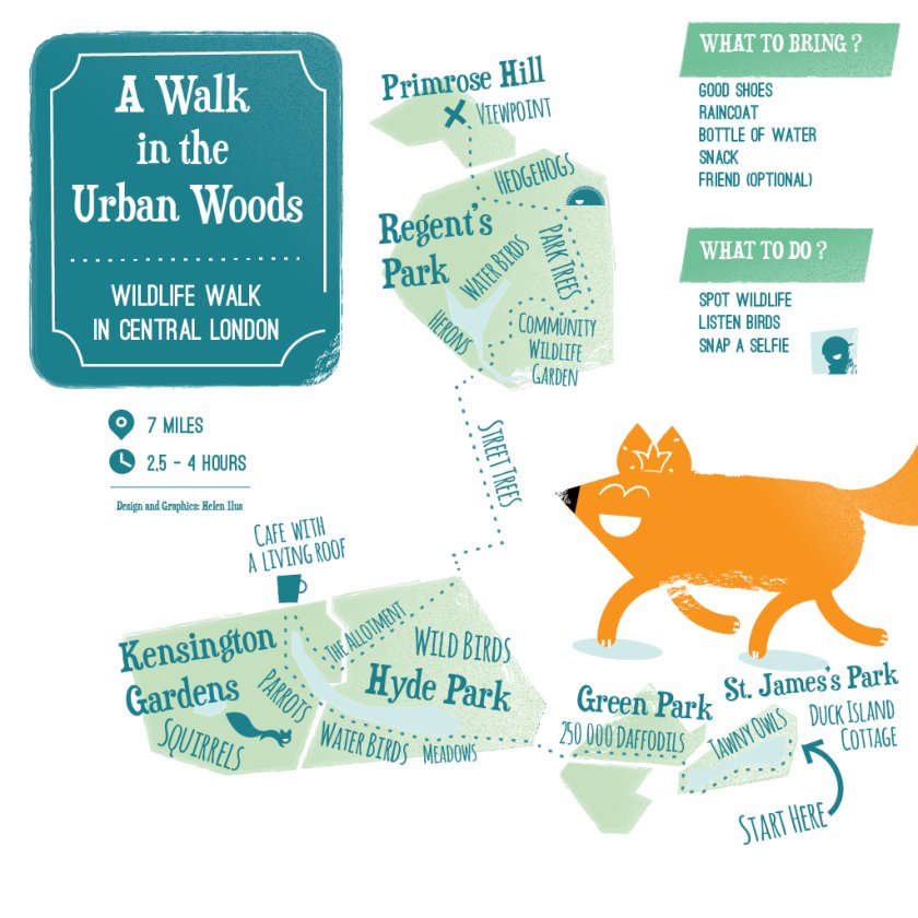
This artistic map of a green walking route in central London has been created by graphic designer Helen Ilus. By showing just the parks that
More...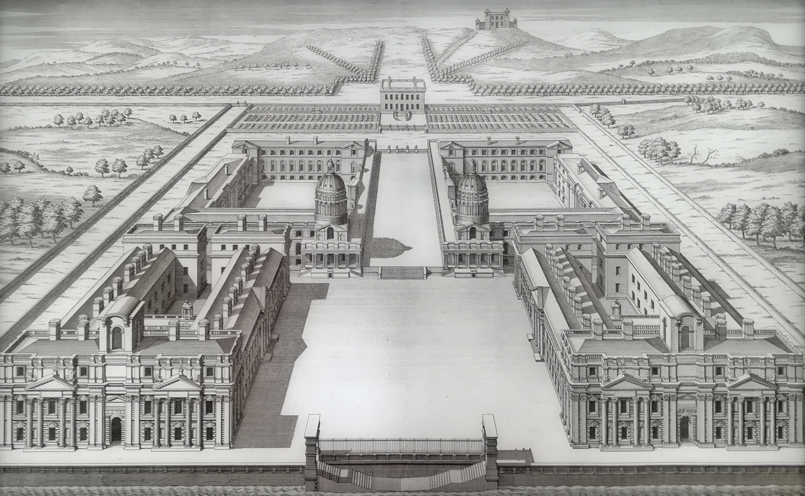
The Painted Hall at the Old Royal Naval College in Greenwich reopens this weekend after a two-year renovation and restoration. At the entrance to the
More...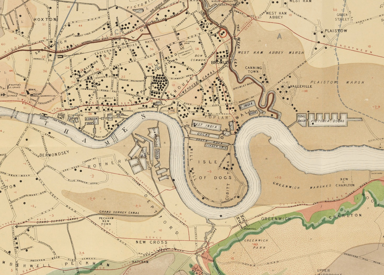
The John Snow Cholera Map is world famous as the map that identified the cause of the disease, and was one of the first epidemiological
More...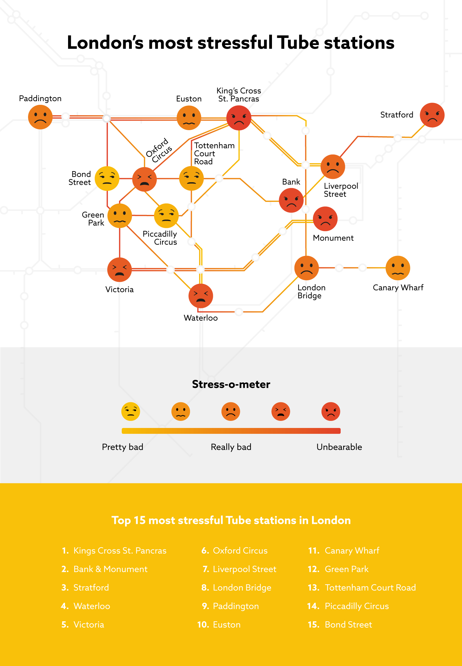
From conference facility organisers PowWowNow comes this map/infographic showing the worst tube stations in central London for stress. They’ve produced a simple index of tube
More...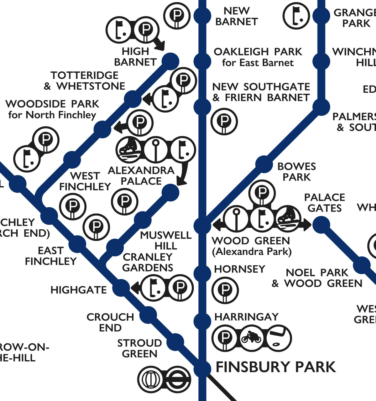
This lovely schematic diagram was first created in 1939 by George Dow. It shows the three LNER (London and North Eastern Railway) north London networks
More...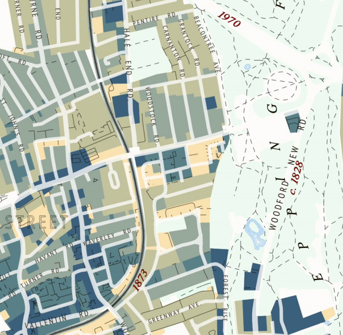
This attractive map of the housing and infrastructure history of Walthamstow and Leyton in north-east London has been created by Scott Davies. Scott used QGIS
More...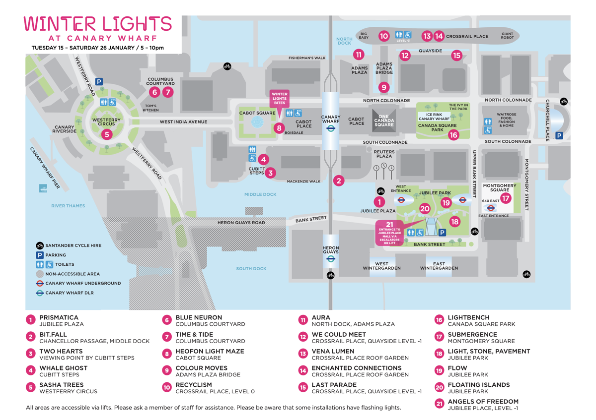
Canary Wharf’s annual public light show is back – it closes this Saturday, so you have just three more evenings to get down to the
More...