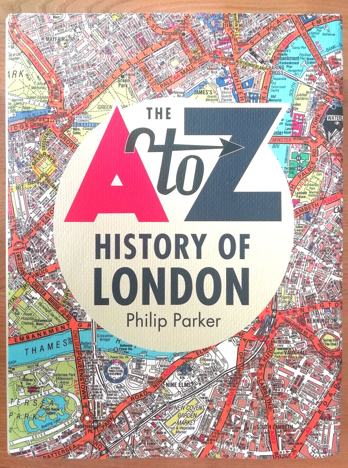
The A to Z is a bit of an institution when it comes to London maps. It, along with the Tube Map, is probably the most famous and well known London map, and certainly the most famous atlas. We’ve reviewed a historic A-Z map of London before, but not the modern one that you will find in many bookshops, newsagents and petrol stations across the city and country. So, when this book – not a map! – the A to Z History of London – arrived in Mapping London Towers, we were curious.
What the book is not, is (just) a history of the A to Z map. Rather, it is a book about the history and geography of London, with A to Z maps used to frame the narrative.
Broadly, there are three sections – looking at its growth through the ages, then looking at particular London themes (e.g. newpapers, markets, architecture, crime, tourism) and then finishing by focusing on few iconic London neighbourhoods. To do this, the narrative is illustrated by A to Z maps, be it historic ones from the first editions dating back to 1936, or the most recent full-colour versions of the map, and everything in-between. Pre-1936, other historic maps, such as Rocque’s 18th century map, or Booth’s poverty map, are used. The other distinctive style in the book which elevates it above just a written history, is the pulling out and highlighting of a single statistic into a number and caption, on many of the pages. It’s a great way to get someone, idly flicking through the pages, drawn into a particular story.
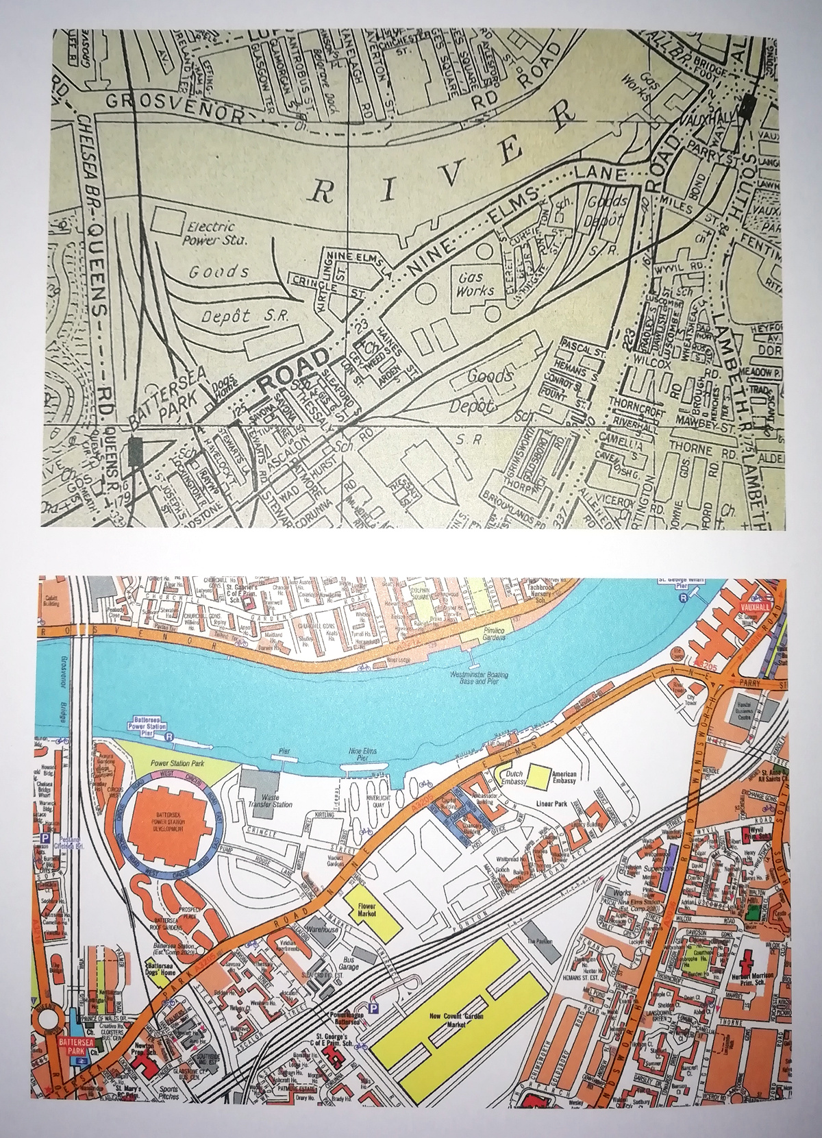
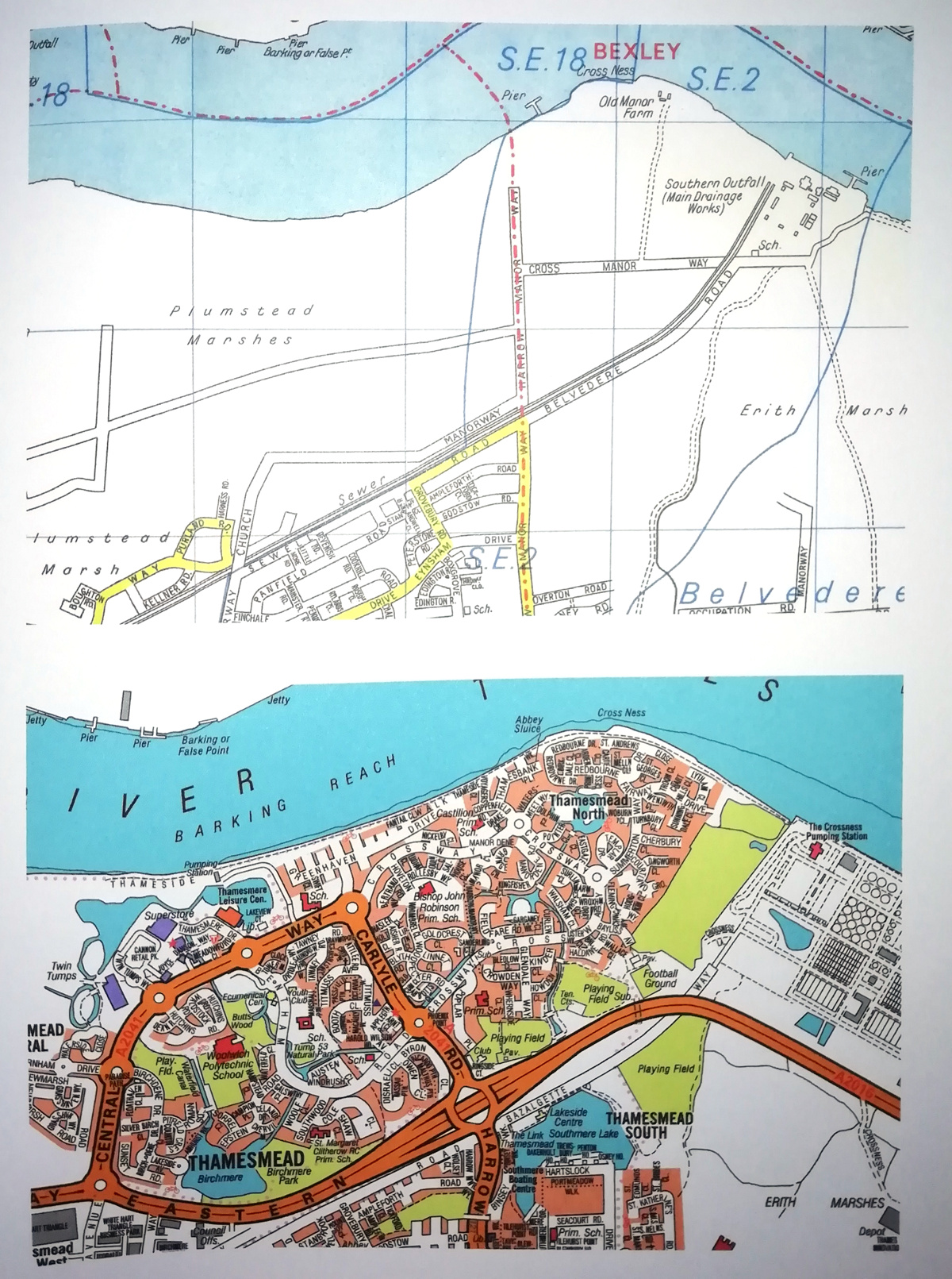
Mapping London’s favourite part of the book is the final section, looking at specific London locations – those which have radically changed since the first A to Z was produced. We particularly like the way the examples in this section are mapped – with an old A to Z map showing the former layout, immediately beside or above a brand new A to Z map to exactly the same scale. For example, the area around Battersea Power Station has comprehensively changed as these two maps show:
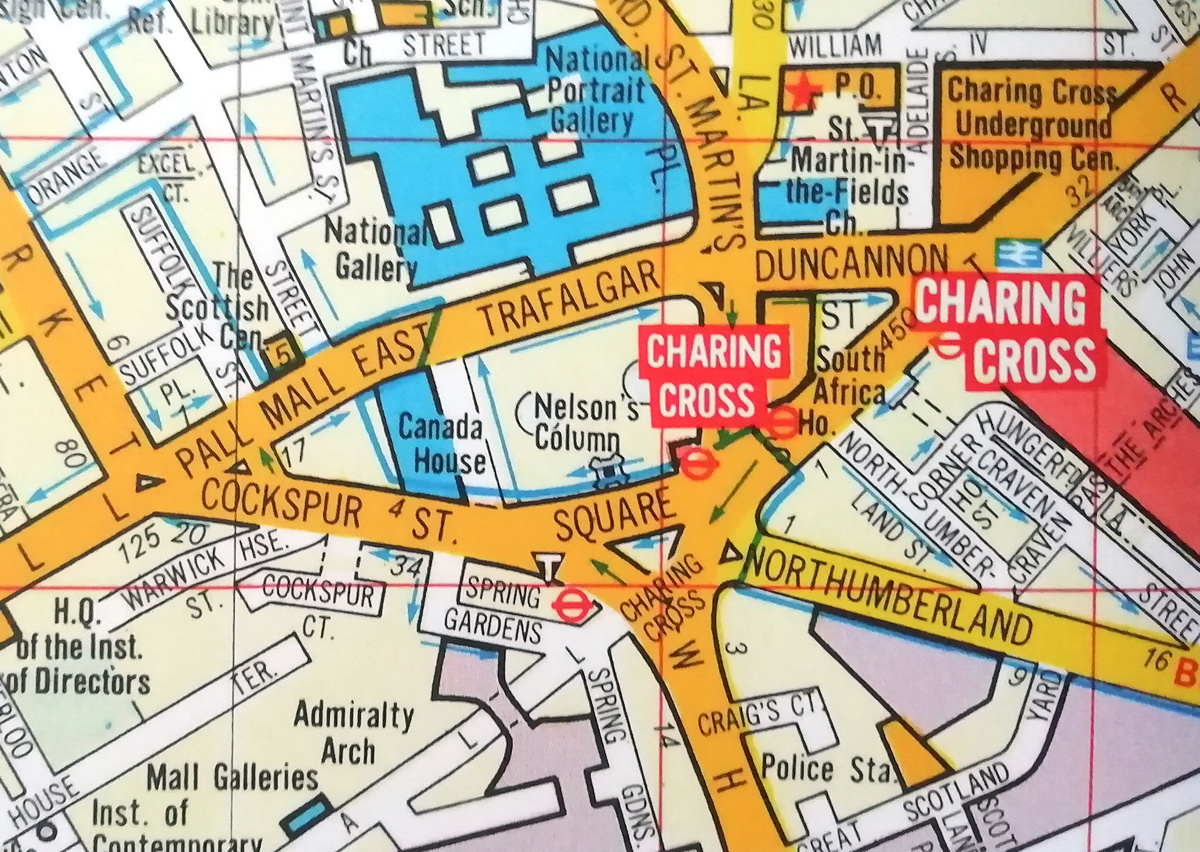
We also enjoyed looking at some fairly-recent maps of London, that look very similar to the up-to-date ones, but show something that has since changed. For example, Trafalgar Square with traffic running on all four sides of it, until it was pedestrianised at the end of last century – how did we take so long to do that?
Of note, the quality of reproduction of the maps is excellent. Both old and new are crisp and clear. The book’s hardcover sleeve also has a rather nice “old parchment map” texture. Small detail we know but adds to the quality feel of the publication.
The A to Z History of London, authored by Philip Parker, is published on 3 October by Collins and will, of course, be available in all good bookshops! The book is available for pre-ordering now on Amazon.
Thank you to Collins for the review copy.
The A to Z History of London – a lovely new book using historic and current versions of the iconic maps to structur… https://t.co/8g0RRlaNeL
The A to Z History of London — https://t.co/G6ks3G71gd
The “A to Z History of London” by Philip Parker is out today. The book looks at the evolution of London – neighbou… https://t.co/6KtYOQbUYP