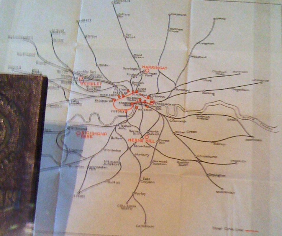

I came across this map of London train lines and underground routes in 1948, part of a guide and travel-card given to competitors at last Olympic Games in London, in 1948, while at an exhibition at Westminster Hall on London 2012. The circle line is highlighted in red and captioned “Inner Circle Line”, while routes are shown simply, with many intermediate stations missing and shown with geographical, rather than just topological (i.e. Beck) accuracy. The main venues of the games are highlighted on the map. 1948 was the post-war “austerity games” and existing venues were re-purposed rather than new ones built, with athletes put up at hotels across the capital.
I wonder if competitors at next year’s games will also be given such a map in their “orientation pack” and what it will look like? Some competitors won’t have to travel far as the Athlete’s Village is on the same site as many of the venues, while some will have to head across to Earl’s Court in West London or even all the way down to Weymouth for the sailing events.