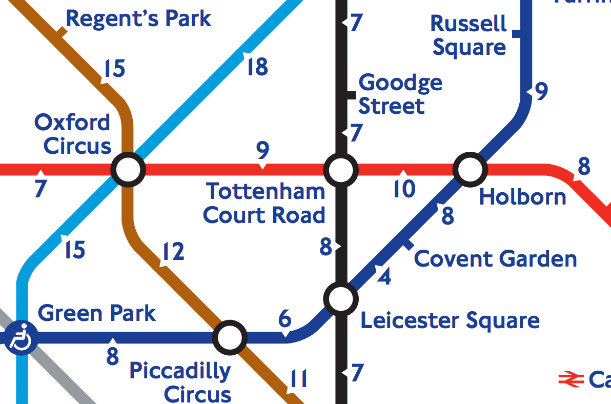
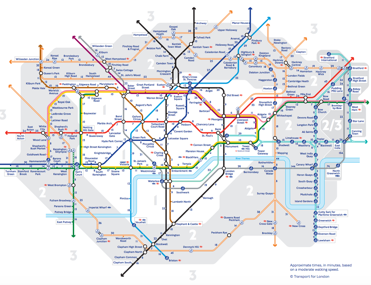
There’s a tube strike on today, with many tube stations expected to be closed. The inner city and central London are likely to be hardest hit, with stations closed in most in Zone 1 and all inside the Circle Line’s loop. Usefully, TfL recently published this map, which shows the central part of the Tube network (zones 1 & 2) with numbers between stations indicating the amount of time it takes to walk that section along the street network, at an average pace. There are some large numbers in places, many due to the obstruction of the River Thames and the fact that the map is not particularly geographically correct, but in general it shows small numbers between most stations. Inevitably, with a tube strike, the bus network will be overloaded and slow, and the roads will be completely clogged with people deciding to drive – so don’t think the taxi or Uber networks will be as useful as they might normally be. So, maybe walking is the way.
(One curiosity of the map is that it does assume use of the Greenwich and Woolwich foot tunnels, but not the Rotherhithe Tunnel – despite appearances, it does allow pedestrians and has a pavement – however the omission is perhaps understandable as it is a very unpleasant route to take, particularly as the Victorian-era staircases have remained closed after damage in the Second World War, meaning the pedestrians have to stay beside the traffic in the tunnel for a long period.)
You can see the full map and download a printable PDF here, or find out more about walking options in central London.

Map © Transport for London.
RT @MapLondon: The tube strike is on. Buses & roads will be packed tomorrow – if you are in central this special tube map may help: https:/…
RT @MapLondon: The tube strike is on. Buses & roads will be packed tomorrow – if you are in central this special tube map may help: https:/…
Tube Strike – Try Walking? — https://t.co/Et6Dqw8Ywq
RT @MapLondon: The tube strike is on. Buses & roads will be packed tomorrow – if you are in central this special tube map may help: https:/…
RT @oobr: The tube strike is on. Buses & roads will be packed tomorrow – if you are in central this special tube map may help: https://t.co…
RT @MapLondon: The tube strike is on. Buses & roads will be packed tomorrow – if you are in central this special tube map may help: https:/…
RT @MapLondon: The tube strike is on. Buses & roads will be packed tomorrow – if you are in central this special tube map may help: https:/…
Buses are packed in London today & many tube lines are closed. If you are in central, check this special tube map:… https://t.co/fGGlf75aCJ
The one thing I wish to everybody is to walk and connect the spaces between Tube stops seen as disconnected islands. https://t.co/ikS2BrMTpz
The one thing I wish to everybody is to walk and connect the spaces between Tube stops seen as disconnected islands. https://t.co/ikS2BrMTpz
RT @MapLondon: The tube strike is on. Buses & roads will be packed tomorrow – if you are in central this special tube map may help: https:/…
RT @MapLondon: The tube strike is on. Buses & roads will be packed tomorrow – if you are in central this special tube map may help: https:/…
RT @MapLondon: Buses are packed in London today & many tube lines are closed. If you are in central, check this special tube map: https://t…
RT @MapLondon: Buses are packed in London today & many tube lines are closed. If you are in central, check this special tube map: https://t…
RT @MapLondon: Buses are packed in London today & many tube lines are closed. If you are in central, check this special tube map: https://t…
RT @MapLondon: Buses are packed in London today & many tube lines are closed. If you are in central, check this special tube map: https://t…
RT @MapLondon: The tube strike is on. Buses & roads will be packed tomorrow – if you are in central this special tube map may help: https:/…
RT @MapLondon: The tube strike is on. Buses & roads will be packed tomorrow – if you are in central this special tube map may help: https:/…