Is this London’s first 3D map?
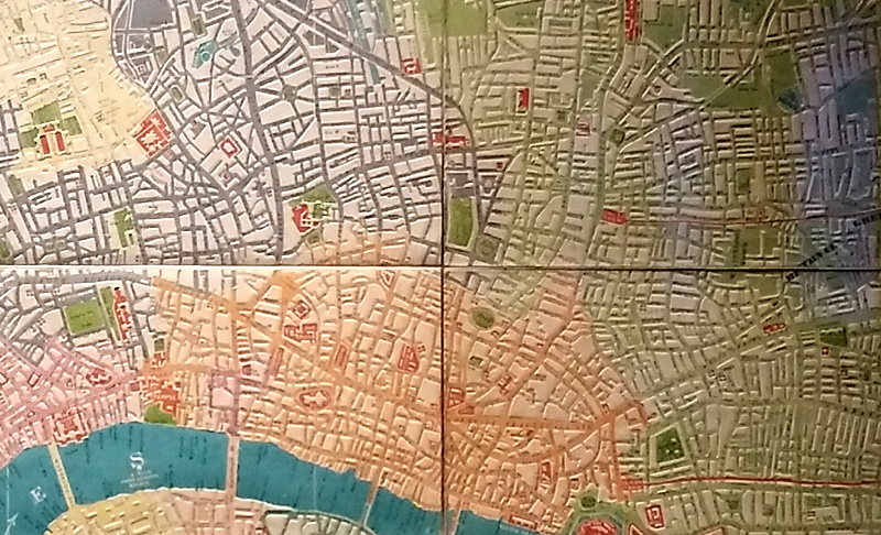
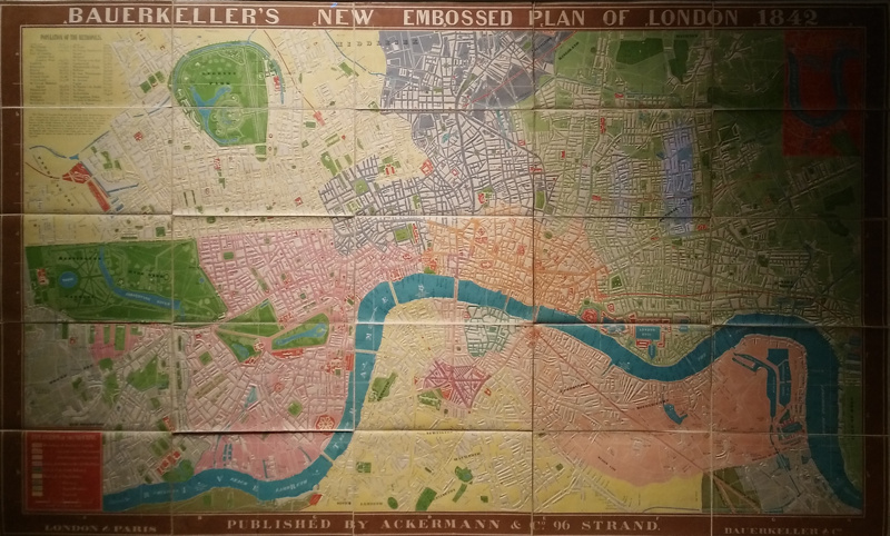
The vivid and historic map of London in 1842, coloured by district, has one unusual feature – it’s embossed. The photos here (taken of the copy in The Map House dealership in Knightsbridge) are from the framed copy that hangs in The Map House and the directional lighting from above picks out the relief of the buildings. This must therefore make it one of London’s earliest “3D” maps, and the embossed effect, even if it is uniformly applied to each building and so does not correspond to the actual heights or height differences, helps emphasise that, even in the mid-nineteenth century, London was already a very large place.
It was a particularly interesting stage in London’s development. UCL had just appeared, then much smaller and simply called “London University” (N.B. misnamed on the map, as it had actually changed its name to University College, London, a few years earlier). The railways were just arriving, the railway companies punching through the surburbs to as close to the centre as they could, and building great terminii stations. London Bridge, Paddington and Fenchurch Street had made it, but King’s Cross and St Pancras hadn’t and the area where they now are is shown as a simple set of residential streets.
The original was folded up into panelled sheets but it is displayed here in its folded out, and framed, glory. The changes of colour for each district make the map a surprisingly lively affair considering its age – the bright colours might not be for everyone but it’s certainly a piece that draws the eye. The map is out of copyright and various editions appear online – but be aware that these are simply lithographic creations – they may reproduce the colours but they almost certainly don’t reproduce the embossing that makes this a 3D map. For that, you need an original, and original copies are unfortunately very rare.

The photos are from an original (i.e. 3D) copy of Bauerkeller’s New Embossed Plan of London 1842 hangs in The Map House.
