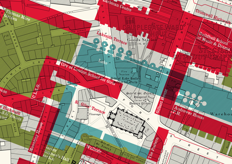

Here is an interesting concept by illustrator Russell Bell. He’s taken a pre-WWII (World War 2) monochrome map of the Barbican area of London (the northern-most part of the ancient City of London) and incorporated a modern, coloured map of the main structures that form the Barbican Estate, that was built following the area suffering heavy damage during the WWII Blitz. During the building process, the street layout fundamentally changed, with streets disappearing or changing alignment, and a new lake appearing. By including the modern map as a translucent overlay on the original, the viewer can clearly contrast the old and the new. It’s worth noting that the new is already changing, as a number of the (non-residential) post-war blocks along London Wall, and Milton Court, have already been demolished for further development.
Russell has made a number of prints of his map, see his online shop.
The Barbican Estate’s multi-levelled structure and maze of “highwalks” means it’s famously being difficult to navigate (which makes it a great orienteering venue), despite various lit maps being available throughout the complex. At one point, famously, orange lines were painted on the ground, to help lead people to the Barbican Arts Centre from the entrances to the estate.
Thanks to Russell for the heads-up.
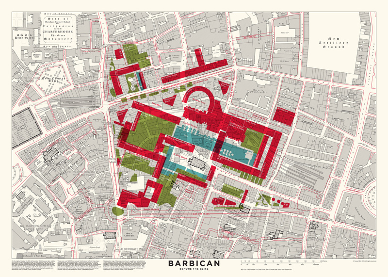
Amazing to see how the layout changed after the war. Without this translucent overlay it would be hard to properly understand.