
We were pleased to recently receive a number of hi-resolution scans of some very old and beautiful London maps, courtesy of the British Library, which is mounting a campaign to scan in, digitise and make available to the world online a great many more of the historic maps of London and beyond that are in the King George III Map Collection.
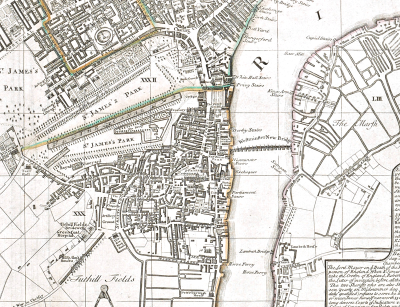
Above is an extract from an example from the collection which has the impressively long title: A New and exact Plan of the Cities of London and Westminster & the Borough of Southwark to this present Year 1738 Exhibiting in a Neater and more distinct manner not only all the New Buildings to this Year but also a considerable Number of Streets Lanes & Alleys Churches Inns of Court Halls Hospitals etc more than any Map hitherto published. Whereunto are added the Rates of Hackney Coachmen and Watermen with several other Embellishments.. It has a printing date of 30 August 1752 and was printed “and fold(ed)” by Eliz Foster at the White Horse Ludgate Hill.”
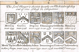 The map is notable for the huge number of adornments and other augmented tables, diagrams and information. For example, a key (A-Z style) of all the streets, a separate key for churches and public buildings, vignettes of major buildings, the coats of arms of the many livery companies of the City, the “Rates of Oars” (5 shillings from London to Kingston), “Rates of Hackney Coaches” (1s 6d from the Royal Exchange to Bloomsbury Square), Rates for Coachmen/Watermen, and a short history and guide to the administration and government of the city.
Shimei Zhou from the British Library writes:
The British Library is home to King George III’s private collection of maps and views which numbers around 60,000 items. We want to fully catalogue, conserve and digitise this collection, a project that will take us approximately 4 years to complete. The project will deliver free public access to anyone anywhere in the world, opening up the collection to a much wider audience.
We have recently launched our fundraising campaign for the maps and views of London from the collection, which number around 1,200. A great deal of London’s history can be told from these unique maps and views, some of which have never been seen by the general public. Some gems include a map by Wenceslaus Hollar showing the damage to London caused by the great fire of 1666 and what is reputed to be Elizabeth I’s own map, recording the measures taken to defend the Thames from the Spanish Armada (1588).
To digitise and share these beautiful maps and views of London, we need to raise £100,000 and we hope that £10,000 will come from our online campaign. More details of our campaign can be found at www.bl.uk/unlock-london-maps.
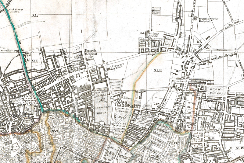
Did you know Old Street, now London’s hub of small technology companies, once had “The Lord Mayor’s Dog House” on it?
See also this similar effort with Victorian Ordnance Survey maps.
One comment