This week, thousands of teenagers across the capital will receive GCSE results that will likely have an impact on the life decisions they take over the
More...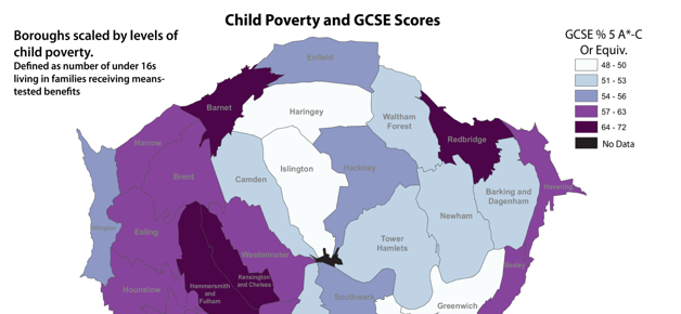
Highlighting the best London maps
This week, thousands of teenagers across the capital will receive GCSE results that will likely have an impact on the life decisions they take over the
More...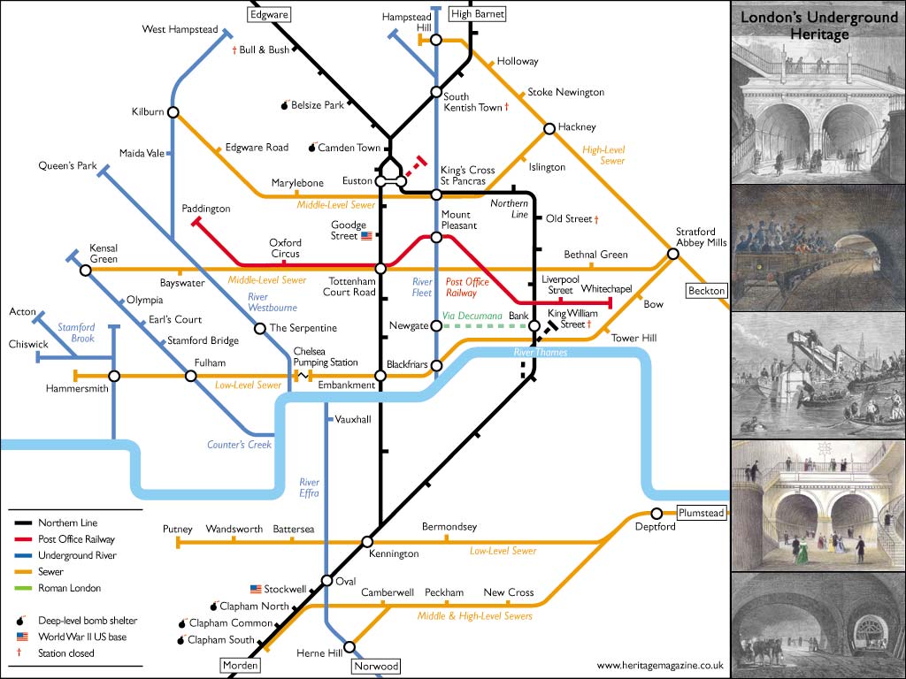
Aside from the odd rumble of a tube train, or perhaps a burst pipe in winter, Londoners often overlook the goings on beneath their feet.
More...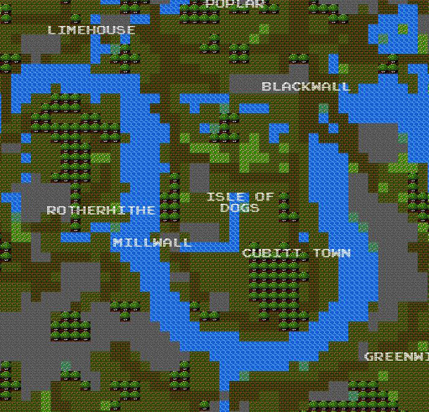
It’s a bit silly, and not exactly very helpful as a map for navigation – but it’s also a lot of fun. Brett Camper has
More...