Layers of London, which has just launched, aims to be a platform for geolocating and documenting the local history of the capital. It works by
More...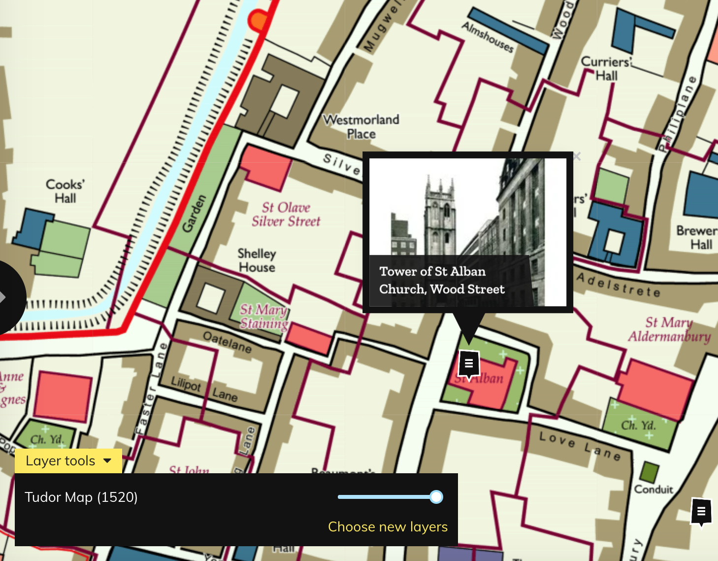
Highlighting the best London maps
Layers of London, which has just launched, aims to be a platform for geolocating and documenting the local history of the capital. It works by
More...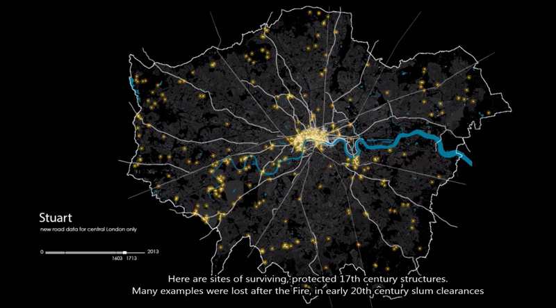
This animation shows how the roads in the London area formed, from Roman times through the industrial revolution and to the modern day. London’s boundary
More...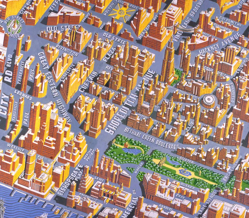
Today, Mapping London brings you not one, but eight maps from prolific cartographer/artist Adam Dant, via the excellent hyper-local blog Spitalfields Life. Firstly, Stories of
More...
Here’s a real treat. The National Library of Scotland’s Map Department, supported by David Rumsey, have taken some very high-resolution scans of the Ordnance Survey
More...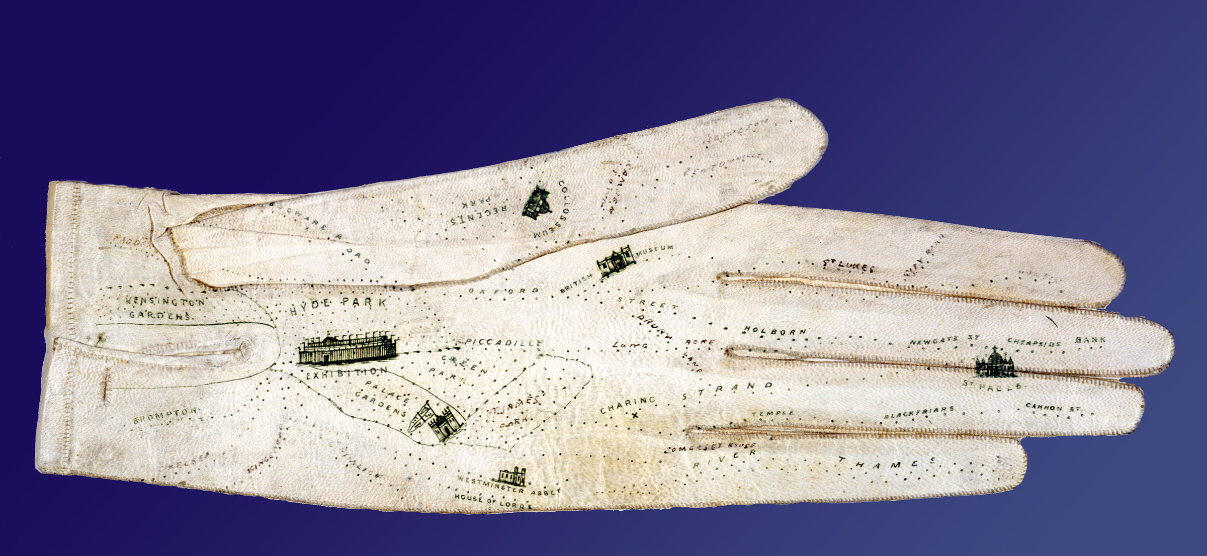
If you lack a sense of direction and resort to writing directions on scraps of paper or the palm of your hand, this glove is
More...