Luminocity3D, an “urban density and dynamics explorer”, is a interactive mapping website developed by UCL CASA’s Duncan Smith, which shows a number of urban demographics
More...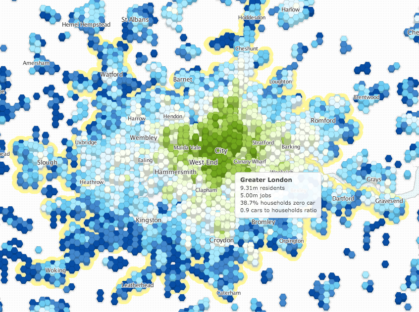
Highlighting the best London maps
Luminocity3D, an “urban density and dynamics explorer”, is a interactive mapping website developed by UCL CASA’s Duncan Smith, which shows a number of urban demographics
More...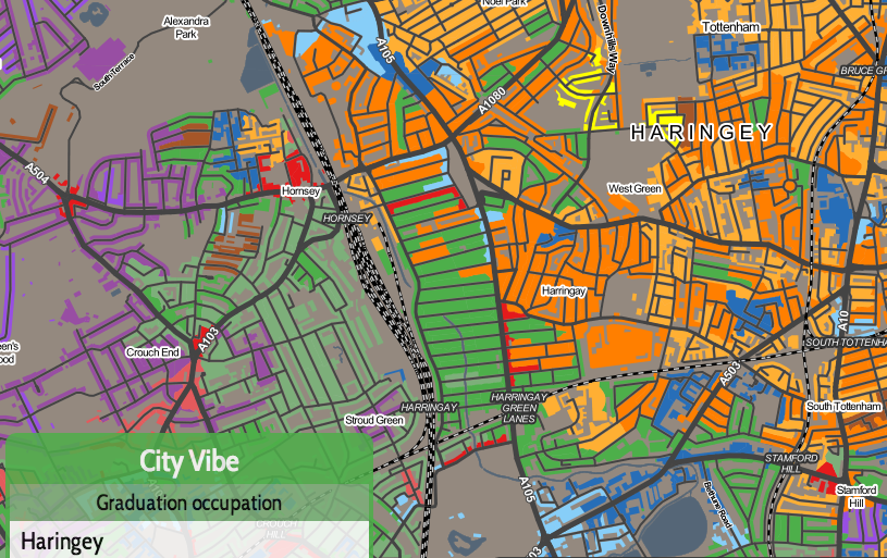
Today, a new version of the Greater London Authority (GLA)’s London Datastore launches, with an updated look, a new responsive data dashboard, and various new
More...
One of my earliest projects at UCL, back in 2009, was to create a customisable online map of all the 2001 Census key statistics. The
More...
“Geodemographics of Housing in Great Britain – a new visualisation in the style of Charles Booth’s map” is a map that I have produced that
More...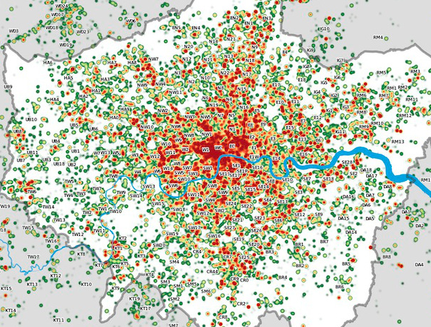
Many Twitter messages, or “tweets”, are sent with latitude/longitude information, allowing an insight into the places where the most amount of tweeting happens. For a
More...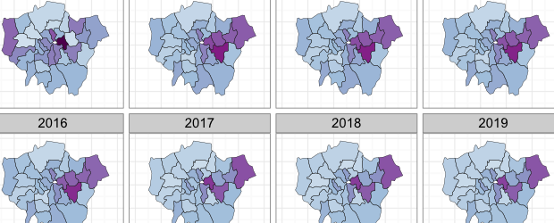
Buried in the London Datastore are the population estimates for each of the London Boroughs between 2001 – 2030. They predict a declining population for most
More...