The Valuation Office Agency publish some interesting open data sets from time-to-time. One that caught my eye recently was a breakdown of counts of residential
More...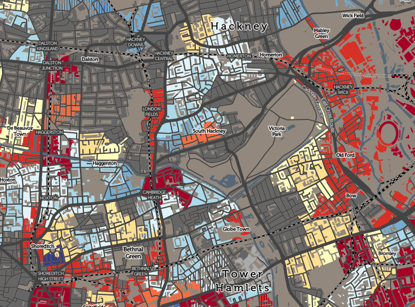
Highlighting the best London maps
The Valuation Office Agency publish some interesting open data sets from time-to-time. One that caught my eye recently was a breakdown of counts of residential
More...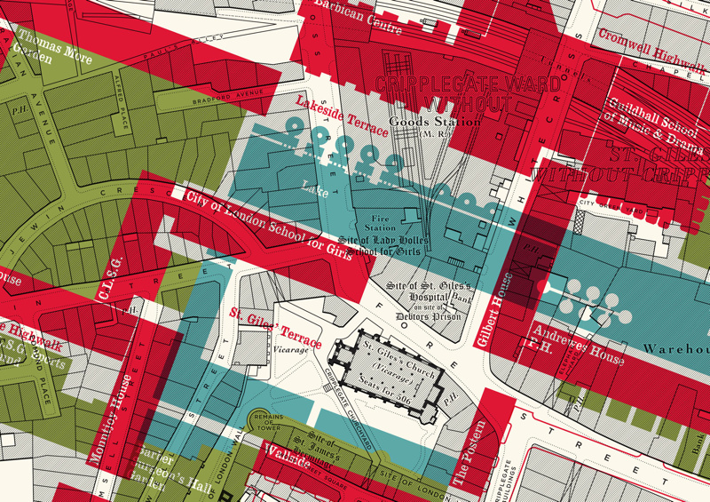
Here is an interesting concept by illustrator Russell Bell. He’s taken a pre-WWII (World War 2) monochrome map of the Barbican area of London (the
More...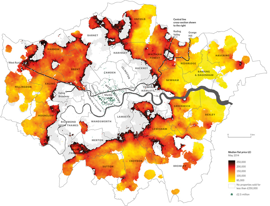
Above is a map from Mapping London co-editor Dr Cheshire’s new book The Information Capital that appeared in this week’s Time Out (print & online).
More...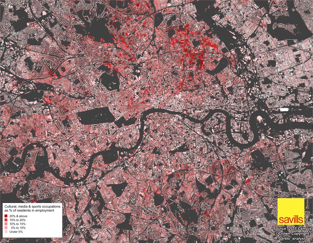
Neal Hudson, housing market analyst at Savills, has been crunching, mapping and graphing interesting results from the 2011 census, since the data started to be
More...