This lovely schematic diagram was first created in 1939 by George Dow. It shows the three LNER (London and North Eastern Railway) north London networks
More...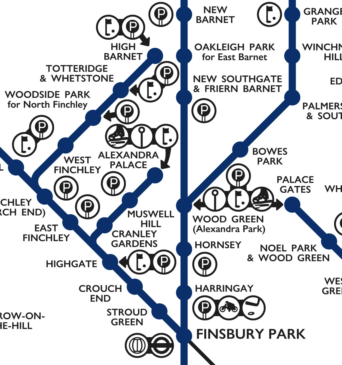
Highlighting the best London maps
This lovely schematic diagram was first created in 1939 by George Dow. It shows the three LNER (London and North Eastern Railway) north London networks
More...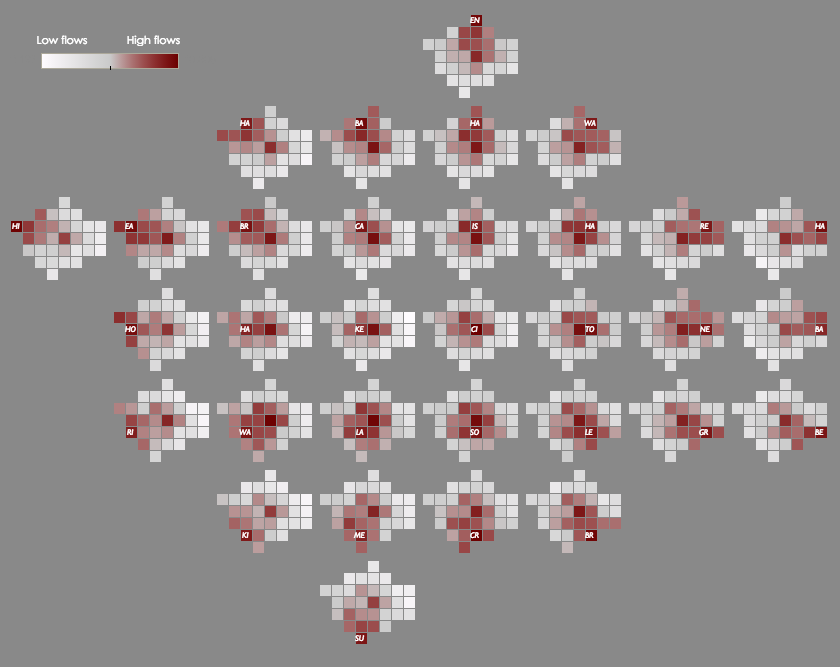
This map shows the cross-borough London commuting flows in a different way to the conventional approach of drawing lines between the start and end of
More...
Crossrail is a massive new railway that is due to open towards the end of the decade. It’s underground in central London, so largely unseen
More...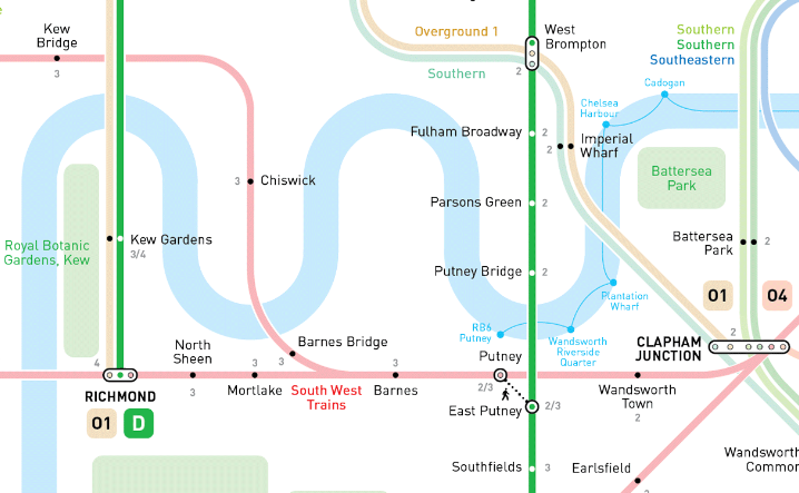
So London’s myriad of suburban commuter rail services, many of which are south of the River Thames and so act as the equivalent of the
More...