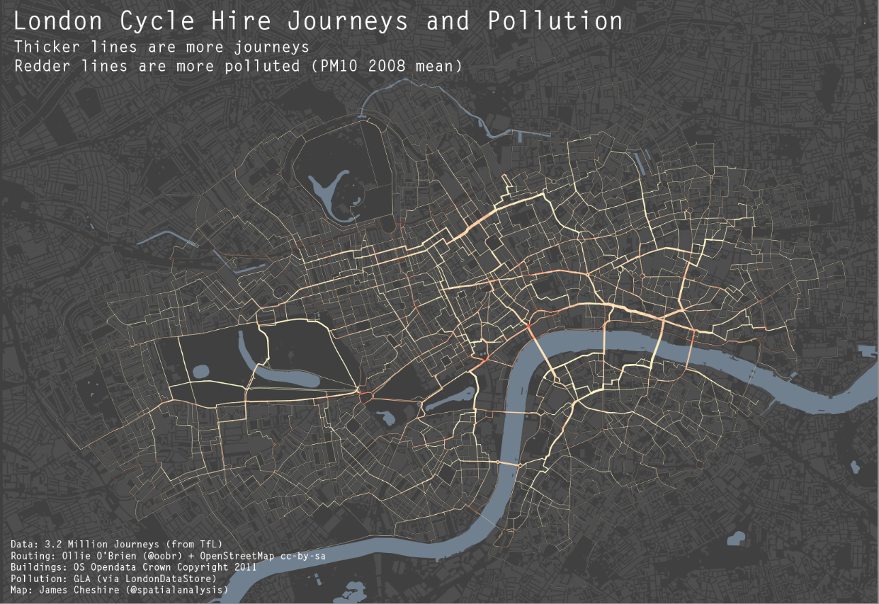
As a cyclist in London you can do your best to avoid left turning buses and dozy pedestrians. One thing you can’t really avoid though is pollution (although I accept cyclists probably aren’t much worse off than pedestrians and drivers in this respect). To illustrate this I have taken data for 3.2 million journeys from the Barclays Cycle Hire scheme and combined it with GLA pollution data for particulate matter. Unsurprisingly, pollution is worse at junctions and where there is lots of static traffic, with the popular cycling routes around Waterloo Bridge and the Strand particularly affected. Most of the journeys are subject to relatively low (by London standards) levels because cyclists try and avoid the busiest routes, such as Euston Road. The loop around Hyde Park is really popular with Boris Bikers and fortunately one of the least polluted but clearly more could be done to sort out the pollution hotspots around the west end.
The routes have been guessed using routing algorithms and OpenStreetMap data and optimised for cyclists (ie we assumed that people would prefer cycle lanes over roads etc). Thanks to Ollie O’Brien for this analysis. You can see more of his work here. I produced this map using the R software package and blog about how I did it here.
*This post was originally published on the spatialanalysis.co.uk blog*


2 comments