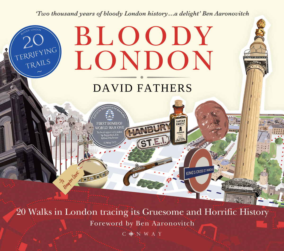
“Bloody London” is a new book by author, illustrator cartographer David Fathers. Previously writing about the Thames Path in London, the Regents’ Canal and London’s “lost rivers“, David has for this book focused on a more general “gruesome and horrific” history of the capital, focused around 20 walks, each of which is for a different part of the city, joining together several points of historic interest.
- Buy the book on Amazon (published 2 April 2020).
The book may look quite small but runs to over 120 pages and each page is packed full of narrative, illustrations and often a section of walk map. You definitely get your money’s worth of content, and yet the book is small enough to fit into a coat pocket.
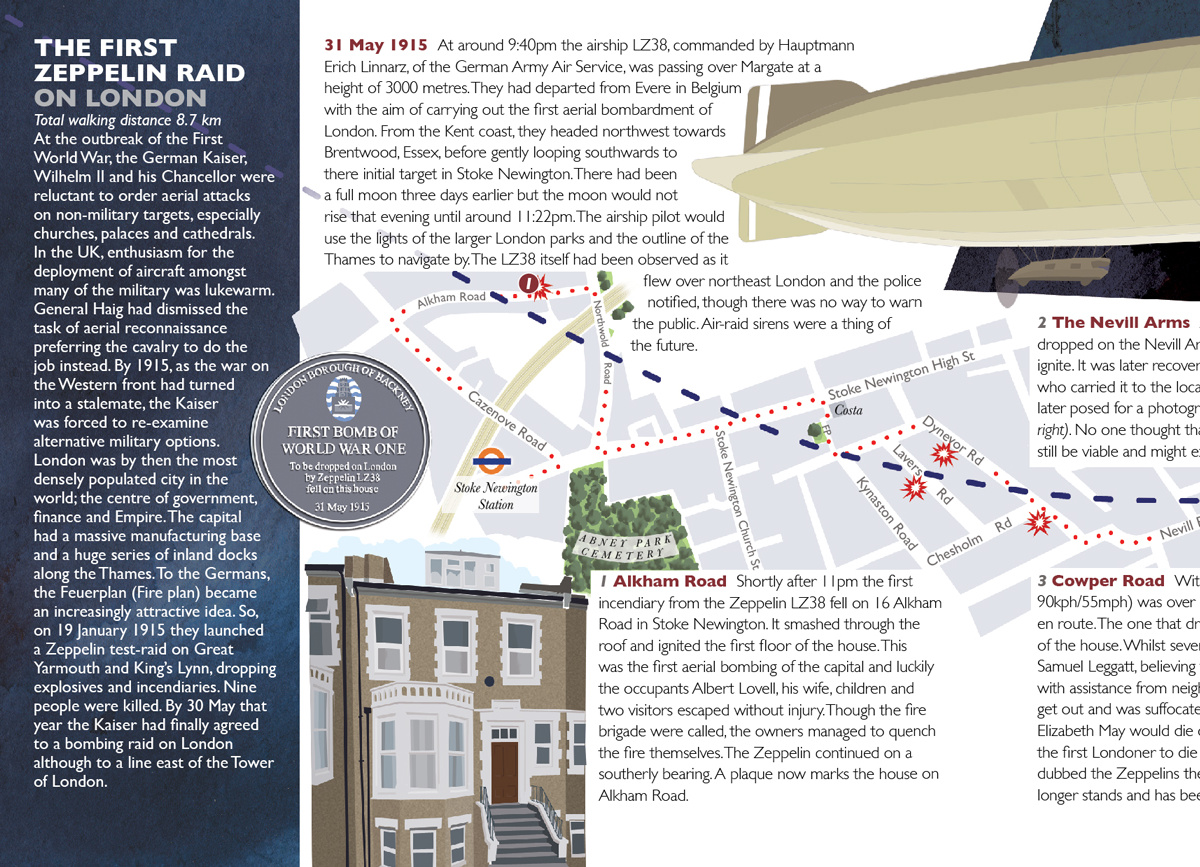
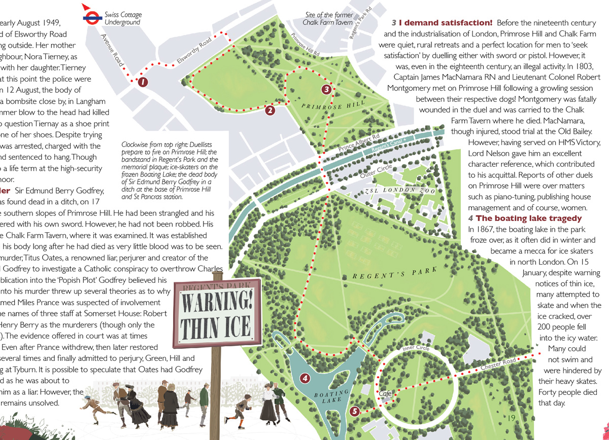
Each walk is between 1km and 10km, and typically includes around 10 points of interest. Each walk includes a number of maps and points of interest, with one map end joining onto the beginning of the next. Some focus on particular areas of London, some look at a theme, such as prisons, and some take on a single event or sequence of events, such as the Great Fire of London (in 1666), the Jack the Ripper murders (in 1888) or the first Zepplin Raid (in 1915), and walk the reader between different places in that were key locations of the incident:

Mapping London has long been a fan of the author’s simple, effective cartography, showing the walking route, key street labels and with parks, rivers and landmarks attractively highlighted – but no clutter. The route maps are critical to linking the narrative together, and straightforward for the reader to follow.
With the current London lockdown due to a health emergency, actually getting out and doing the walks is not practical – unless one happens to be close by your house. However there is so much detail in the book that you will be pretty informed just by staying in and reading.
This is a well-written and attractively illustrated book, Mapping London feels equally better informed and horrified by London’s gruesome history.
Bloody London is published by Conway, a Bloomsbury imprint, and released on 2 April. Physical bookstores will be closed but it is available for pre-order on Amazon.

Thanks to Bloomsbury for the review copy.
Bloody London https://t.co/kXJeP3ohp4
RT @MapLondon: Bloody London – a guide, structured around 20 walks over 100 pages, to London’s darker history over the last 2000 years, inc…
#Map: Bloody London https://t.co/T8TJkrMby4
A splendid review of my new book, BLOODY LONDON, at Mapping London @maplondon @oobr
https://t.co/CEpCP50HKJ… https://t.co/zpQiYwcF7C
RT @TheTilbury: A splendid review of my new book, BLOODY LONDON, at Mapping London @maplondon @oobr
https://t.co/CEpCP50HKJ
@bloomsburyboo…
RT @TheTilbury: A splendid review of my new book, BLOODY LONDON, at Mapping London @maplondon @oobr
https://t.co/CEpCP50HKJ
@bloomsburyboo…