The Mind the Map exhibition, at the London Transport Museum, doesn’t only feature historic maps, such as Beck’s “joke map” that we covered before.
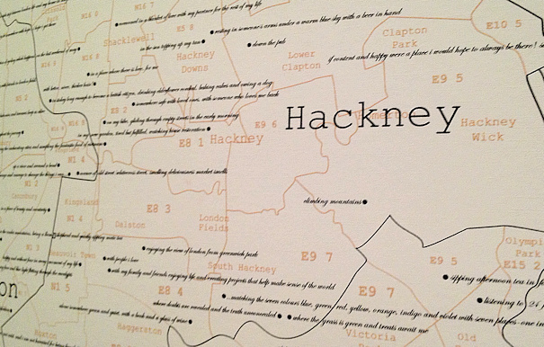
This extract above is a photo of on of the new art commissions for the exhibition. It’s called The Proustian Map of London – The Land of Hopeful Commuters. It’s a work by Agnes Poitevin-Navarre and consists of a minimalistic map of the London boroughs and postcode districts, on which are interspersed various comments by commuters. The locations of each comment correspond to the postcode of the person who made the comment. Comments were solicited via the Transport Museum website and other sources. The question that was to be answered was “Where do you hope to be?”.
My own comment is above, comparatively alone – much of the empty space nearby is due to the Olympic Park and Victoria Park.
It’s interesting looking at the spatial distribution of responses – perhaps giving an indication of where the younger, social-media savvy, connected demographic of London lives. Camden and Islington have many comments crammed together, while Richmond, Newham and Barking & Dagenham are sparse.
The map is displayed on a giant cylindrical section in the upstairs part of the exhibition, with the northern half of London taking up one 180-degree section and southern London on the other side.

