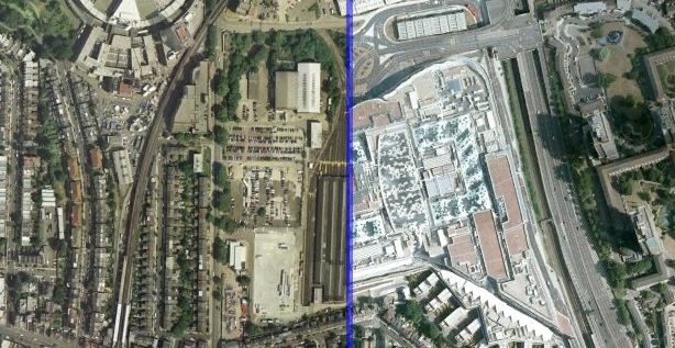
Using the visualisation technique used by ABC Australia and the New York Times to show before/after photographs of the impact of the Japan Tsunami, below are before/after photographs of four areas in London which have seen dramatic change in the last ten years. Pass your mouse over each image to move the divider bar. Can you recognise the four places?
The aerial imagery is from Google Earth and is copyright Bluesky. The “before” pictures are generally from 2002-6 and the “after” pictures are from the recent (June 2010) update.

Architects should start paying more attention to how their buildings look from above
The photos do not show up, only source? (using FireFox)
Thanks Max, the page got messed up when I moved the blog to a new server. A couple of key tags got stripped out. Fixed now!
Amazing photographs of London. Are some of these pics taken from a helicopter as well? Very tough to get good clicks from a normal airplane.Also, what camera is this !
A few of my own aerial clicks of New York as well – aerial pictures of JFK Airport, Manhattan and the bridges, in case you’re interested
Prashant – source information is in the article.