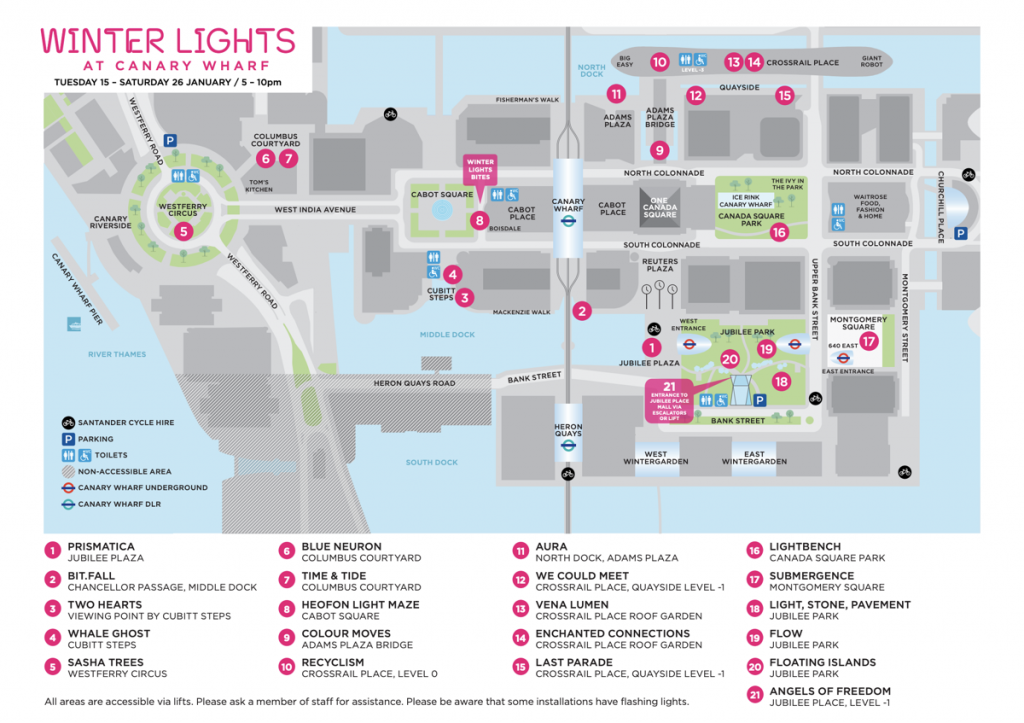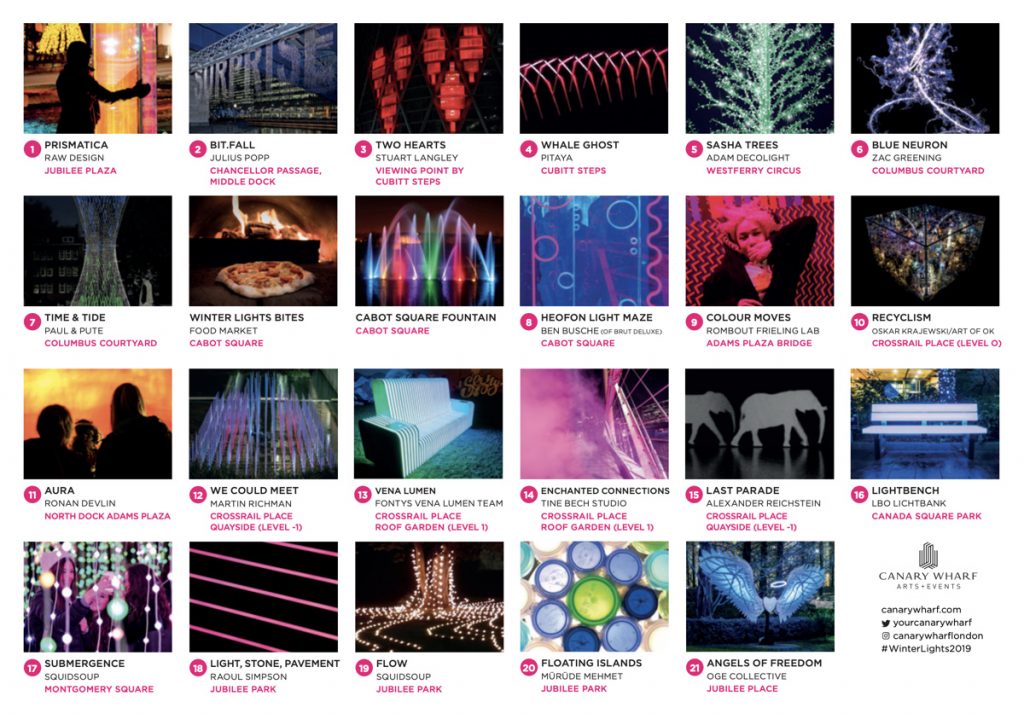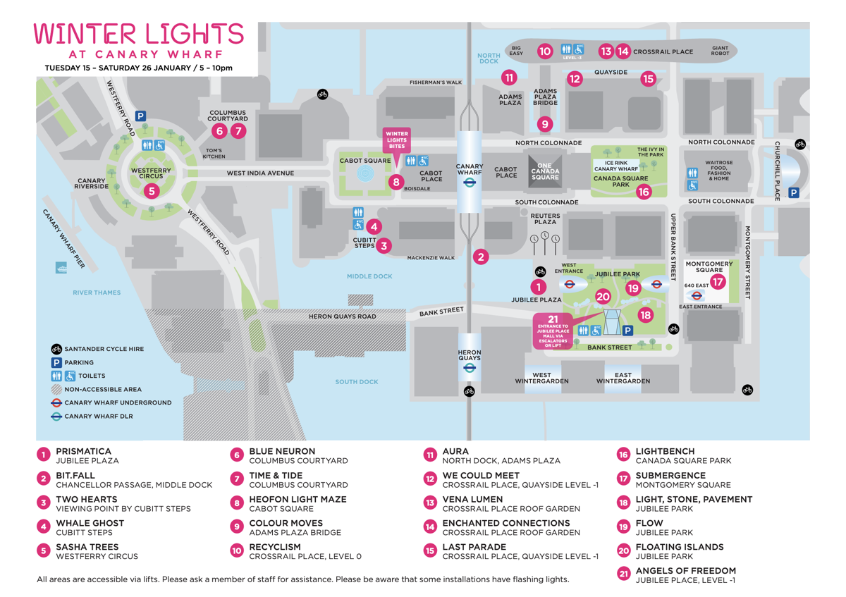
Canary Wharf’s annual public light show is back – it closes this Saturday, so you have just three more evenings to get down to the Isle of Dogs after dark and see 21 illuminated artworks. There’s a special map produced each year to show where on the campus the exhibits are. We reviewed last year’s map, and for this year’s show, it’s been updated with locations and preview pics – here’s the official map as a PDF.
The site is relatively compact and you can likely visit all 21 in a short walk by starting at Westferry Circus and heading eastwards, then anticlockwise and Jubilee Park, ending in the north at the Crossrail Place shopping centre/rooftop garden/future station, which has various food options. Or, if arriving by DLR, start at Heron Quays, go anticlockwise around to Crossrail Place, and then head westwards out to Westferry Circus to complete the tour.
Winter Lights is a nice idea, it’s not ridiculously crowded like the London Lumiere was last year, so you can see the works without having to look over people’s shoulders, and get between places quite quickly. And it’s really nice to see a bespoke, attractive map being produced, rather than a collection pins on a Google Map or poorly designed smartphone app which seems to be more common for events like this.

From the Canary Wharf website.

Winter Lights 2019 – Mapping London looks at the map showing the many illuminated artworks at @canarywharflondon un… https://t.co/aNlhEkJ46t
Winter Lights 2019 — https://t.co/aS28Quzmm0