
Lumiere London is a festival of light and art taking place every evening until this Sunday. From 6:30-10pm, nearly 30 temporary artworks in central London will come alive with lights. From a holographic elephant to neon sausage-dogs and a strange organic-looking structure suspended over London’s principal crossroads (Oxford Circus), it’s a great excuse to brave the cold weather – for tourists it’s extra to see in London’s traditionally quiet January, while for locals it’s an opportunity to get out to the city to see something impressive and free, to stave off the post-Christmas low. Most of the pieces are around the Regent Street, Piccadilly Circus and Trafalgar Square area, all of which are closed to regular traffic in the evening to provide more space for the crowds. Further away from the main zone, King’s Cross Central (the space going northwards from the gap between King’s Cross and St Pancras) has a line of lit artworks, while Westminster Abbey, to the west, is also precision-lit with a mosaic of colours.
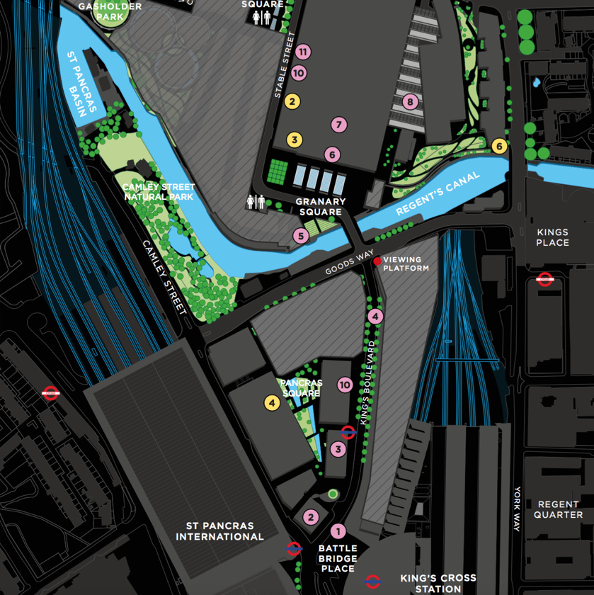
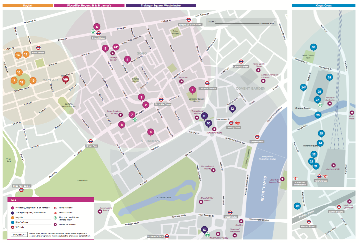
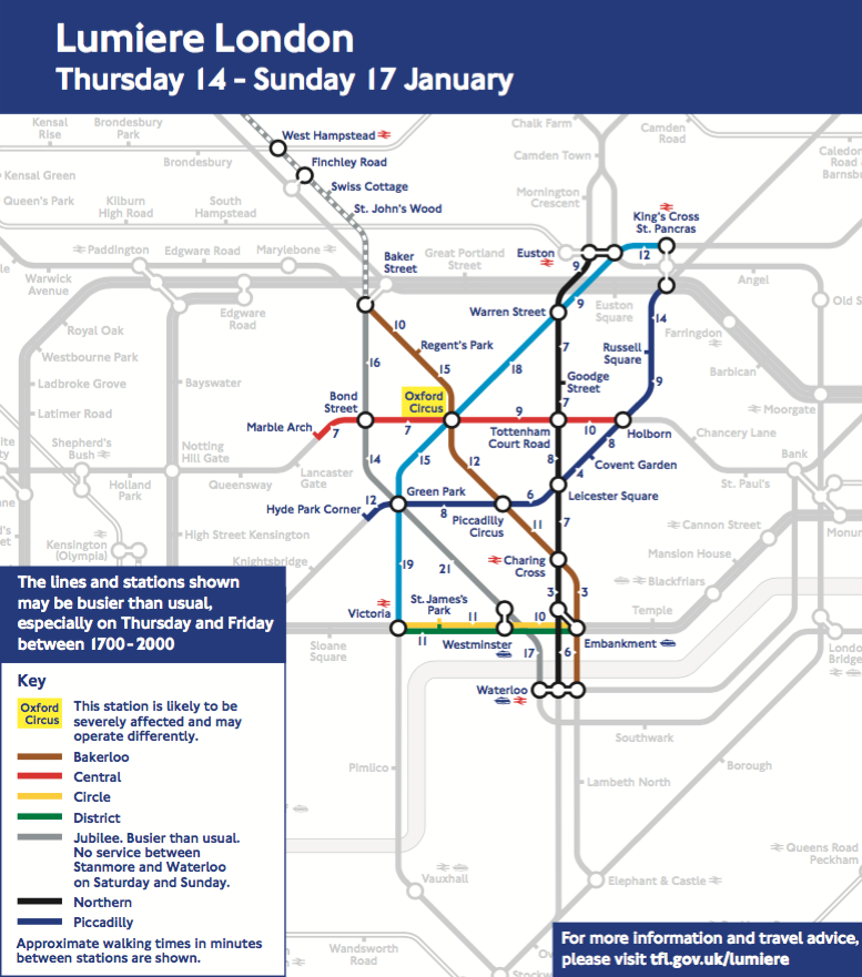
The organisers have released a couple of maps, one for the general central London area (below) and one for King’s Cross (extract above). In addition, TfL have released a special tube line walking-distance map (bottom) for the Lumiere areas. Tube stations are likely to be unusually busy, and bus routes suspended – the purpose of the last map is to emphasise that it’s really not that far walking between the tube stations in the vicinity.
It’s great to see these proper maps being produced for the event (paper copies of the first two are available at some of the installations). They are attractive to look at and informative about what’s happening. All three are supplied as vector PDFs so they are nice and sharp at any resolution. The King’s Cross one in particular is my favourite as it has an appropriately dark background, with bright colours for the locations of the artworks itself, and clear labels – many for places which will be unfamiliar to most as the area is very new.
The central London map isn’t quite as striking but still useful as a navigational aid, with each zone roughly grouped by colour. The “walking” tube map is an interesting idea. The tube distorts real-life geography a lot, so I wouldn’t normally recommend it as an aid for above-ground navigation, but within the highlighted zone it is perhaps useful if just as an encouragement to consider walking between the areas.
Lumiere finishes on Sunday when the lights get switched off at 10pm, and bear in mind the crowds will likely to be immense, so plan your visit carefully.
Maps copyright Artichoke Productions, London & Partners and Transport for London.
RT @MapLondon: Lumiere London: Three special maps to accompany London’s festival of art and light on now: https://t.co/0wh5Ul84Yw https://t…