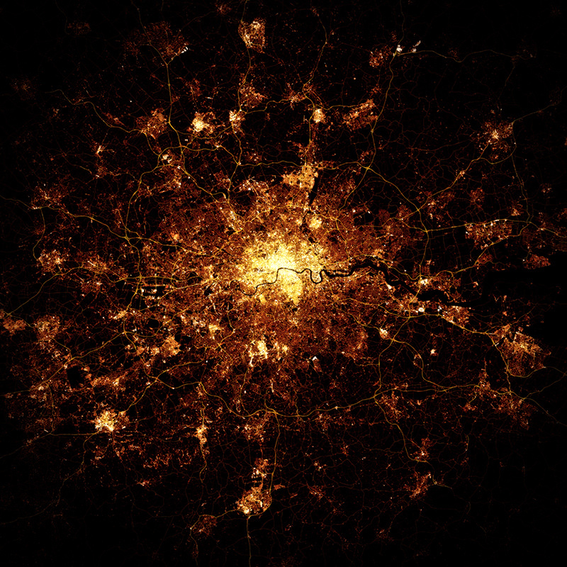

At first glance, this looks like a photo of London at night, maybe from the International Space Station (ISS) or another satellite.
Creator Marc Khachfe hasn’t commissioned NASA to take photos for him though, instead he’s used OpenStreetMap data and painstakingly built up a pseudo-photographic map in this distinctive style. Building and roads (of different types) are carefully coloured to mimic the effect of streetlights, a number of filters being applied, and compositing operations carried out, to produce the nighttime “glow”. The final map, especially when printed large on glossy photo paper, is quite compelling.
Marc was inspired by the amazing photographs of cities at night that Canadian astronaut Chris Hadfield regularly tweeted from the ISS. He’s produced maps for a number of cities. Each city has tended to have been mapped in OpenStreetMap in different ways, so a different treatment is normally needed for each one, to produce the effect. Of course, being maps, rather than photos, the detail is super sharp and you can see individual streets if you look carefully!
There’s more of Marc’s satellite-esque maps on his Flickr page, and the artist has an Etsy store where you can buy bespoke copies of the images. Marc is also exhibiting the maps at the RAW London art fair on 1 May.
Image reproduced here courtesy of Marc Khachfe. Marc also visited Mapping London Towers to show off a physical print, to considerable office approval.
It’s a nice effect, but he needs to use a different data source for buildings. If you look at the detailed images, a large part of Southwark looks really bright, which is because I added masses of buildings there, whilst neighbouring boroughs that are just as built up appear quite dark.
That is a great picture. I like it. Seeing the Thames outlined is great.