
I was intrigued by this blog post of a lovely looking map of London’s Green Belt, dated 1939. The map can be compared a modern map of the Green Belt created by the Telegraph in 2009.
The book that the map comes from is Fifty Years of the L.C.C. (London County Council) by S. P. B. Mais, published in 1939 by Cambridge University Press. It is one of four maps – two more are shown here – in the book. The maps themselves were drawn by Kupfer-Sachs. The book, being 75 years old, is rather hard to track down, but I found a copy buried in the depths of UCL’s main library.
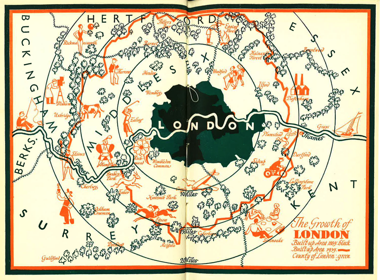
Above is “The Growth of London” – like all four of the maps, it is printed in red and orange colours.combined in places to produce black. The map shows a comparison of London’s built up area with its (at the time) much smaller political area and, smaller still, the built-up extent just 50 years before. What I like most about the map though are the little sketches of stereotypes of people in each area, scattered amongst various clumps of trees. There’s the public schoolboy at Harrow, a woman dressed for the Lido in Rickmansworth, a scout in Epping Forest and King Henry VIII at Hampton.
Below is another map, showing some unfamiliar London boundaries. The Met Police district stretched to (and indeed beyond) the present-day London boundary, rather than stopping at the L.C.C. boundary. The London Electricity District was even larger. The Metropolitan Water Board area was influenced by the rivers and water catchments, so stretched up to Hertford (on the River Lea) but not south of Crystal Palace. Finally, the London Passenger Transport Area was the largest of them all, encompassing places as far flung as Stevenage, Slough and Dorking. All part of London’s commuter belt today, but definitely beyond the reach of Transport for London’s Oyster cards.
The book itself is an interesting read – even the chapter list hints at different priorities for London back then – “London’s Greens”, “London’s Blind”, “London’s Protection”. There are various old photographs of fires, bridges (including an accurate sketch of the at-the-time unrebuilt Waterloo Bridge) and buildings. A photo of Essex Street, Hoxton, looks dramatically bleak, contrasting with the various shiny new 1930s LCC estates. A “noisy” horse-tram is compared with the comfort and efficeincy of a 70-seater trolley-bus. Oxford Street appears to have just as many buses as today. “One of London’s loveliest sights” describes a two-towered, working Battersea Power Station. How times have changed.
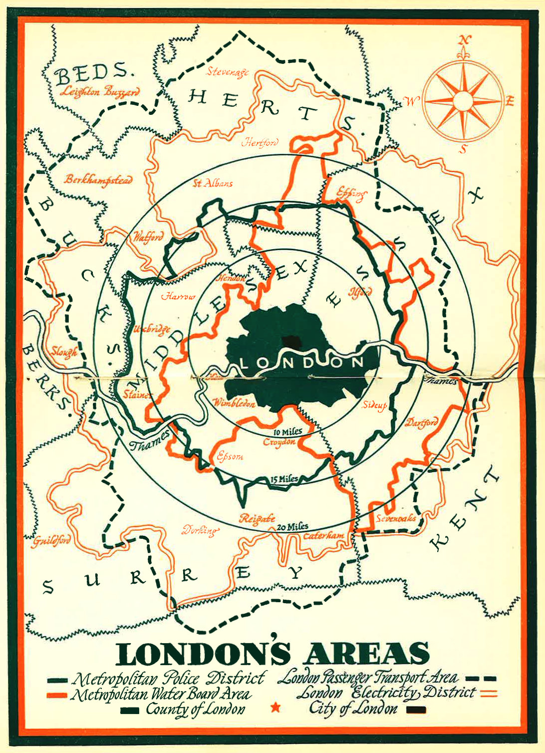
Maps scanned from Fifty Years of the L.C.C. by S.P. B. Mais. Click on the maps for a larger version.
One comment