
The Mapping London blog is 1 year today! We launched on February 24, 2011.
To celebrate, today we are featuring Google Maps, and how it currently looks like for the UCL campus in Bloomsbury, Central London, where the Mapping London authors are based.
I think it wouldn’t be much of an exaggeration to say that Google Maps pretty much kicked off web mapping as we know it today. It certainly popularised the concept of a “slippy map”, a map which fills the whole browser window, which you can drag around and easily zoom in and out of with the flick of a scroll wheel. Remember those little web maps you used to get in a postcard sized window, and you had to click a little button to move the map to the east?
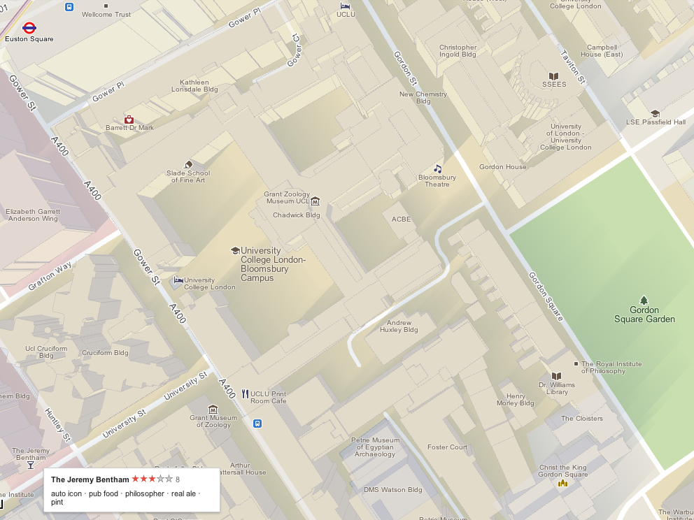
Google hasn’t stopped innovating and adding to Google Maps though. It’s trying out MapsGL, a WebGL-based new technology which gives the mapping data to your web browser and then lets it do the rendering. For parts of central London, including the UCL campus, building outlines have been added in, allowing for a pseudo-3D effect. In the MapsGL version, shown above, shadows have been added. Lots of extra layers can be added in – live traffic information for the bigger roads, underground route maps, bus stops, and extra information on many items is just a click away. I’ve clicked on the “Jeremy Bentham” in the screenshot above, which reveals it currently has three stars and some other attributes about the pub.
Google also finally own their mapping data for the UK – they aren’t licensing it from other providers any more. This gives them the freedom to do some really interesting things with it – I look forward to further enhancements!
An anniversary wouldn’t be an anniversary without some stats:
| Top 10 websites that linked to us | The top 10 most popular posts |
|
|
| Number of posts: 61. Number of Costa coffees bought for us by our readers: 16 – Thanks! |
|
Here’s to a second year of finding and featuring the best maps of London.
Map data @2012 Google.
You guys should now be looking forward to Google Map Maker opening up editing of the maps for the UK and other European countries!