There is a shop in London that I always peer into when I walk past but have always resisted going in as it presented a real risk of bankruptcy. With a couple of hours (the minimum required I thought) to spare last weekend I thought it was finally time to go and look around the cartophiles paradise that is King’s Court Galleries in Fulham. Many of the finds were too good not to blog so I thought I should share them here (I did my best with my phone camera). All my favourite maps seemed to relate to the planning of London.

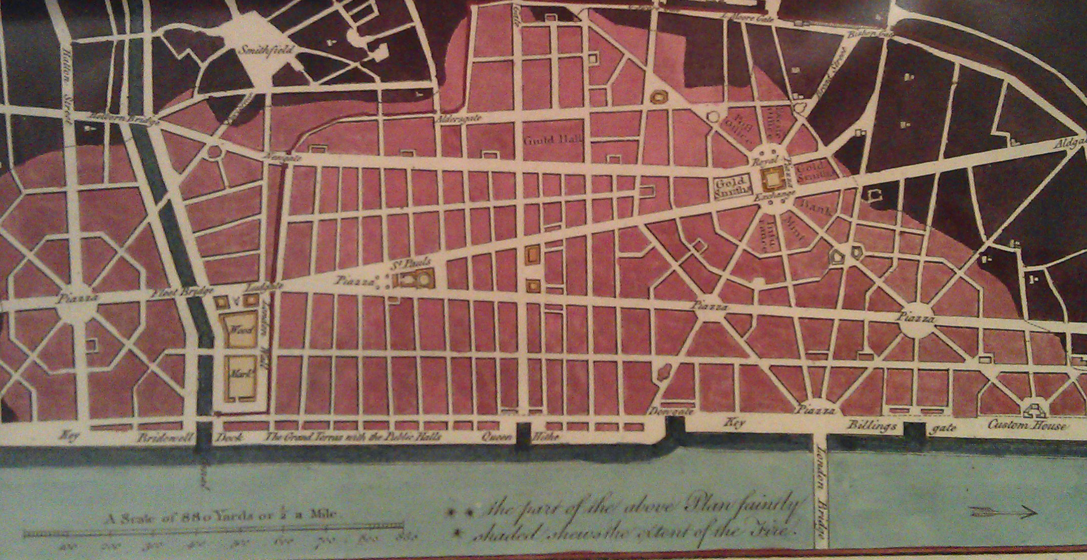
The first, and probably most well-known, of the plans I saw was Christopher Wren’s 1666 proposal for London in the aftermath of the Great Fire. The version above, published by Walter Harrison in 1775, depicts the straightening of roads in the City to create broad avenues and large piazzas. Much of the plan was unfeasible both due to a lack of consideration for London’s topography but also, perhaps more importantly, because people were quick to claim their land (that once contained their home/ business) soon after the fire. This meant the layout of the City remained relatively unchanged despite widespread rebuilding and is the reason why the pre-1666 street layout is largely present today.
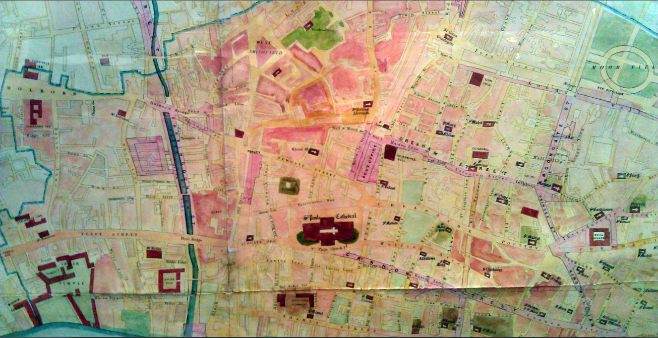
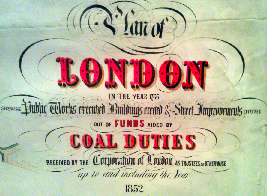
Moving ahead 100 years, the map above, as its elaborate title below explains, illustrates the improvements to London that were funded by Coal Duties. The changes are shown in shades of red/ pink. One of the most interesting is the covering of the River Fleet, one of London’s best known underground rivers. This map is clearly designed to demonstrate the necessity of taxation so I guess the contemporary equivalent (although I doubt it exists) could be road improvements funded by the London congestion charge or speed cameras.
On the theme of accountability on behalf of taxpayers, this map (it is 19th Century but I forgot to note down exactly when) has a series of proposed improvements to London streets (the nature of these are unclear) coloured by the person that suggested them.
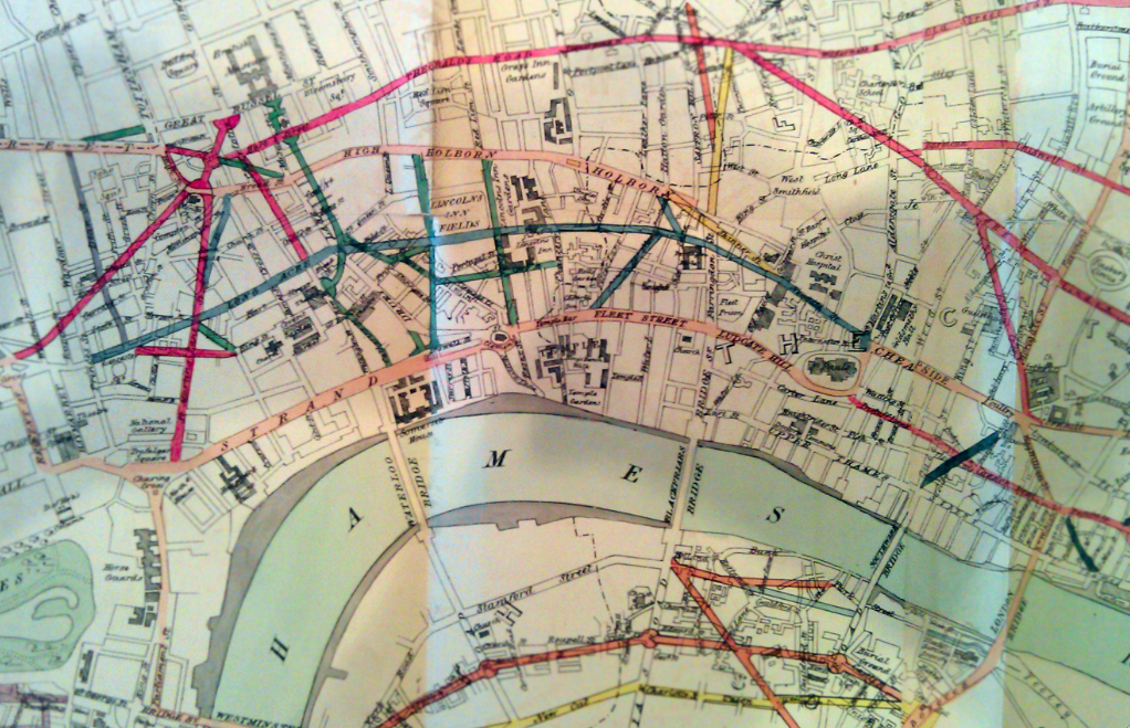
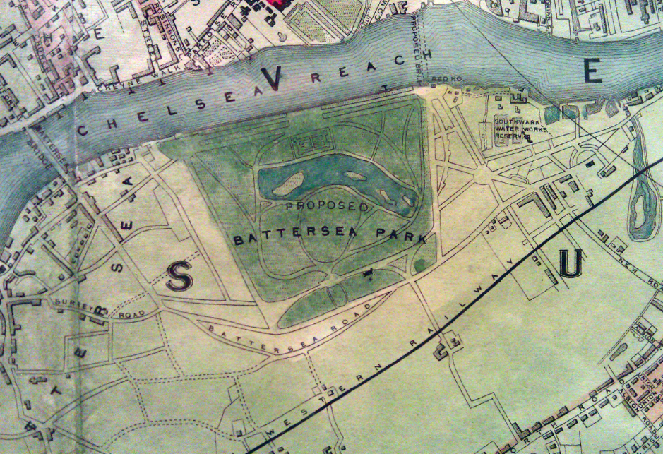
We have T. Marsh Nelson, for example, to thank for changes in red and John Roe for those in pink. Of the many things, however, that Londoners have the Victorians to thank for, I think we are particularly proud of our parks. The excerpt below shows the proposed location and layout for Battersea Park and is taken from a much larger map, published in 1851, with the grand title of “Tallis’s Illustrated Plan of London and its Environs in Commemoration of the Great Exhibition of All Nations”.
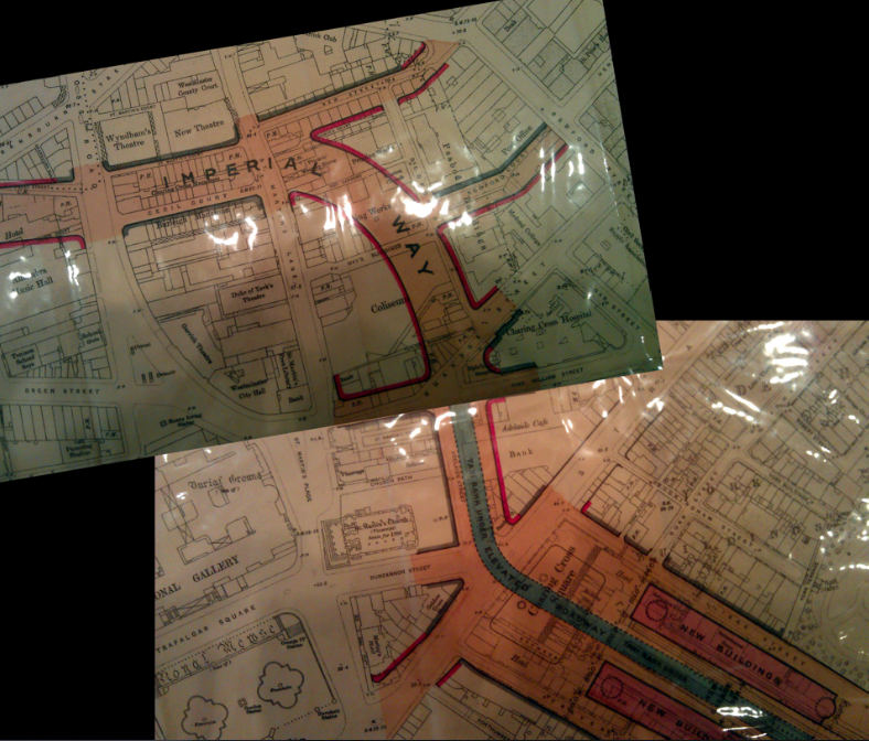
The final map (it is one continuous map- I have just stuck two photos together) presents a radical proposal from John Murray (printed around 1864) to reconfigure Charing Cross Station to include a large new access road. What is striking about this is the number of buildings, not least the London Coliseum(!) that would have had to be cleared to accomodate this. Such plans demonstrate the ambition of the Victorians to modernise London and the resources at their disposal to do it.
This was a really enjoyable post to write and I am grateful to David and also Chris at Kings Court Galleries who took the time to explain the maps and let me take pictures. Next time you are in Fulham they are worth a visit (maps cost between £50 to £75k). We are not on commission (nor have we been sponsored to write this post) but please mention mappinglondon.co.uk if you purchase anything! If you know of a map shop near you that is worth checking out, do let us know.
Good morning,
We are designing a nice restaurant near Battersea Park
WE would love to do as a big mural the map I can see on this article as : “Tallis’s Illustrated Plan of London and its Environs in Commemoration of the Great Exhibition of All Nations”.
Could we get the copyright of it?
Or if you don’t do this, where do you think we could get it from?
Thank you co much for your time
All the best
Natalie Weavers Interiors
[email address removed]