Many Twitter messages, or “tweets”, are sent with latitude/longitude information, allowing an insight into the places where the most amount of tweeting happens. For a
More...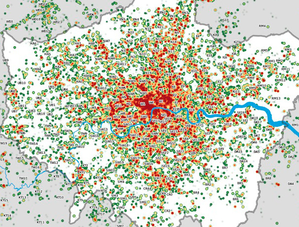
Highlighting the best London maps
Many Twitter messages, or “tweets”, are sent with latitude/longitude information, allowing an insight into the places where the most amount of tweeting happens. For a
More...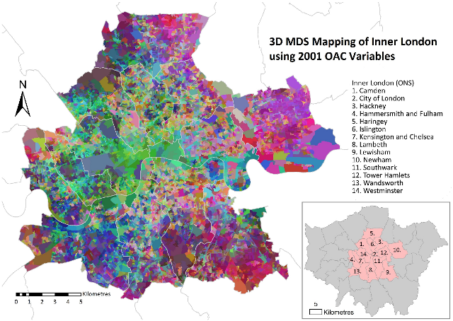
Daniel Lewis, a Geography Ph.D student at UCL, has produced this map of inner London, using multidimensional scaling (MDS) to simultaneously depict 41 geodemographic measures of each area.
More...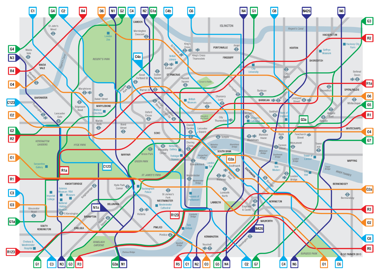
Congratulations to Cycle Lifestyle, who have won £6000 in funding for “creating a colour coded Tube style map of the Capital’s cycling network” in the
More...
Readers may be interested in the London Mapping Festival, a grouping of several events relating to mapping in London, that takes place over the next
More...